
| Distance / Altitude | Location | Report Date / Time | Live Weather | Wind | Gusts | Temp. | Visibility | Cloud |
|---|---|---|---|---|---|---|---|---|
| 48 km S / 103 m | Santa Clara Airport (Cuba) | 2025-12-24 05:50 local (2025/12/24 10:50 GMT) | - | calm (4 km/h at 60) | 18°C | 8.0 | few | |
| 98 km S / 337 m | Cienfuegos Airport (Cuba) | 2025-12-24 05:50 local (2025/12/24 10:50 GMT) | - | light winds from the NE (13 km/h at 50) | — | 0.0 | ||
| 147 km WSW / 213 m | Varadero Airport (Cuba) | 2025-12-24 05:50 local (2025/12/24 10:50 GMT) | - | light winds from the ENE (9 km/h at 60) | 20°C | 9.0 | few | |
| 147 km WSW / 65 m | VaraderoMT (Cuba) | 2025-12-24 07:00 local (2025/12/24 12:00 GMT) | Clear skies | light winds from the ENE (11 km/h at 70) | 19°C | 29 km | few | |
| 179 km ESE / 4 m | Canagua Airport (Cuba) | 2025-12-24 05:50 local (2025/12/24 10:50 GMT) | Dry and partly cloudy | light winds from the ENE (19 km/h at 70) | 24°C | 9.0 | scattered | |
| 207 km NW / 3 m | SHIP1875 (Marine) | 2025-12-24 05:00 local (2025/12/24 10:00 GMT) | - (- km/h at -) | 23°C | - | |||
| 207 km NW / 3 m | SHIP2485 (Marine) | 2025-12-24 05:00 local (2025/12/24 10:00 GMT) | - (- km/h at -) | 23°C | - | |||
| 207 km NW / 15 m | SHIP3568 (Marine) | 2025-12-24 05:00 local (2025/12/24 10:00 GMT) | - (- km/h at -) | — | - km | |||
| 207 km NW / 3 m | SHIP5261 (Marine) | 2025-12-24 05:00 local (2025/12/24 10:00 GMT) | - (- km/h at -) | 23°C | - | |||
| 207 km NW / 15 m | SHIP7409 (Marine) | 2025-12-24 05:00 local (2025/12/24 10:00 GMT) | - (- km/h at -) | — | - km |
| Contours: | Roads & Rivers: | Select a
tide station / surf break / city |
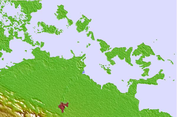
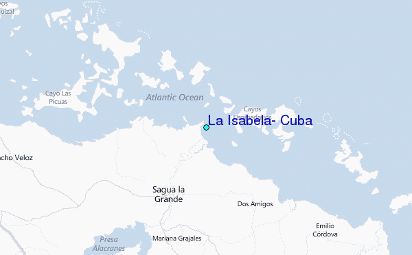
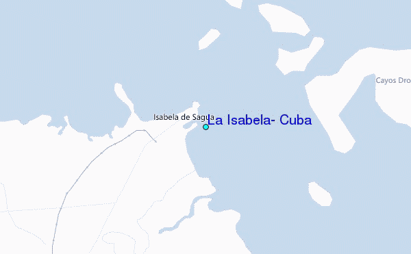
Use this relief map to navigate to tide stations, surf breaks and cities that are in the area of La Isabela, Cuba.
Other Nearby Locations' tide tables and tide charts to La Isabela, Cuba:
click location name for more details
 Surf breaks close to La Isabela, Cuba:
|
||
|---|---|---|
| Closest surf break | South Beach (Miami) | 196 mi |
| Second closest surf break | Fifth Street (Miami) | 197 mi |
| Third closest surf break | 21st Street (Miami) | 198 mi |
| Fourth closest surf break | Dunes Hotel (Miami) | 200 mi |
| Fifth closest surf break | Harbor House | 205 mi |


 Nearest
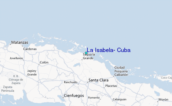