
| Distance / Altitude | Location | Report Date / Time | Live Weather | Wind | Gusts | Temp. | Visibility | Cloud |
|---|---|---|---|---|---|---|---|---|
| 5 km S / 18 m | LA Paz- Bcs (Mexico) | 2025-12-24 20:00 local (2025/12/25 03:00 GMT) | no report | wind obs. (18 kph from 170 degs) was rejected (- km/h at -) | 27°C | 2000 | - | |
| 13 km S / 273 m | La Paz International Airport (Mexico) | 2025-12-24 19:41 local (2025/12/25 02:41 GMT) | Dry and partly cloudy | calm (0 km/h at 0) | 24°C | 13 | scattered | |
| 15 km SSW / 25 m | La Paz (Mexico) | 2025-12-24 20:24 local (2025/12/25 03:24 GMT) | dry | - (- km/h at ) | — | - | - - 0 | |
| 110 km S / 15 m | SHIP2708 (Marine) | 2025-12-24 20:00 local (2025/12/25 03:00 GMT) | - (- km/h at -) | — | - km | |||
| 131 km SSE / 246 m | Los Cabos International Airport/San José del Cabo (Mexico) | 2025-12-24 19:50 local (2025/12/25 02:50 GMT) | Dry and cloudy | light winds from the WNW (9 km/h at 300) | 24°C | 16 | overcast | |
| 130 km SSE / 246 m | Los Cabos International Airport/San José del Cabo (Mexico) | 2025-12-24 19:50 local (2025/12/25 02:50 GMT) | Dry and cloudy | light winds from the WNW (9 km/h at 300) | 24°C | 16 | overcast | |
| 130 km S / 15 m | SHIP4403 (Marine) | 2025-12-24 19:00 local (2025/12/25 02:00 GMT) | - (- km/h at -) | — | - km | |||
| 130 km S / 15 m | SHIP3212 (Marine) | 2025-12-24 19:00 local (2025/12/25 02:00 GMT) | - (- km/h at -) | — | - km | |||
| 130 km S / 3 m | SHIP5855 (Marine) | 2025-12-24 19:00 local (2025/12/25 02:00 GMT) | - (- km/h at -) | 25°C | - | |||
| 133 km SSE / 52 m | San Jose del Cabo (Mexico) | 2025-12-24 20:30 local (2025/12/25 03:30 GMT) | dry | calm (3 km/h at 323) | 24°C | - | - - 0 |
| Contours: | Roads & Rivers: | Select a
tide station / surf break / city |
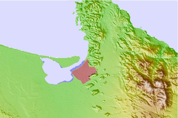

Use this relief map to navigate to tide stations, surf breaks and cities that are in the area of La Paz.
Other Nearby Locations' tide tables and tide charts to La Paz:
click location name for more details
 Surf breaks close to La Paz:
|
||
|---|---|---|
| Closest surf break | Beachbreak | 37 mi |
| Second closest surf break | Punta Marquez | 40 mi |
| Third closest surf break | La Bocana | 42 mi |
| Fourth closest surf break | La Pastora | 44 mi |
| Fifth closest surf break | Punta Conejo | 45 mi |


 Nearest