
| Distance / Altitude | Location | Report Date / Time | Live Weather | Wind | Gusts | Temp. | Visibility | Cloud |
|---|---|---|---|---|---|---|---|---|
| 41 km SE / 4 m | LadyElliotIsland (Australia) | 2025-12-25 13:00 local (2025/12/25 03:00 GMT) | Rain | light winds from the NNW (13 km/h at 330) | 26°C | - | - no observation - | |
| 70 km WNW / 6 m | HeronIslandRes Stn (Australia) | 2025-12-25 13:00 local (2025/12/25 03:00 GMT) | - | light winds from the NNE (15 km/h at 20) | — | - | no observation | |
| 111 km S / 33 m | Bundaberg Airport (Australia) | 2025-12-25 13:00 local (2025/12/25 03:00 GMT) | no report | moderate winds from the NNW (20 km/h at 340) | 28°C | - | - no observation - | |
| 114 km WSW / 75 m | Gladstone Radar (Australia) | 2025-12-25 13:00 local (2025/12/25 03:00 GMT) | no report | wind obs. (6 kph from 130 degs) was rejected (- km/h at -) | 22°C | - | - no observation - | |
| 118 km WSW / 17 m | Gladstone Airport (Australia) | 2025-12-25 13:00 local (2025/12/25 03:00 GMT) | Moderate rain | light winds from the SSE (9 km/h at 150) | 22°C | 4.7 | broken broken broken | |
| 118 km WSW / 17 m | Gladstone Airport (Australia) | 2025-12-25 13:00 local (2025/12/25 03:00 GMT) | no report | calm (0 km/h at 0) | 22°C | - | - no observation - | |
| 120 km W / 20 m | Rundle Island (Australia) | 2025-12-25 13:00 local (2025/12/25 03:00 GMT) | no report | light winds from the ESE (15 km/h at 110) | 24°C | - | - no observation - | |
| 164 km SSE / 19 m | Hervey Bay Airport (Australia) | 2025-12-25 13:00 local (2025/12/25 03:00 GMT) | no report | moderate winds from the NNW (22 km/h at 330) | 28°C | - | - no observation - | |
| 181 km WSW / 300 m | lightning 55km S of Rockhampton (Australia) | 2025-12-25 12:19 local (2025/12/25 02:19 GMT) | Thunderstorm | (- km/h at -) | — | |||
| 182 km S / 11 m | Maryborough(94567-0) (Australia) | 2025-12-25 13:00 local (2025/12/25 03:00 GMT) | - | light winds from the NNW (17 km/h at 340) | — | - | - no observation - |
| Contours: | Roads & Rivers: | Select a
tide station / surf break / city |


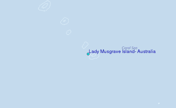
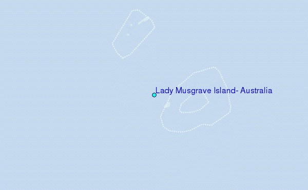
Use this relief map to navigate to tide stations, surf breaks and cities that are in the area of Lady Musgrave Island, Australia.
Other Nearby Locations' tide tables and tide charts to Lady Musgrave Island, Australia:
click location name for more details
 Surf breaks close to Lady Musgrave Island, Australia:
|
||
|---|---|---|
| Closest surf break | Agnes Waters | 36 mi |
| Second closest surf break | Archies | 66 mi |
| Third closest surf break | Elliott Heads | 71 mi |
| Fourth closest surf break | Fraser Island - Waddy Point | 95 mi |
| Fifth closest surf break | Fraser Island - Indian Head | 98 mi |


 Nearest
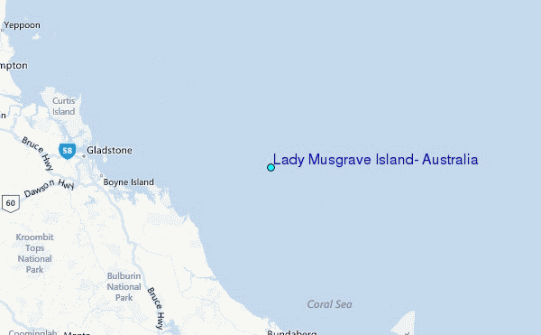