
| Distance / Altitude | Location | Report Date / Time | Live Weather | Wind | Gusts | Temp. | Visibility | Cloud |
|---|---|---|---|---|---|---|---|---|
| 2 km NW / 5 m | Launceston (TI Tree Bend) (Australia) | 2026-04-19 11:00 local (2026/04/19 01:00 GMT) | no report | calm (2 km/h at 30) | 11°C | - | - no observation - | |
| 10 km SSE / 216 m | Launceston Airport (Australia) | 2026-04-19 10:30 local (2026/04/19 00:30 GMT) | Dry and cloudy | light winds from the SSW (6 km/h at 210) | 10°C | 10.0 | overcast | |
| 15 km SSE / 168 m | Launceston Airport (Australia) | 2026-04-19 11:00 local (2026/04/19 01:00 GMT) | no report | light winds from the WSW (7 km/h at 250) | 11°C | - | - no observation - | |
| 15 km SSE / 168 m | Launceston Airport (Australia) | 2026-04-19 11:00 local (2026/04/19 01:00 GMT) | no report | wind obs. (17 kph from 160 degs) was rejected (- km/h at -) | 6°C | - | - | |
| 42 km NE / 198 m | Scottsdale(West Minstone Road) (Australia) | 2026-04-19 11:00 local (2026/04/19 01:00 GMT) | no report | light winds from the S (11 km/h at 180) | 7°C | - | - no observation - | |
| 52 km WNW / 4 m | LowHead (Australia) | 2026-04-19 11:00 local (2026/04/19 01:00 GMT) | no report | moderate winds from the SSE (22 km/h at 160) | 12°C | - | - no observation - | |
| 65 km SSW / 1042 m | Liawenee (Australia) | 2026-04-19 11:00 local (2026/04/19 01:00 GMT) | no report | light winds from the SSW (7 km/h at 200) | 2°C | - | - - - | |
| 66 km W / 10 m | Devonport Airport (Australia) | 2026-04-19 11:00 local (2026/04/19 01:00 GMT) | no report | light winds from the SSE (17 km/h at 160) | 12°C | - | - no observation - | |
| 68 km WSW / 294 m | SheffieldSchoolFarm (Australia) | 2026-04-19 11:00 local (2026/04/19 01:00 GMT) | no report | light winds from the S (6 km/h at 170) | 5°C | - | - no observation - | |
| 72 km SSE / 186 m | Ross(TheBoulevards) (Australia) | 2026-04-19 09:00 local (2026/04/18 23:00 GMT) | Clouds developing | calm (4 km/h at 160) | 2°C | 50 km | - scattered - |
| Contours: | Roads & Rivers: | Select a
tide station / surf break / city |
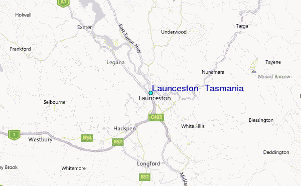
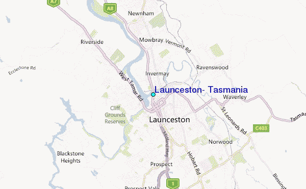
Use this relief map to navigate to tide stations, surf breaks and cities that are in the area of Launceston, Tasmania.
Other Nearby Locations' tide tables and tide charts to Launceston, Tasmania:
click location name for more details
 Surf breaks close to Launceston, Tasmania:
|
||
|---|---|---|
| Closest surf break | Tam O'Shanter | 30 mi |
| Second closest surf break | East Beach | 30 mi |
| Third closest surf break | Devonport Rivermouth | 44 mi |
| Fourth closest surf break | Dark Hollow | 59 mi |
| Fifth closest surf break | Scamander Rivermouth | 59 mi |


 Nearest
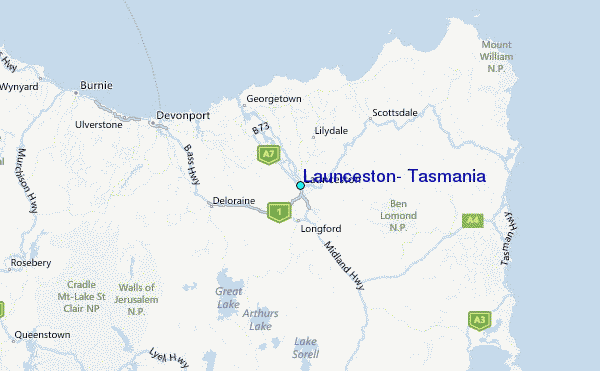