
| Distance / Altitude | Location | Report Date / Time | Live Weather | Wind | Gusts | Temp. | Visibility | Cloud |
|---|---|---|---|---|---|---|---|---|
| 10 km NE / 11 m | thunderstorm affecting Saint Petersburg (United States) | 2026-06-10 20:48 local (2026/06/11 00:48 GMT) | Thunderstorm | (- km/h at -) | — | |||
| 10 km N / 6 m | thunderstorm affecting Kenneth City (United States) | 2026-06-10 18:35 local (2026/06/10 22:35 GMT) | Thunderstorm | (- km/h at -) | — | |||
| 10 km NW / 5 m | thunderstorm affecting Bay Pines (United States) | 2026-06-10 20:04 local (2026/06/11 00:04 GMT) | Thunderstorm | (- km/h at -) | — | |||
| 11 km ENE / 218 m | St Peters/Albert Whitted Airport (Florida) | 2026-06-10 19:53 local (2026/06/10 23:53 GMT) | Dry and cloudy | light winds from the E (19 km/h at 80) | 27°C | 16 | overcast | |
| 12 km NW / 3 m | thunderstorm affecting Seminole (United States) | 2026-06-10 20:04 local (2026/06/11 00:04 GMT) | Thunderstorm | (- km/h at -) | — | |||
| 12 km E / 3 m | BUOY-SAPF1 (Marine) | 2026-06-10 20:48 local (2026/06/11 00:48 GMT) | light winds from the E (17 km/h at 100) | — | - | |||
| 14 km SSE / 2 m | lightning 8km SE of Tierra Verde (United States) | 2026-06-10 20:34 local (2026/06/11 00:34 GMT) | Thunderstorm | (- km/h at -) | — | |||
| 17 km SSE / 0 m | lightning 10km N of Anna Maria (United States) | 2026-06-10 20:49 local (2026/06/11 00:49 GMT) | Thunderstorm | (- km/h at -) | — | |||
| 18 km ESE / 3 m | BUOY-MTBF1 (Marine) | 2026-06-10 20:48 local (2026/06/11 00:48 GMT) | moderate winds from the SSW (26 km/h at 210) | — | - | |||
| 22 km N / 9 m | lightning 4km ENE of Clearwater (United States) | 2026-06-10 18:31 local (2026/06/10 22:31 GMT) | Thunderstorm | (- km/h at -) | — |
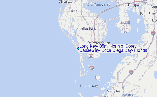
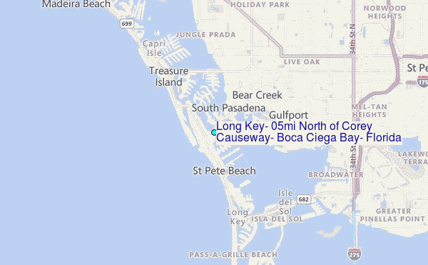
Choose Long Key, 0.5mi North of Corey Causeway, Boca Ciega Bay, Florida Location Map Zoom:
| Contours: | Roads & Rivers: | Select a
tide station / surf break / city |
Use this relief map to navigate to tide stations, surf breaks and cities that are in the area of Long Key, 0.5mi North of Corey Causeway, Boca Ciega Bay, Florida.
Other Nearby Locations' tide tables and tide charts to Long Key, 0.5mi North of Corey Causeway, Boca Ciega Bay, Florida:
click location name for more details
 Surf breaks close to Long Key, 0.5mi North of Corey Causeway, Boca Ciega Bay, Florida:
|
||
|---|---|---|
| Closest surf break | Sunset Beach | 1 mi |
| Second closest surf break | Upham Beach | 1 mi |
| Third closest surf break | Redington Breakwater | 7 mi |
| Fourth closest surf break | Indian Rocks Beach | 9 mi |
| Fifth closest surf break | Bellair Beach | 13 mi |


 Nearest
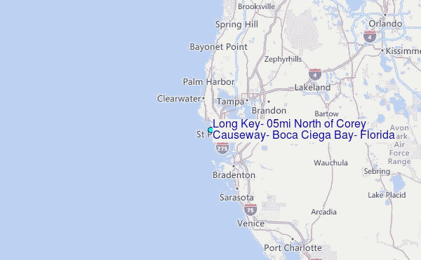