
| Distance / Altitude | Location | Report Date / Time | Live Weather | Wind | Gusts | Temp. | Visibility | Cloud |
|---|---|---|---|---|---|---|---|---|
| 9 km WNW / 0 m | thunderstorm affecting Bradenton Beach (United States) | 2026-07-20 17:01 local (2026/07/20 21:01 GMT) | Thunderstorm | (- km/h at -) | — | |||
| 9 km E / 219 m | Sarasota/Bradenton Airport (Florida) | 2026-07-20 17:53 local (2026/07/20 21:53 GMT) | - | moderate winds from the S (22 km/h at 190) | 29°C | 16 | few few | |
| 11 km NE / 2 m | Bradenton wx (United States) | 2026-07-20 18:38 local (2026/07/20 22:38 GMT) | dry | calm (0 km/h at 289) | 31°C | - | - - 0 | |
| 17 km ESE / 9 m | thunderstorm affecting Desoto Lakes (United States) | 2026-07-20 19:01 local (2026/07/20 23:01 GMT) | Thunderstorm | (- km/h at -) | — | |||
| 22 km NNE / 3 m | SHIP3547 (Marine) | 2026-07-20 19:00 local (2026/07/20 23:00 GMT) | - (- km/h at -) | 29°C | - | |||
| 22 km NNE / 15 m | SHIP3891 (Marine) | 2026-07-20 19:00 local (2026/07/20 23:00 GMT) | - (- km/h at -) | — | - km | |||
| 25 km NE / 6 m | lightning 8km NNE of Memphis (United States) | 2026-07-20 17:01 local (2026/07/20 21:01 GMT) | Thunderstorm | (- km/h at -) | — | |||
| 25 km NW / 15 m | SHIP5120 (Marine) | 2026-07-20 18:00 local (2026/07/20 22:00 GMT) | - (- km/h at -) | — | - km | |||
| 25 km NW / 3 m | SHIP6682 (Marine) | 2026-07-20 18:00 local (2026/07/20 22:00 GMT) | - (- km/h at -) | 31°C | - | |||
| 25 km NW / 15 m | SHIP232 (Marine) | 2026-07-20 18:00 local (2026/07/20 22:00 GMT) | - (- km/h at -) | — | - km |
| Contours: | Roads & Rivers: | Select a
tide station / surf break / city |
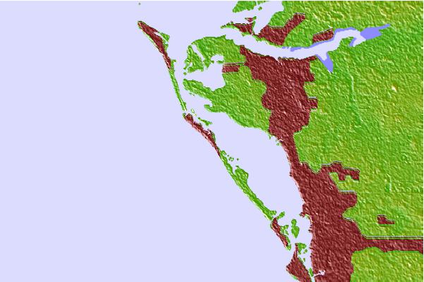
Use this relief map to navigate to tide stations, surf breaks and cities that are in the area of Longboat Key.
Other Nearby Locations' tide tables and tide charts to Longboat Key:
click location name for more details
 Surf breaks close to Longboat Key:
|
||
|---|---|---|
| Closest surf break | Siesta | 3 mi |
| Second closest surf break | Turtle Beach | 5 mi |
| Third closest surf break | Bradenton Beach | 6 mi |
| Fourth closest surf break | Holmes Beach Pier | 7 mi |
| Fifth closest surf break | Anna Maria Key | 9 mi |


 Nearest