
| Distance / Altitude | Location | Report Date / Time | Live Weather | Wind | Gusts | Temp. | Visibility | Cloud |
|---|---|---|---|---|---|---|---|---|
| 15 km NNE / 3 m | BUOY-APCF1 (Marine) | 2026-07-27 22:00 local (2026/07/28 02:00 GMT) | calm (5 km/h at 300) | 30°C | - | |||
| 15 km N / 218 m | Apalachicola Airport (Florida) | 2026-07-27 20:53 local (2026/07/28 00:53 GMT) | - | light winds from the WNW (15 km/h at 300) | 30°C | 16 | few | |
| 22 km NNE / 10 m | lightning 8km N of Apalachicola (United States) | 2026-07-27 23:03 local (2026/07/28 03:03 GMT) | Thunderstorm | (- km/h at -) | — | |||
| 25 km NE / 3 m | BUOY-APXF1 (Marine) | 2026-07-27 22:00 local (2026/07/28 02:00 GMT) | light winds from the WNW (17 km/h at 300) | 31°C | - | |||
| 30 km ENE / 0 m | lightning 10km ENE of Eastpoint (United States) | 2026-07-27 23:00 local (2026/07/28 03:00 GMT) | Thunderstorm | (- km/h at -) | — | |||
| 30 km WNW / 3 m | Ward Ridge wx (United States) | 2026-07-27 21:15 local (2026/07/28 01:15 GMT) | dry | calm (0 km/h at 259) | 30°C | - | - - 0 | |
| 39 km WNW / 5 m | lightning 9km N of Port Saint Joe (United States) | 2026-07-27 23:02 local (2026/07/28 03:02 GMT) | Thunderstorm | (- km/h at -) | — | |||
| 47 km NW / 4 m | lightning 13km NE of Mexico Beach (United States) | 2026-07-27 23:03 local (2026/07/28 03:03 GMT) | Thunderstorm | (- km/h at -) | — | |||
| 51 km NW / 8 m | lightning 8km S of Wewahitchka (United States) | 2026-07-27 23:03 local (2026/07/28 03:03 GMT) | Thunderstorm | (- km/h at -) | — | |||
| 67 km WNW / 5 m | Tyndall Drone Airport (Florida) | 2026-07-27 20:55 local (2026/07/28 00:55 GMT) | Dry and cloudy | light winds from the W (13 km/h at 280) | 31°C | 16 | overcast |
| Contours: | Roads & Rivers: | Select a
tide station / surf break / city |
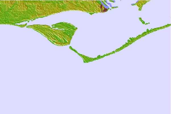

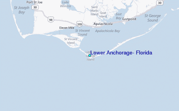
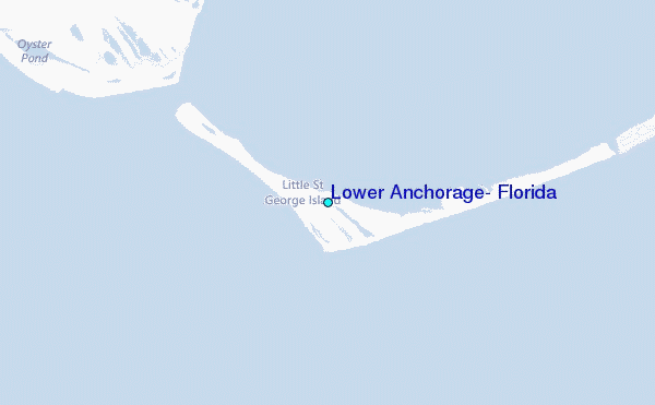
Use this relief map to navigate to tide stations, surf breaks and cities that are in the area of Lower Anchorage, Florida.
Other Nearby Locations' tide tables and tide charts to Lower Anchorage, Florida:
click location name for more details
 Surf breaks close to Lower Anchorage, Florida:
|
||
|---|---|---|
| Closest surf break | St George Island | 11 mi |
| Second closest surf break | Shell Island | 52 mi |
| Third closest surf break | The Pass | 55 mi |
| Fourth closest surf break | St Andrews State Park | 56 mi |
| Fifth closest surf break | Panama City Beach | 58 mi |


 Nearest
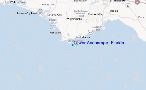