
| Distance / Altitude | Location | Report Date / Time | Live Weather | Wind | Gusts | Temp. | Visibility | Cloud |
|---|---|---|---|---|---|---|---|---|
| 27 km NW / 215 m | Hydaburg Airport (Alaska) | 2026-04-03 15:15 local (2026/04/03 23:15 GMT) | Dry and cloudy | light winds from the ESE (19 km/h at 120) | 6°C | 0.0 | broken overcast | |
| 58 km ENE / 15 m | SHIP5876 (Marine) | 2026-04-03 16:00 local (2026/04/04 00:00 GMT) | fresh winds from the SSE (33.480000000000004 km/h at 160) | 6°C | - km | |||
| 59 km ENE / - m | SHIP1334 (ocean) | 2026-04-03 14:00 local (2026/04/03 22:00 GMT) | No report | fresh winds from the S (31 km/h at 190) | 8°C | - | no observation | |
| 59 km ENE / - m | SHIP1052 (ocean) | 2026-04-03 14:00 local (2026/04/03 22:00 GMT) | No report | fresh winds from the S (31 km/h at 190) | 8°C | - | no observation | |
| 59 km ENE / 15 m | SHIP5424 (Marine) | 2026-04-03 14:00 local (2026/04/03 22:00 GMT) | fresh winds from the S (31.680000000000003 km/h at 190) | 6°C | - km | |||
| 59 km ENE / - m | SHIP536 (ocean) | 2026-04-03 14:00 local (2026/04/03 22:00 GMT) | No report | fresh winds from the S (31 km/h at 190) | 8°C | - | no observation | |
| 62 km ENE / 15 m | SHIP7605 (Marine) | 2026-04-03 15:00 local (2026/04/03 23:00 GMT) | fresh winds from the SSW (31.680000000000003 km/h at 200) | 7°C | - km | |||
| 62 km ENE / 15 m | SHIP3927 (Marine) | 2026-04-03 14:00 local (2026/04/03 22:00 GMT) | fresh winds from the S (33.480000000000004 km/h at 190) | 6°C | - km | |||
| 62 km ENE / - m | SHIP57 (ocean) | 2026-04-03 15:00 local (2026/04/03 23:00 GMT) | No report | moderate winds from the S (28 km/h at 190) | 9°C | - | no observation | |
| 62 km ENE / - m | SHIP174 (ocean) | 2026-04-03 15:00 local (2026/04/03 23:00 GMT) | No report | fresh winds from the SSW (31 km/h at 200) | 7°C | - | no observation |
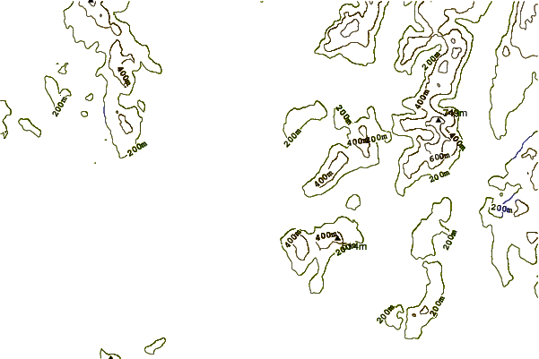
| Contours: | Roads & Rivers: | Select a
tide station / surf break / city |
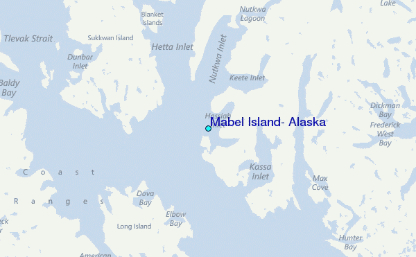
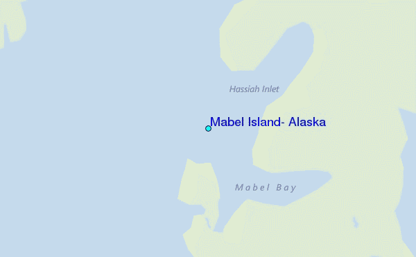
Use this relief map to navigate to tide stations, surf breaks and cities that are in the area of Mabel Island, Alaska.
Other Nearby Locations' tide tables and tide charts to Mabel Island, Alaska:
click location name for more details
 Surf breaks close to Mabel Island, Alaska:
|
||
|---|---|---|
| Closest surf break | Lepus Beach (Haida-Gwaii) | 60 mi |
| Second closest surf break | Tow Hill Beach | 71 mi |
| Third closest surf break | Cannon Beach | 410 mi |
| Fourth closest surf break | Graveyards | 414 mi |
| Fifth closest surf break | Ocean Cape | 415 mi |


 Nearest
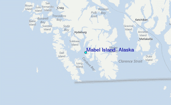