
| Distance / Altitude | Location | Report Date / Time | Live Weather | Wind | Gusts | Temp. | Visibility | Cloud |
|---|---|---|---|---|---|---|---|---|
| 19 km N / 301 m | Westlake Village (California) | 2026-04-02 08:09 local (2026/04/02 15:09 GMT) | dry | calm (0 km/h at 275) | 11°C | - | - - 0 | |
| 19 km ENE / 746.8 m | Malibu (California) | 2026-04-02 08:14 local (2026/04/02 15:14 GMT) | dry | light winds from the SSW (11 km/h at 197) | 10°C | - | - - 0 | |
| 21 km NE / 321 m | Topanga (California) | 2026-04-02 07:16 local (2026/04/02 14:16 GMT) | dry | calm (0 km/h at 0) | 10°C | - | - - 0 | |
| 21 km E / 3 m | BUOY-46268 (Marine) | 2026-04-02 07:30 local (2026/04/02 14:30 GMT) | - (- km/h at -) | — | - | |||
| 22 km SE / 3 m | Santa Monica Bay- CA (Marine) | 2026-04-02 07:26 local (2026/04/02 14:26 GMT) | - (- km/h at -) | — | - | |||
| 24 km N / 324 m | Thousand Oaks (California) | 2026-04-02 07:32 local (2026/04/02 14:32 GMT) | dry | calm (0 km/h at 97) | 12°C | - | - - 0 | |
| 25 km NE / 359 m | Woodland Hills (California) | 2026-04-02 08:07 local (2026/04/02 15:07 GMT) | dry | calm (0 km/h at 318) | 13°C | - | - - 0 | |
| 27 km N / 274 m | Simi Valley wx (United States) | 2026-04-02 07:38 local (2026/04/02 14:38 GMT) | - | calm (0 km/h at 143) | 12°C | - | - - 0 | |
| 29 km SSW / - m | SHIP1396 (ocean) | 2026-04-02 08:00 local (2026/04/02 15:00 GMT) | - | moderate winds from the WNW (22 km/h at 290) | 16°C | - | no observation | |
| 29 km E / 3 m | BUOY-ICAC1 (Marine) | 2026-04-02 07:48 local (2026/04/02 14:48 GMT) | calm (4 km/h at 10) | — | - |
| Contours: | Roads & Rivers: | Select a
tide station / surf break / city |
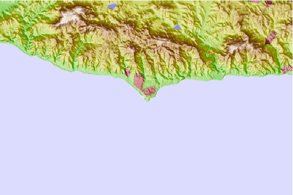
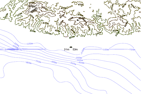
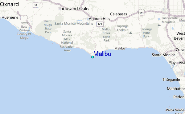
Use this relief map to navigate to tide stations, surf breaks and cities that are in the area of Malibu.
Other Nearby Locations' tide tables and tide charts to Malibu:
click location name for more details
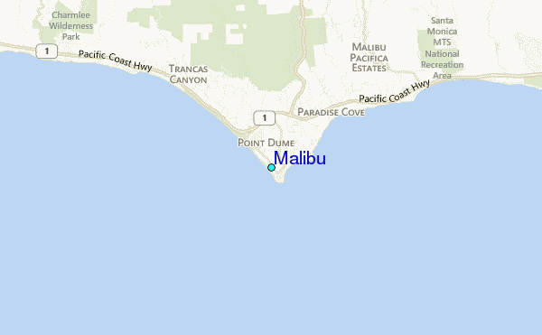
 Surf breaks close to Malibu:
|
||
|---|---|---|
| Closest surf break | Westward Beach/Point Dume | 1 mi |
| Second closest surf break | Point Dume Little Dume | 1 mi |
| Third closest surf break | Zuma Beach | 2 mi |
| Fourth closest surf break | Latigo Canyon | 3 mi |
| Fifth closest surf break | Trancas Point | 3 mi |


 Nearest
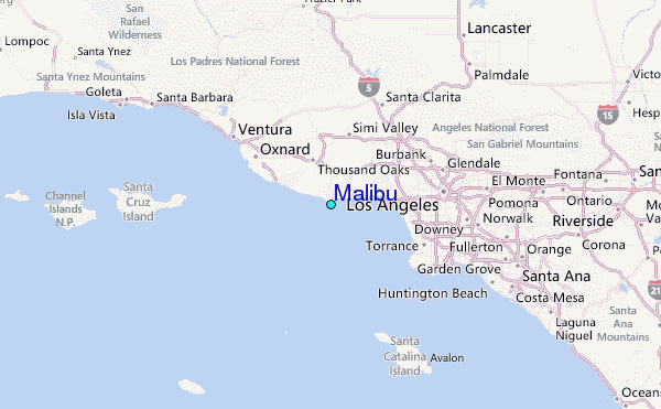