
| Distance / Altitude | Location | Report Date / Time | Live Weather | Wind | Gusts | Temp. | Visibility | Cloud |
|---|---|---|---|---|---|---|---|---|
| 278 km SSE / 3 m | SHIP2181 (Marine) | 2025-12-24 15:00 local (2025/12/24 12:00 GMT) | fresh winds from the NE (32 km/h at 50) | 25°C | 20.4 | |||
| 339 km S / 546 m | Tôlanaro/Marillac Airport (Comoros) | 2025-12-24 14:00 local (2025/12/24 11:00 GMT) | Dry and partly cloudy | strong winds from the E (43 km/h at 100) | 29°C | 10.0 | few scattered | |
| 343 km S / 41 m | 1157 (Madagascar) | 2025-12-24 15:00 local (2025/12/24 12:00 GMT) | - | severe gales from the NE (80 km/h at 45) | 25°C | - | - - 0 | |
| 375 km N / 1388 m | Antananarivo/Ivato Airport (Comoros) | 2025-12-24 14:00 local (2025/12/24 11:00 GMT) | Dry and partly cloudy | wind obs. (13 kph from 160 degs) was rejected (- km/h at -) | 22°C | 10.0 | scattered few broken | |
| 469 km NNE / 195 m | Tamatave/Toamasina Airport (Comoros) | 2025-12-24 14:00 local (2025/12/24 11:00 GMT) | Shower - in the vicinity | light winds from the SSE.(Wind varies from 120 to 180 degs) (7 km/h at 150) | 27°C | 10.0 | scattered broken | |
| 318 km E / 3 m | SHIP8258 (Marine) | 2025-12-24 15:00 local (2025/12/24 12:00 GMT) | fresh winds from the E (37 km/h at 100) | 27°C | 20.4 | |||
| 337 km S / 546 m | Tôlanaro/Marillac Airport (Comoros) | 2025-12-24 14:00 local (2025/12/24 11:00 GMT) | Dry and partly cloudy | strong winds from the E (43 km/h at 100) | 29°C | 10.0 | few scattered | |
| 342 km S / 41 m | 1157 (Madagascar) | 2025-12-24 15:00 local (2025/12/24 12:00 GMT) | - | severe gales from the NE (80 km/h at 45) | 25°C | - | - - 0 | |
| 373 km N / 1388 m | Antananarivo/Ivato Airport (Comoros) | 2025-12-24 14:00 local (2025/12/24 11:00 GMT) | Dry and partly cloudy | wind obs. (13 kph from 160 degs) was rejected (- km/h at -) | 22°C | 10.0 | scattered few broken | |
| 413 km SE / 15 m | SHIP3066 (Marine) | 2025-12-24 15:00 local (2025/12/24 12:00 GMT) | fresh winds from the ENE (36.0 km/h at 70) | — | - km |
| Contours: | Roads & Rivers: | Select a
tide station / surf break / city |

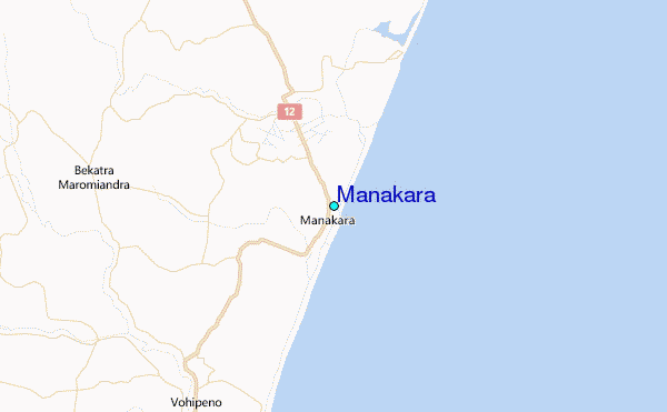
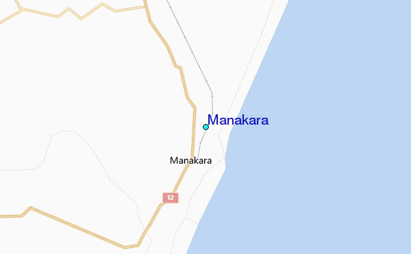
Use this relief map to navigate to tide stations, surf breaks and cities that are in the area of Manakara.
Other Nearby Locations' tide tables and tide charts to Manakara:
click location name for more details
 Surf breaks close to Manakara:
|
||
|---|---|---|
| Closest surf break | Manafiafy | 191 mi |
| Second closest surf break | Lokaro Island | 203 mi |
| Third closest surf break | Evatra | 206 mi |
| Fourth closest surf break | Fort Dauphin | 209 mi |
| Fifth closest surf break | Libanona Beach | 211 mi |


 Nearest