
| Distance / Altitude | Location | Report Date / Time | Live Weather | Wind | Gusts | Temp. | Visibility | Cloud |
|---|---|---|---|---|---|---|---|---|
| 11 km W / 7 m | OLERON CHAR A VOILE (France) | 2026-04-03 19:00 local (2026/04/03 17:00 GMT) | - | fresh winds from the SW (30 km/h at 219) | 12°C | - | - - 0 | |
| 15 km N / 5 m | Port-des-Barques wx (France) | 2026-04-03 19:40 local (2026/04/03 17:40 GMT) | dry | calm (5 km/h at 257) | 13°C | - | - - 0 | |
| 34 km WNW / 23 m | Pointe DE Chassiron (France) | 2026-04-03 19:00 local (2026/04/03 17:00 GMT) | - | light winds from the W (7 km/h at 260) | — | - | - - - | |
| 35 km N / 217 m | La Rochelle/Île de Ré Airport (France) | 2026-04-03 18:30 local (2026/04/03 16:30 GMT) | Dry and cloudy | moderate winds from the SW (20 km/h at 230) | 13°C | 10.0 | overcast | |
| 38 km NNE / 19 m | Saint-Médard-d'Aunis wx (France) | 2026-04-03 19:04 local (2026/04/03 17:04 GMT) | dry | light winds from the SW (18 km/h at 234) | 13°C | - | - - 0 | |
| 41 km N / 18 m | La Rochelle Aeroport Ile de Ré (France) | 2026-04-03 19:00 local (2026/04/03 17:00 GMT) | - | light winds from the NW (11 km/h at 320) | — | 35 | - - - | |
| 52 km NW / 5 m | Ile de Ré (PSL LOIX) (France) | 2026-04-03 19:00 local (2026/04/03 17:00 GMT) | - | moderate winds from the SW (24 km/h at 228) | 13°C | - | - - 0 | |
| 56 km ESE / 10 m | Salignac-sur-Charente wx (France) | 2026-04-03 19:21 local (2026/04/03 17:21 GMT) | dry | light winds from the SW (8 km/h at 218) | 13°C | - | - - 0 | |
| 62 km ESE / 34 m | Cognac (France) | 2026-04-03 19:00 local (2026/04/03 17:00 GMT) | dry | calm (0 km/h at 258) | 13°C | - | - - 0 | |
| 64 km ESE / 217 m | Cognac/Chateau Bernard Airport (France) | 2026-04-03 19:00 local (2026/04/03 17:00 GMT) | - | light winds from the W (7 km/h at 260) | — | 35 | broken overcast - |
| Contours: | Roads & Rivers: | Select a
tide station / surf break / city |
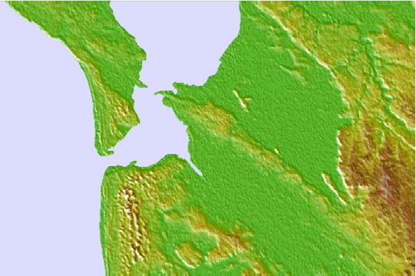
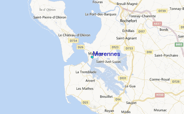
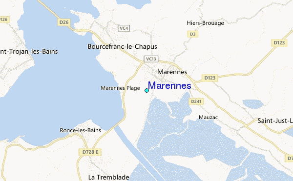
Use this relief map to navigate to tide stations, surf breaks and cities that are in the area of Marennes.
Other Nearby Locations' tide tables and tide charts to Marennes:
click location name for more details
 Surf breaks close to Marennes:
|
||
|---|---|---|
| Closest surf break | La Cote Sauvage - La Pointe Espagnole | 6 mi |
| Second closest surf break | Ile d'Oleron - St Trojan | 7 mi |
| Third closest surf break | Ile d'Oleron - Grand Village | 7 mi |
| Fourth closest surf break | La Cote Sauvage - Le 27 | 8 mi |
| Fifth closest surf break | Ile d'Oleron - Vert Bois/Les Allassins | 8 mi |


 Nearest