
| Distance / Altitude | Location | Report Date / Time | Live Weather | Wind | Gusts | Temp. | Visibility | Cloud |
|---|---|---|---|---|---|---|---|---|
| 6 km WSW / 3 m | BUOY-PTWW1 (Marine) | 2025-12-23 19:00 local (2025/12/24 03:00 GMT) | calm (4 km/h at 280) | 6°C | - | |||
| 10 km NNE / 61 m | OLF COUPEVILLE (WA) (United States) | 2025-12-23 17:46 local (2025/12/24 01:46 GMT) | Dry and partly cloudy | calm (0 km/h at 0) | 5°C | 16 | broken | |
| 11 km SW / 37 m | Port Townsend Airport (Washington) (Washington) | 2025-12-23 18:35 local (2025/12/24 02:35 GMT) | Dry and partly cloudy | calm (0 km/h at 0) | 3°C | 16 | broken broken | |
| 17 km N / 59 m | Oak Harbor Airpa (Washington) | 2025-12-23 18:09 local (2025/12/24 02:09 GMT) | Dry and partly cloudy | light winds from the E (6 km/h at 90) | 6°C | 16 | scattered | |
| 27 km NW / 3 m | BUOY-SISW1 (Marine) | 2025-12-23 19:20 local (2025/12/24 03:20 GMT) | calm (5 km/h at 130) | 7°C | - | |||
| 28 km N / 218 m | Whidbey Island Airport (Washington) | 2025-12-23 17:53 local (2025/12/24 01:53 GMT) | Dry and partly cloudy | calm (0 km/h at 0) | 5°C | 16 | scattered broken broken | |
| 33 km W / 1 m | Dungeness wx (United States) | 2025-12-23 19:04 local (2025/12/24 03:04 GMT) | dry | calm (5 km/h at 180) | 4°C | - | - - 0 | |
| 36 km WSW / 6 m | Old Town wx (United States) | 2025-12-23 19:08 local (2025/12/24 03:08 GMT) | dry | wind obs. (6 kph from 219 degs) was rejected (- km/h at -) | 3°C | - | - - 0 | |
| 36 km SE / 218 m | Everett Airport (Washington) | 2025-12-23 17:53 local (2025/12/24 01:53 GMT) | Dry and cloudy | light winds from the ESE (7 km/h at 110) | 5°C | 16 | overcast | |
| 39 km E / 197 m | Arlington Municipal Airport (Washington) | 2025-12-23 17:56 local (2025/12/24 01:56 GMT) | Dry and cloudy | light winds from the N (6 km/h at 350) | 4°C | 16 | overcast |
| Contours: | Roads & Rivers: | Select a
tide station / surf break / city |
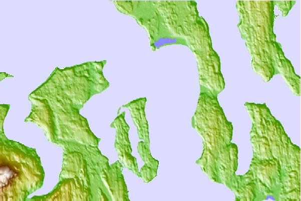
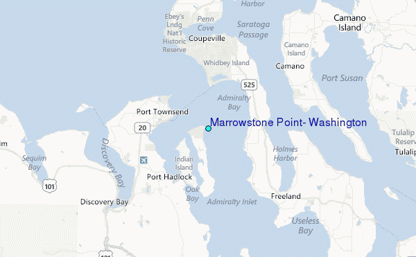
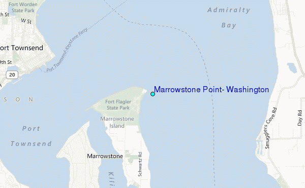
Use this relief map to navigate to tide stations, surf breaks and cities that are in the area of Marrowstone Point, Washington.
Other Nearby Locations' tide tables and tide charts to Marrowstone Point, Washington:
click location name for more details
 Surf breaks close to Marrowstone Point, Washington:
|
||
|---|---|---|
| Closest surf break | Fort. Ebey | 9 mi |
| Second closest surf break | Super green | 28 mi |
| Third closest surf break | Elwha | 41 mi |
| Fourth closest surf break | Crescent | 48 mi |
| Fifth closest surf break | Whiskey Creek | 51 mi |


 Nearest
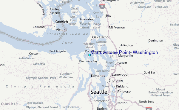