
| Distance / Altitude | Location | Report Date / Time | Live Weather | Wind | Gusts | Temp. | Visibility | Cloud |
|---|---|---|---|---|---|---|---|---|
| 3 km SE / 92 m | Broughton Moor wx (United Kingdom) | 2025-12-25 07:31 local (2025/12/25 07:31 GMT) | - | wind obs. (16 kph from 144 degs) was rejected (- km/h at -) | 2°C | - | - - 0 | |
| 17 km SSE / 202 m | Kirkland (United Kingdom) | 2025-12-25 07:45 local (2025/12/25 07:45 GMT) | dry | - (- km/h at ) | — | - | - - 0 | |
| 22 km S / 124 m | STBeesHead NO 2 (United Kingdom) | 2025-12-25 08:00 local (2025/12/25 08:00 GMT) | - | light winds from the E (7 km/h at 100) | 0°C | 60 km | clear | |
| 25 km ESE / 238 m | Keswick Automatic Weather Station (United Kingdom) | 2025-12-25 08:00 local (2025/12/25 08:00 GMT) | - | light winds from the ESE (15 km/h at 120) | 4°C | >70 km | - scattered - | |
| 34 km W / 238 m | Dundrennan (United Kingdom) | 2025-12-25 08:00 local (2025/12/25 08:00 GMT) | - | fresh winds from the ENE (31 km/h at 60) | 3°C | 50 km | - few - | |
| 56 km ENE / 75 m | Brampton wx (United Kingdom) | 2025-12-25 07:31 local (2025/12/25 07:31 GMT) | dry | light winds from the ENE (14 km/h at 75) | 4°C | - | - - 0 | |
| 57 km ESE / 238 m | Shap (United Kingdom) | 2025-12-25 08:00 local (2025/12/25 08:00 GMT) | no report | wind obs. (22 kph from 80 degs) was rejected (- km/h at -) | 3°C | 55 km | - mostly cloudy - | |
| 65 km S / 1 m | Vickerstown wx (United Kingdom) | 2025-12-25 08:13 local (2025/12/25 08:13 GMT) | dry | calm (0 km/h at ) | 3°C | - | - - 0 | |
| 66 km SSE / 15 m | WalneyIsland (United Kingdom) | 2025-12-25 08:00 local (2025/12/25 08:00 GMT) | - | light winds from the NNE (11 km/h at 20) | 3°C | 65 km | - clear - | |
| 68 km E / 664 m | GreatDunFell NO 2 (United Kingdom) | 2025-12-25 08:00 local (2025/12/25 08:00 GMT) | - | wind obs. (63 kph from 80 degs) was rejected (- km/h at -) | -2°C | - | - no observation - |
| Contours: | Roads & Rivers: | Select a
tide station / surf break / city |
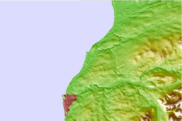
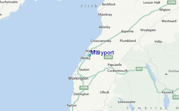
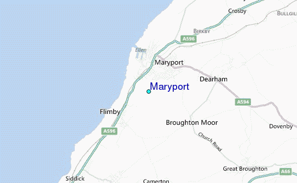
Use this relief map to navigate to tide stations, surf breaks and cities that are in the area of Maryport.
Other Nearby Locations' tide tables and tide charts to Maryport:
click location name for more details
 Surf breaks close to Maryport:
|
||
|---|---|---|
| Closest surf break | Peel | 58 mi |
| Second closest surf break | Castletown | 63 mi |
| Third closest surf break | Gansey | 65 mi |
| Fourth closest surf break | Port St Mary Point | 66 mi |
| Fifth closest surf break | Blyth Beach | 85 mi |


 Nearest
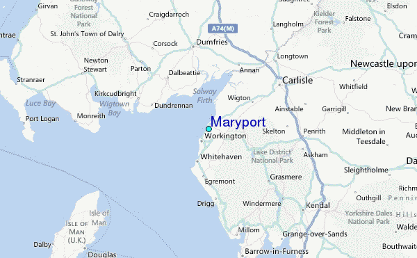