
| Distance / Altitude | Location | Report Date / Time | Live Weather | Wind | Gusts | Temp. | Visibility | Cloud |
|---|---|---|---|---|---|---|---|---|
| 360 km ENE / 216 m | Gizan Airport (Saudi Arabia) | 2025-12-07 07:00 local (2025/12/07 04:00 GMT) | Dry and partly cloudy | light winds from the E (9 km/h at 90) | 23°C | 8.0 | no significant cloud | |
| 443 km NE / 2135 m | Abha Airport (Saudi Arabia) | 2025-12-07 07:00 local (2025/12/07 04:00 GMT) | - | calm (0 km/h at 0) | — | 0.0 | ||
| 461 km NE / 2014 m | Khamis Mushait Air Base Airport (Saudi Arabia) | 2025-12-07 07:00 local (2025/12/07 04:00 GMT) | - | calm (0 km/h at 0) | — | 0.0 | ||
| 566 km NNE / 1578 m | Al Baha (Saudi Arabia) | 2025-12-07 07:00 local (2025/12/07 04:00 GMT) | Dry and partly cloudy | light winds from the SE (7 km/h at 140) | — | 0.0 | few scattered - | |
| 573 km ENE / 705 m | Nejran Airport (Saudi Arabia) | 2025-12-07 07:00 local (2025/12/07 04:00 GMT) | - | calm (4 km/h at 300) | — | 0.0 | - - - | |
| 577 km N / 2 m | Shoaiba Kite Lagoon (Saudi Arabia) | 2025-12-07 08:00 local (2025/12/07 05:00 GMT) | - | strong winds from the SE (50 km/h at 130) | 30°C | - | - - 0 | |
| 586 km NE / 696 m | Bisha Airport (Saudi Arabia) | 2025-12-07 07:00 local (2025/12/07 04:00 GMT) | - | calm (4 km/h at 200) | — | 0.0 | few scattered - | |
| 602 km SE / 76 m | Ambouli Djibouti Airport (Djibouti) | 2025-12-07 08:00 local (2025/12/07 05:00 GMT) | - | light winds from the SSE (11 km/h at 150) | 25°C | 10.0 | few | |
| 657 km N / 1471 m | Ta'if Regional Airport (Saudi Arabia) | 2025-12-07 07:00 local (2025/12/07 04:00 GMT) | - | light winds from the S (9 km/h at 190) | — | 0.0 | few - - | |
| 671 km N / 217 m | Jeddah/King Abdulaziz International Airport (Saudi Arabia) | 2025-12-07 07:00 local (2025/12/07 04:00 GMT) | Dry and partly cloudy | light winds from the ESE (6 km/h at 120) | 25°C | 7.0 | no significant cloud |
| Contours: | Roads & Rivers: | Select a
tide station / surf break / city |
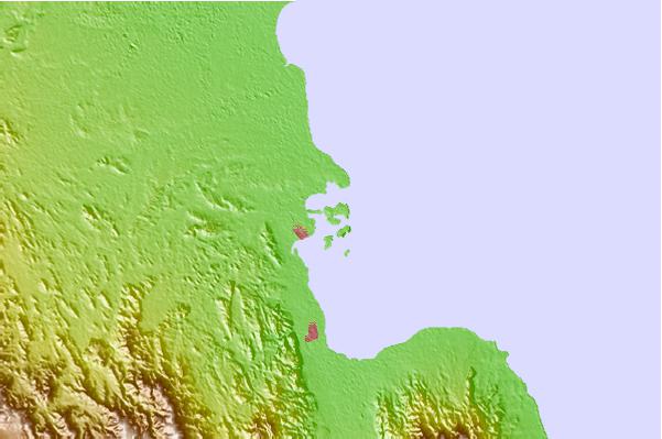
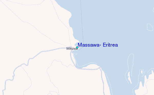
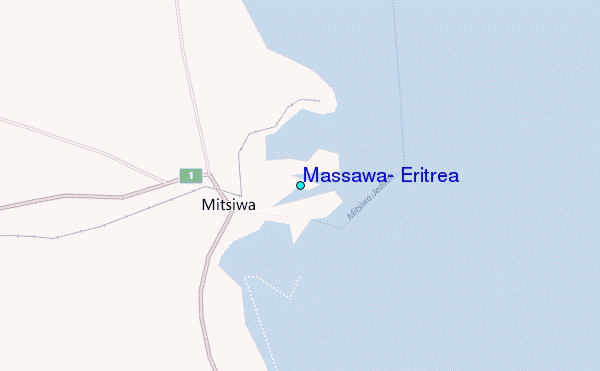
Use this relief map to navigate to tide stations, surf breaks and cities that are in the area of Massawa, Eritrea.
Other Nearby Locations' tide tables and tide charts to Massawa, Eritrea:
click location name for more details
 Surf breaks close to Massawa, Eritrea:
|
||
|---|---|---|
| Closest surf break | Marsa Alaam | 720 mi |
| Second closest surf break | Pirights | 866 mi |
| Third closest surf break | Qulansiyah | 962 mi |
| Fourth closest surf break | Eilat (Green Beach) | 1004 mi |
| Fifth closest surf break | Mangaf | 1084 mi |


 Nearest
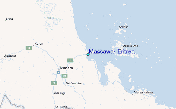