
| Distance / Altitude | Location | Report Date / Time | Live Weather | Wind | Gusts | Temp. | Visibility | Cloud |
|---|---|---|---|---|---|---|---|---|
| 1 km W / 3 m | WeatherServiceOffice- Chuuk- Eci (Micronesia) | 2026-03-06 10:00 local (2026/03/06 00:00 GMT) | Light rain showers | light winds from the (11 km/h at 990) | 27°C | 39 km | overcast | |
| 2 km N / 211 m | Weno Island/Chuuk International Airport (Micronesia) | 2026-03-06 09:50 local (2026/03/05 23:50 GMT) | Shower light rain shower | light winds from the N (11 km/h at 1) | 27°C | 19 | scattered overcast | |
| 240 km ESE / 15 m | ASCATB154E7N (Marine) | 2026-03-06 09:01 local (2026/03/05 23:01 GMT) | fresh winds from the S (38 km/h at 185) | — | - km | |||
| 244 km E / 15 m | ASCATB154E8N (Marine) | 2026-03-06 09:00 local (2026/03/05 23:00 GMT) | strong winds from the SSE (40 km/h at 163) | — | - km | |||
| 285 km SE / 15 m | ASCATB154E6N (Marine) | 2026-03-06 09:01 local (2026/03/05 23:01 GMT) | moderate winds from the SSE (28 km/h at 152) | — | - km | |||
| 295 km ENE / 15 m | ASCATB154E9N (Marine) | 2026-03-06 09:00 local (2026/03/05 23:00 GMT) | fresh winds from the ESE (30 km/h at 106) | — | - km | |||
| 296 km E / 15 m | ASCATB155E8N (Marine) | 2026-03-06 09:00 local (2026/03/05 23:00 GMT) | strong winds from the S (39 km/h at 176) | — | - km | |||
| 313 km ESE / 15 m | ASCATB155E7N (Marine) | 2026-03-06 09:01 local (2026/03/05 23:01 GMT) | moderate winds from the SE (28 km/h at 128) | — | - km | |||
| 322 km ENE / 15 m | ASCATB155E9N (Marine) | 2026-03-06 09:00 local (2026/03/05 23:00 GMT) | moderate winds from the ESE (23 km/h at 115) | — | - km | |||
| 361 km SSE / 15 m | ASCATB153E5N (Marine) | 2026-03-06 09:01 local (2026/03/05 23:01 GMT) | fresh winds from the SSE (34 km/h at 163) | — | - km |
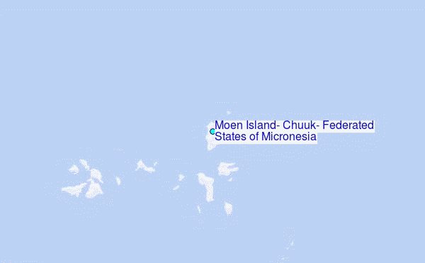
Choose Moen Island, Chuuk, Federated States of Micronesia Location Map Zoom:
| Contours: | Roads & Rivers: | Select a
tide station / surf break / city |
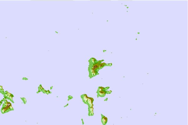
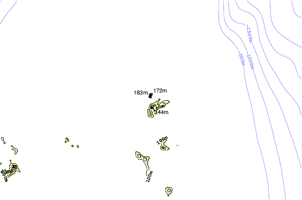
Use this relief map to navigate to tide stations, surf breaks and cities that are in the area of Moen Island, Chuuk, Federated States of Micronesia.
Other Nearby Locations' tide tables and tide charts to Moen Island, Chuuk, Federated States of Micronesia:
click location name for more details
 Surf breaks close to Moen Island, Chuuk, Federated States of Micronesia:
|
||
|---|---|---|
| Closest surf break | Talofofo/The Bay | 630 mi |
| Second closest surf break | Pickop's Point | 630 mi |
| Third closest surf break | Ylig | 632 mi |
| Fourth closest surf break | Threes | 633 mi |
| Fifth closest surf break | Tubeys/Point Death | 633 mi |


 Nearest