
| Distance / Altitude | Location | Report Date / Time | Live Weather | Wind | Gusts | Temp. | Visibility | Cloud |
|---|---|---|---|---|---|---|---|---|
| 18 km SSW / 34 m | Shark Bay Airport (Australia) | 2026-03-15 09:00 local (2026/03/15 01:00 GMT) | No report | moderate winds from the SSE (22 km/h at 160) | 28°C | - | - no observation - | |
| 102 km N / 7 m | Carnarvon Airport (Australia) | 2026-03-15 09:00 local (2026/03/15 01:00 GMT) | No report | moderate winds from the S (28 km/h at 180) | 28°C | - | - no observation - | |
| 102 km N / 7 m | Carnarvon Airport (Australia) | 2026-03-15 09:00 local (2026/03/15 01:00 GMT) | No report | moderate winds from the S (28 km/h at 180) | 28°C | - | - no observation - | |
| 144 km SE / 117 m | Billabong Asa (Australia) | 2026-03-15 09:00 local (2026/03/15 01:00 GMT) | no report | - (- km/h at -) | — | - | - | |
| 216 km SSE / 120 m | Kalbarri (Australia) | 2026-03-15 09:00 local (2026/03/15 01:00 GMT) | State of sky unchanged | light winds from the E (15 km/h at 90) | 28°C | 50 km | clear | |
| 277 km S / 3 m | North Island (Australia) | 2026-03-15 09:00 local (2026/03/15 01:00 GMT) | No report | fresh winds from the SE (37 km/h at 140) | 24°C | - | - no observation - | |
| 344 km SSE / 34 m | Geraldton Airport (Australia) | 2026-03-15 09:00 local (2026/03/15 01:00 GMT) | Clear skies | fresh winds from the ESE (31 km/h at 120) | 27°C | - | - no observation - | |
| 344 km SSE / 34 m | Geraldton Airport (Australia) | 2026-03-15 09:00 local (2026/03/15 01:00 GMT) | Clear skies | fresh winds from the ESE (31 km/h at 120) | 27°C | - | - no observation - | |
| 350 km SSE / 35 m | Mullewa (Australia) | 2026-03-15 09:00 local (2026/03/15 01:00 GMT) | State of sky unchanged | moderate winds from the ESE (22 km/h at 110) | 25°C | 40 km | clear | |
| 396 km N / 6 m | LearmonthAirport (Australia) | 2026-03-15 09:00 local (2026/03/15 01:00 GMT) | no report | light winds from the SW (17 km/h at 230) | 23°C | - | - no observation - |
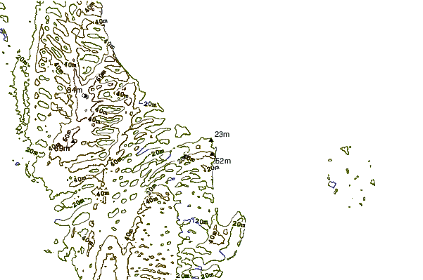
| Contours: | Roads & Rivers: | Select a
tide station / surf break / city |
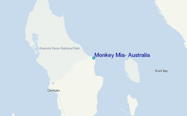
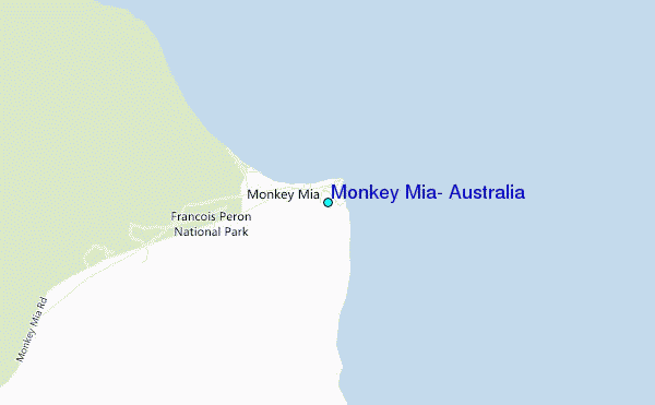
Use this relief map to navigate to tide stations, surf breaks and cities that are in the area of Monkey Mia, Australia.
Other Nearby Locations' tide tables and tide charts to Monkey Mia, Australia:
click location name for more details
 Surf breaks close to Monkey Mia, Australia:
|
||
|---|---|---|
| Closest surf break | Dirk Hartog Island | 40 mi |
| Second closest surf break | Steep Point | 42 mi |
| Third closest surf break | Red Bluff | 124 mi |
| Fourth closest surf break | Turtles | 127 mi |
| Fifth closest surf break | Blue Holes | 135 mi |


 Nearest
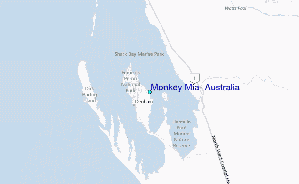