
| Distance / Altitude | Location | Report Date / Time | Live Weather | Wind | Gusts | Temp. | Visibility | Cloud |
|---|---|---|---|---|---|---|---|---|
| 2 km N / 22 m | Mawlamyine (Myanmar) | 2025-12-26 15:30 local (2025/12/26 09:00 GMT) | state of sky unchanged | calm (4 km/h at 220) | 31°C | 6 | - scattered - | |
| 45 km N / 10 m | Hpaan (Myanmar) | 2025-12-26 15:30 local (2025/12/26 09:00 GMT) | state of sky unchanged | calm (0 km/h at 0) | 34°C | 28 km | - few - | |
| 100 km ENE / 9 m | Mae Sot-(แม่สอด) (Thailand) | 2025-12-26 14:30 local (2025/12/26 08:00 GMT) | - | light winds from the N (9 km/h at 1) | 31°C | 10.0 | few - - | |
| 102 km ENE / 197 m | Mae Sot (Thailand) | 2025-12-26 15:30 local (2025/12/26 09:00 GMT) | no report | light winds from the NNE (6 km/h at 20) | 31°C | 30 km | - scattered - | |
| 139 km S / 7 m | YE (Myanmar) | 2025-12-26 15:30 local (2025/12/26 09:00 GMT) | no report | wind obs. (7 kph from 220 degs) was rejected (- km/h at -) | 31°C | 5 | - few - | |
| 143 km ESE / 457 m | Umphang (Thailand) | 2025-12-26 15:30 local (2025/12/26 09:00 GMT) | Haze | light winds from the S (7 km/h at 170) | 30°C | 29 km | - scattered - | |
| 144 km ENE / 868 m | Musoe Agromet (Thailand) | 2025-12-26 15:30 local (2025/12/26 09:00 GMT) | Haze | wind obs. (6 kph from 120 degs) was rejected (- km/h at -) | 24°C | 29 km | - few - | |
| 151 km WNW / 15 m | Bago (Myanmar) | 2025-12-26 15:30 local (2025/12/26 09:00 GMT) | continuous moderate drizzle | calm (2 km/h at 40) | 32°C | 30 km | - clear - | |
| 160 km W / 29 m | Mingaladon (Myanmar) | 2025-12-26 15:30 local (2025/12/26 09:00 GMT) | light to moderate thunderstorm | calm (4 km/h at 180) | 26°C | 5 | - | |
| 162 km W / 20 m | Yangon (Myanmar) | 2025-12-26 15:30 local (2025/12/26 09:00 GMT) | light to moderate thunderstorm | calm (2 km/h at 220) | 27°C | 6 | - scattered - |
| Contours: | Roads & Rivers: | Select a
tide station / surf break / city |
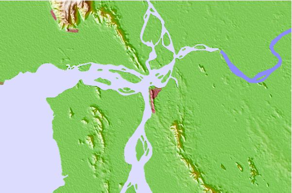
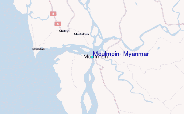
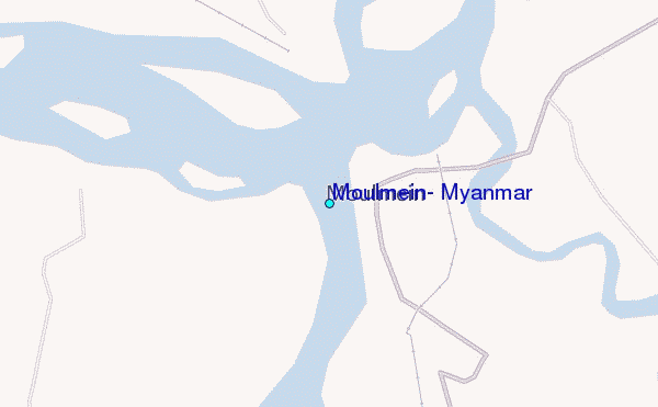
Use this relief map to navigate to tide stations, surf breaks and cities that are in the area of Moulmein, Myanmar.
Other Nearby Locations' tide tables and tide charts to Moulmein, Myanmar:
click location name for more details
 Surf breaks close to Moulmein, Myanmar:
|
||
|---|---|---|
| Closest surf break | Prachuap Khiri Khan | 355 mi |
| Second closest surf break | Rayong Mae Ramphung Beach | 370 mi |
| Third closest surf break | Ko Samet - Sai Kaew | 374 mi |
| Fourth closest surf break | Hinsuay Namsay | 375 mi |
| Fifth closest surf break | Mae Phim Beach (Rayong) | 377 mi |


 Nearest
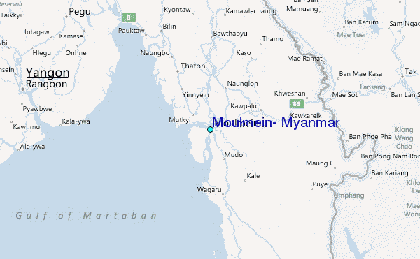