
| Distance / Altitude | Location | Report Date / Time | Live Weather | Wind | Gusts | Temp. | Visibility | Cloud |
|---|---|---|---|---|---|---|---|---|
| 133 km S / 211 m | Weno Island/Chuuk International Airport (Micronesia) | 2025-12-24 10:52 local (2025/12/24 00:52 GMT) | Dry and partly cloudy | light winds from the NE (13 km/h at 40) | 30°C | 24 | few broken | |
| 681 km ESE / 3 m | BUOY-52213 (Marine) | 2025-12-24 11:30 local (2025/12/24 01:30 GMT) | - (- km/h at -) | — | - | |||
| 682 km ESE / 235 m | Pohnpei Airport (Micronesia) | 2025-12-24 10:53 local (2025/12/24 00:53 GMT) | Shower light rain shower | light winds from the ENE (7 km/h at 60) | 31°C | 24 | scattered broken overcast | |
| 819 km SSE / 15 m | ASCATC154E2N (Marine) | 2025-12-24 09:28 local (2025/12/23 23:28 GMT) | moderate winds from the NE (23 km/h at 44) | — | - km | |||
| 826 km SSE / 15 m | ASCATC155E2N (Marine) | 2025-12-24 09:28 local (2025/12/23 23:28 GMT) | moderate winds from the NE (23 km/h at 46) | — | - km | |||
| 849 km SSW / 15 m | ASCATC148E3N (Marine) | 2025-12-24 09:28 local (2025/12/23 23:28 GMT) | light winds from the E (17 km/h at 86) | — | - km | |||
| 914 km SSE / 15 m | ASCATC154E1N (Marine) | 2025-12-24 09:28 local (2025/12/23 23:28 GMT) | moderate winds from the ENE (21 km/h at 58) | — | - km | |||
| 920 km SSE / 15 m | ASCATC155E1N (Marine) | 2025-12-24 09:28 local (2025/12/23 23:28 GMT) | moderate winds from the NE (22 km/h at 52) | — | - km | |||
| 921 km SW / 3 m | SHIP8482 (Marine) | 2025-12-24 10:00 local (2025/12/24 00:00 GMT) | light winds from the ENE (18 km/h at 70) | 33°C | 20.4 | |||
| 921 km SW / 15 m | SHIP3901 (Marine) | 2025-12-24 10:00 local (2025/12/24 00:00 GMT) | light winds from the ENE (18.36 km/h at 70) | 30°C | 17.7 km |
| Contours: | Roads & Rivers: | Select a
tide station / surf break / city |

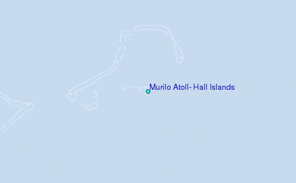
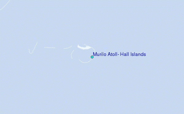
Use this relief map to navigate to tide stations, surf breaks and cities that are in the area of Murilo Atoll, Hall Islands.
Other Nearby Locations' tide tables and tide charts to Murilo Atoll, Hall Islands:
click location name for more details
 Surf breaks close to Murilo Atoll, Hall Islands:
|
||
|---|---|---|
| Closest surf break | Talofofo/The Bay | 603 mi |
| Second closest surf break | Pickop's Point | 604 mi |
| Third closest surf break | Ylig | 605 mi |
| Fourth closest surf break | Threes | 607 mi |
| Fifth closest surf break | Tubeys/Point Death | 608 mi |


 Nearest
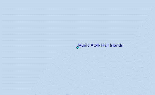