
| Distance / Altitude | Location | Report Date / Time | Live Weather | Wind | Gusts | Temp. | Visibility | Cloud |
|---|---|---|---|---|---|---|---|---|
| 12 km NE / 8 m | lightning 14km SE of Piney Green (United States) | 2026-04-25 23:49 local (2026/04/26 03:49 GMT) | Thunderstorm | (- km/h at -) | — | |||
| 16 km E / 0 m | lightning 15km SSW of Swansboro (United States) | 2026-04-26 02:33 local (2026/04/26 06:33 GMT) | Thunderstorm | (- km/h at -) | — | |||
| 23 km NW / 219 m | New River Marine Corps Air Station Airport (North Carolina) | 2026-04-26 00:56 local (2026/04/26 04:56 GMT) | - | light winds from the NNE (13 km/h at 30) | 18°C | 16 | few | |
| 25 km ESE / 0 m | lightning 27km S of Cape Carteret (United States) | 2026-04-26 02:01 local (2026/04/26 06:01 GMT) | Thunderstorm | (- km/h at -) | — | |||
| 33 km ENE / 204 m | Bogue/Swansboro Airport (North Carolina) | 2026-04-26 01:02 local (2026/04/26 05:02 GMT) | Thunderstorm moderate rain thunderstorm | light winds from the NE (9 km/h at 50) | 18°C | 5 | few broken | |
| 39 km SSW / 0 m | lightning 16km ENE of Bayshore (United States) | 2026-04-26 00:33 local (2026/04/26 04:33 GMT) | Thunderstorm | (- km/h at -) | — | |||
| 41 km WNW / 220 m | Jacksonville Airport (North Carolina) | 2026-04-26 01:21 local (2026/04/26 05:21 GMT) | Dry and partly cloudy | calm (0 km/h at 0) | 18°C | 16 | few scattered | |
| 42 km NNE / 9 m | lightning 17km NNE of Pumpkin Center (United States) | 2026-04-26 00:04 local (2026/04/26 04:04 GMT) | Thunderstorm | (- km/h at -) | — | |||
| 44 km SSE / 0 m | lightning 48km ESE of Surf City (United States) | 2026-04-26 02:03 local (2026/04/26 06:03 GMT) | Thunderstorm | (- km/h at -) | — | |||
| 45 km ESE / 0 m | lightning 41km S of Emerald Isle (United States) | 2026-04-26 02:34 local (2026/04/26 06:34 GMT) | Thunderstorm | (- km/h at -) | — |
| Contours: | Roads & Rivers: | Select a
tide station / surf break / city |
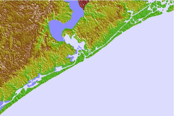

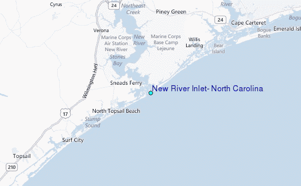
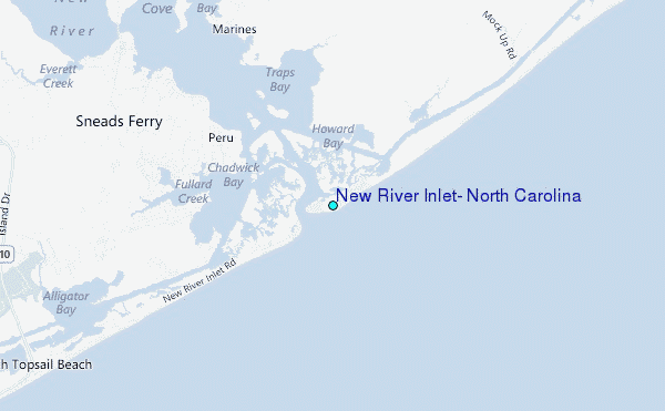
Use this relief map to navigate to tide stations, surf breaks and cities that are in the area of New River Inlet, North Carolina.
Other Nearby Locations' tide tables and tide charts to New River Inlet, North Carolina:
click location name for more details
 Surf breaks close to New River Inlet, North Carolina:
|
||
|---|---|---|
| Closest surf break | Topsail Island | 11 mi |
| Second closest surf break | Surf City Pier | 14 mi |
| Third closest surf break | The Point | 16 mi |
| Fourth closest surf break | Bogue Pier | 22 mi |
| Fifth closest surf break | Wrightsville Beach | 34 mi |


 Nearest
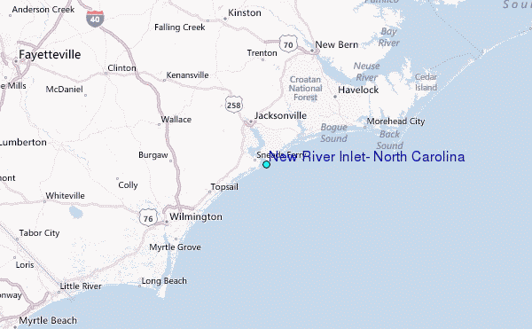