
| Distance / Altitude | Location | Report Date / Time | Live Weather | Wind | Gusts | Temp. | Visibility | Cloud |
|---|---|---|---|---|---|---|---|---|
| 5 km NE / 3 m | BUOY-PSBM1 (Marine) | 2026-04-17 01:00 local (2026/04/17 05:00 GMT) | light winds from the S (15 km/h at 170) | 5°C | - | |||
| 24 km SE / 78 m | Grand Manan Sar Cs- NB (Canada) | 2026-04-17 01:00 local (2026/04/17 05:00 GMT) | - | light winds from the WSW (11 km/h at 250) | — | - | - no observation - | |
| 28 km WNW / 56 m | Blanchard Corner wx (United States) | 2026-04-17 01:19 local (2026/04/17 05:19 GMT) | light rain | calm (0 km/h at 331) | 6°C | - | - - 0 | |
| 28 km S / 3 m | BUOY-CFWM1 (Marine) | 2026-04-17 01:00 local (2026/04/17 05:00 GMT) | calm (4 km/h at 120) | 4°C | - | |||
| 30 km SW / 30 m | lightning 7km N of East Machias (United States) | 2026-04-16 23:50 local (2026/04/17 03:50 GMT) | Thunderstorm | (- km/h at -) | — | |||
| 31 km NW / 29 m | Red Beach wx (United States) | 2026-04-17 01:21 local (2026/04/17 05:21 GMT) | dry | calm (0 km/h at 298) | 6°C | - | - - 0 | |
| 33 km SSE / 0 m | lightning 38km SE of Eastport (United States) | 2026-04-17 02:01 local (2026/04/17 06:01 GMT) | Thunderstorm | (- km/h at -) | — | |||
| 35 km W / 83 m | Cooper (Maine) | 2026-04-17 01:37 local (2026/04/17 05:37 GMT) | light rain | calm (0 km/h at ) | 6°C | - | - - 0 | |
| 39 km WNW / 41 m | lightning 10km SW of Calais (United States) | 2026-04-16 23:19 local (2026/04/17 03:19 GMT) | Thunderstorm | (- km/h at -) | — | |||
| 41 km NW / 210 m | St. Stephen Airport (New Brunswick) | 2026-04-17 00:00 local (2026/04/17 04:00 GMT) | - | light winds from the SSE (6 km/h at 160) | 7°C | 0.0 |
| Contours: | Roads & Rivers: | Select a
tide station / surf break / city |
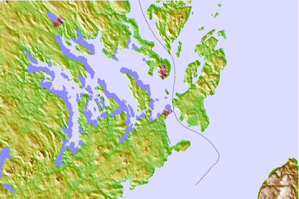
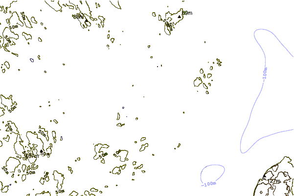
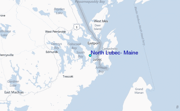
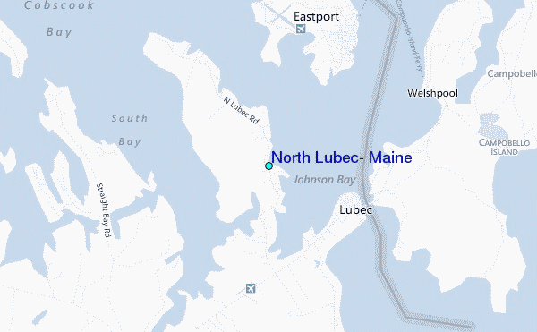
Use this relief map to navigate to tide stations, surf breaks and cities that are in the area of North Lubec, Maine.
Other Nearby Locations' tide tables and tide charts to North Lubec, Maine:
click location name for more details
 Surf breaks close to North Lubec, Maine:
|
||
|---|---|---|
| Closest surf break | Summerville | 126 mi |
| Second closest surf break | Scotts Bay | 129 mi |
| Third closest surf break | White Point Beach | 129 mi |
| Fourth closest surf break | Western Head Reef | 131 mi |
| Fifth closest surf break | Western Head Point | 131 mi |


 Nearest