
| Distance / Altitude | Location | Report Date / Time | Live Weather | Wind | Gusts | Temp. | Visibility | Cloud |
|---|---|---|---|---|---|---|---|---|
| 11 km ENE / 219 m | North Myrtle Bea Airport (South Carolina) | 2026-05-28 10:53 local (2026/05/28 14:53 GMT) | Clear | light winds from the WNW (9 km/h at 290) | 27°C | 16 | ||
| 15 km SSW / 3 m | BUOY-MROS1 (Marine) | 2026-05-28 12:00 local (2026/05/28 16:00 GMT) | light winds from the W (13 km/h at 270) | 27°C | - | |||
| 15 km SSW / 205 m | Myrtle Beach Airport (South Carolina) | 2026-05-28 10:53 local (2026/05/28 14:53 GMT) | - | light winds from the W (15 km/h at 280) | 27°C | 16 | few | |
| 29 km W / 11 m | Conway - Horry County Airport (South Carolina) (South Carolina) | 2026-05-28 11:35 local (2026/05/28 15:35 GMT) | Clear | light winds from the W (7 km/h at 260) | 27°C | 16 | ||
| 32 km ENE / 3 m | Sunset Beach Nearshore Buoy (Marine) | 2026-05-28 12:12 local (2026/05/28 16:12 GMT) | - (- km/h at -) | — | - | |||
| 32 km ENE / 3 m | BUOY-41024 (Marine) | 2026-05-28 12:08 local (2026/05/28 16:08 GMT) | light winds from the SW (7 km/h at 220) | 25°C | - | |||
| 56 km N / 217 m | Whiteville Airport (North Carolina) | 2026-05-28 11:35 local (2026/05/28 15:35 GMT) | Dry and partly cloudy | light winds from the NW.(Wind varies from 260 to 330 degs) (13 km/h at 310) | 29°C | 11 | broken broken | |
| 67 km WNW / 28 m | Marion County Airport (South Carolina) (South Carolina) | 2026-05-28 11:35 local (2026/05/28 15:35 GMT) | Clear | light winds from the W (17 km/h at 280) | 28°C | 16 | ||
| 68 km SSW / 12 m | Georgetown County Airport (South Carolina) (South Carolina) | 2026-05-28 11:35 local (2026/05/28 15:35 GMT) | Dry and partly cloudy | light winds from the W (11 km/h at 280) | 28°C | 16 | scattered | |
| 70 km ENE / 217 m | Southport Airport (North Carolina) | 2026-05-28 11:35 local (2026/05/28 15:35 GMT) | Clear | light winds from the WSW (19 km/h at 240) | 28°C | 16 |
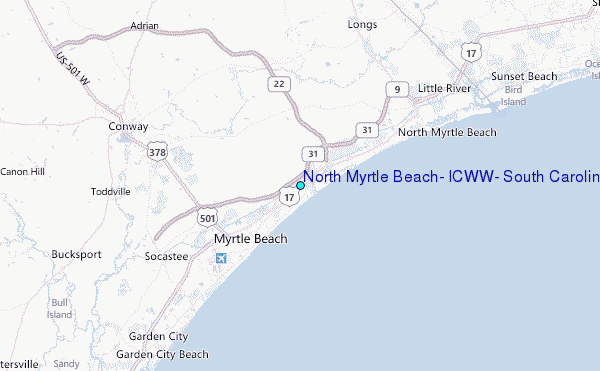
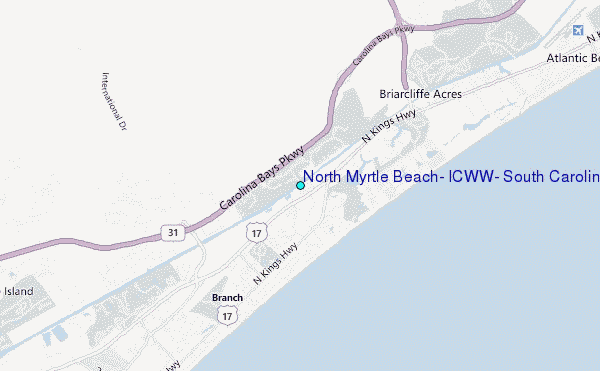
Choose North Myrtle Beach, ICWW, South Carolina Location Map Zoom:
| Contours: | Roads & Rivers: | Select a
tide station / surf break / city |
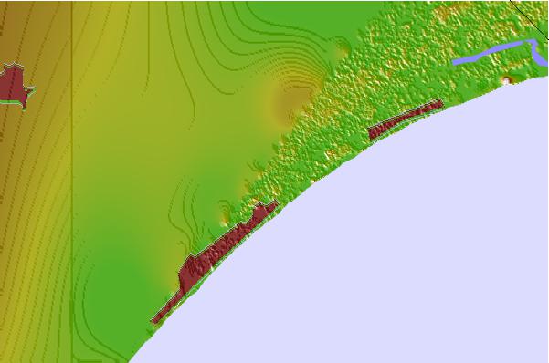

Use this relief map to navigate to tide stations, surf breaks and cities that are in the area of North Myrtle Beach, ICWW, South Carolina.
Other Nearby Locations' tide tables and tide charts to North Myrtle Beach, ICWW, South Carolina:
click location name for more details
 Surf breaks close to North Myrtle Beach, ICWW, South Carolina:
|
||
|---|---|---|
| Closest surf break | Dunes Cove | 2 mi |
| Second closest surf break | Myrtle Beach - Pier 14 | 2 mi |
| Third closest surf break | Apache Pier | 5 mi |
| Fourth closest surf break | Springmaid Beach | 6 mi |
| Fifth closest surf break | 13th Ave South Surfside | 8 mi |


 Nearest
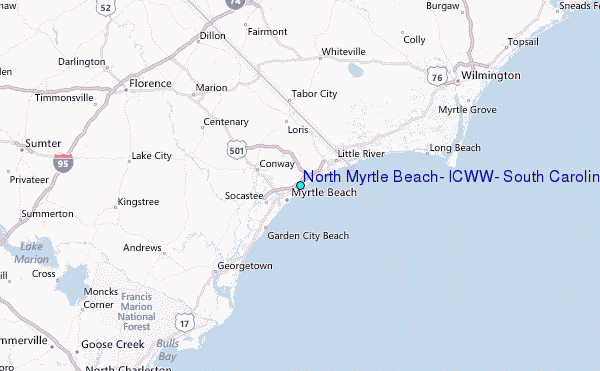