
| Distance / Altitude | Location | Report Date / Time | Live Weather | Wind | Gusts | Temp. | Visibility | Cloud |
|---|---|---|---|---|---|---|---|---|
| 10 km WNW / 3 m | BUOY-ROBN4 (Marine) | 2026-06-03 04:48 local (2026/06/03 08:48 GMT) | moderate winds from the N (21 km/h at 360) | — | - | |||
| 12 km N / 7 m | Downtown Manhattan/Wall Street Heliport Airport (New york) | 2026-06-03 03:56 local (2026/06/03 07:56 GMT) | Clear | wind obs. (6 kph from 280 degs) was rejected (- km/h at -) | 19°C | 16 | ||
| 12 km N / 3 m | BUOY-BATN6 (Marine) | 2026-06-03 04:48 local (2026/06/03 08:48 GMT) | - (- km/h at -) | — | - | |||
| 13 km S / 3 m | BUOY-SDHN4 (Marine) | 2026-06-03 04:48 local (2026/06/03 08:48 GMT) | light winds from the N (9 km/h at 10) | — | - | |||
| 15 km W / 3 m | BUOY-MHRN6 (Marine) | 2026-06-03 04:48 local (2026/06/03 08:48 GMT) | light winds from the N (11 km/h at 10) | — | - | |||
| 17 km NNE / 33 m | Middle Village (New York) | 2026-06-03 04:29 local (2026/06/03 08:29 GMT) | dry | calm (2 km/h at 349) | 13°C | - | - - 0 | |
| 18 km WNW / 218 m | Newark Airport (New Jersey) | 2026-06-03 03:51 local (2026/06/03 07:51 GMT) | Dry and partly cloudy | light winds from the NNE (11 km/h at 20) | 16°C | 16 | scattered scattered | |
| 20 km ENE / 218 m | New York City/JFK Airport (New York) | 2026-06-03 03:51 local (2026/06/03 07:51 GMT) | Dry and partly cloudy | light winds from the N (15 km/h at 360) | 17°C | 16 | scattered scattered | |
| 22 km SSW / 11 m | Hazlet (New Jersey) | 2026-06-03 04:12 local (2026/06/03 08:12 GMT) | - | - (- km/h at ) | 29°C | - | - - 0 | |
| 22 km WSW / 7 m | Linden Airport (New jersey) | 2026-06-03 04:35 local (2026/06/03 08:35 GMT) | Clear | light winds from the NW (7 km/h at 310) | 16°C | 16 |
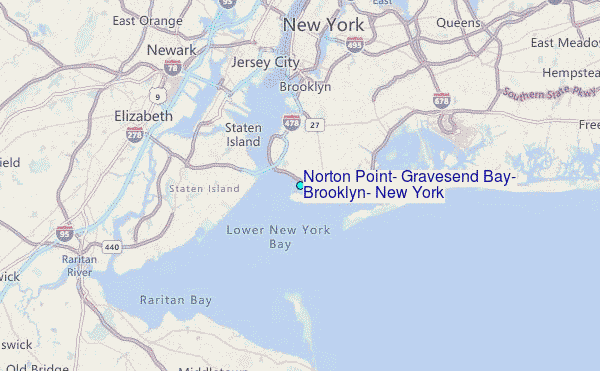
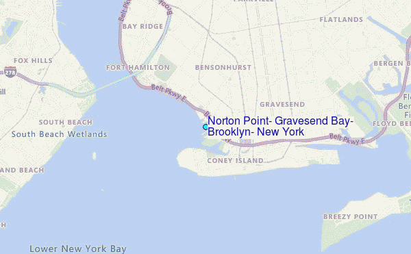
Choose Norton Point, Gravesend Bay, Brooklyn, New York Location Map Zoom:
| Contours: | Roads & Rivers: | Select a
tide station / surf break / city |
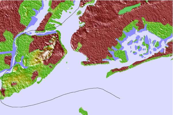
Use this relief map to navigate to tide stations, surf breaks and cities that are in the area of Norton Point, Gravesend Bay, Brooklyn, New York.
Other Nearby Locations' tide tables and tide charts to Norton Point, Gravesend Bay, Brooklyn, New York:
click location name for more details
 Surf breaks close to Norton Point, Gravesend Bay, Brooklyn, New York:
|
||
|---|---|---|
| Closest surf break | Rockaway | 7 mi |
| Second closest surf break | The Cove at Sandy Hook | 9 mi |
| Third closest surf break | 92nd Street | 10 mi |
| Fourth closest surf break | 1st Parking Lot | 11 mi |
| Fifth closest surf break | Sandy Hook/The Cove | 12 mi |


 Nearest
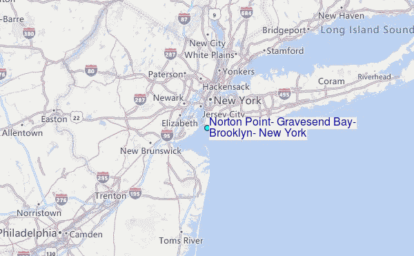