
| Distance / Altitude | Location | Report Date / Time | Live Weather | Wind | Gusts | Temp. | Visibility | Cloud |
|---|---|---|---|---|---|---|---|---|
| 1 km W / 3 m | BUOY-OCIM2 (Marine) | 2026-06-08 20:30 local (2026/06/09 00:30 GMT) | light winds from the E (11 km/h at 90) | 17°C | - | |||
| 3 km SW / 217 m | Ocean City Airport (Maryland) | 2026-06-08 19:53 local (2026/06/08 23:53 GMT) | Clear | light winds from the E (15 km/h at 90) | 17°C | 16 | ||
| 24 km N / 3 m | BUOY-44084 (Marine) | 2026-06-08 20:56 local (2026/06/09 00:56 GMT) | - (- km/h at -) | — | - | |||
| 36 km WSW / 218 m | Salisbury Airport (Maryland) | 2026-06-08 19:54 local (2026/06/08 23:54 GMT) | Clear | light winds from the ENE (15 km/h at 70) | 18°C | 16 | ||
| 37 km ENE / 3 m | Delaware Bay Buoy (Marine) | 2026-06-08 20:50 local (2026/06/09 00:50 GMT) | fresh winds from the ENE (29 km/h at 60) | 16°C | - | |||
| 39 km ENE / - m | SHIP1217 (ocean) | 2026-06-08 19:00 local (2026/06/08 23:00 GMT) | - | fresh winds from the ENE (29 km/h at 70) | 17°C | - | no observation | |
| 39 km ENE / - m | SHIP224 (ocean) | 2026-06-08 21:00 local (2026/06/09 01:00 GMT) | - | fresh winds from the ENE (29 km/h at 60) | 16°C | - | no observation | |
| 39 km ENE / - m | SHIP1806 (ocean) | 2026-06-08 19:00 local (2026/06/08 23:00 GMT) | - | moderate winds from the ENE (25 km/h at 60) | 17°C | - | no observation | |
| 39 km ENE / - m | SHIP1681 (ocean) | 2026-06-08 19:00 local (2026/06/08 23:00 GMT) | - | moderate winds from the ENE (25 km/h at 70) | 17°C | - | no observation | |
| 39 km ENE / - m | SHIP723 (ocean) | 2026-06-08 19:00 local (2026/06/08 23:00 GMT) | - | moderate winds from the ENE (25 km/h at 70) | 17°C | - | no observation |
Choose Ocean City (fishing pier), Maryland Location Map Zoom:
| Contours: | Roads & Rivers: | Select a
tide station / surf break / city |
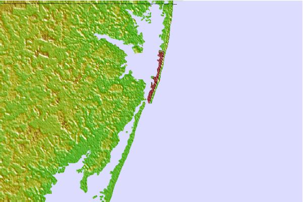
Use this relief map to navigate to tide stations, surf breaks and cities that are in the area of Ocean City (fishing pier), Maryland.
Other Nearby Locations' tide tables and tide charts to Ocean City (fishing pier), Maryland:
click location name for more details
 Surf breaks close to Ocean City (fishing pier), Maryland:
|
||
|---|---|---|
| Closest surf break | The Inlet and Pier | 0 mi |
| Second closest surf break | North Assateague (The Wedge) | 1 mi |
| Third closest surf break | Wedge | 1 mi |
| Fourth closest surf break | Outside Shoals | 2 mi |
| Fifth closest surf break | 48th Street | 5 mi |


 Nearest