
| Distance / Altitude | Location | Report Date / Time | Live Weather | Wind | Gusts | Temp. | Visibility | Cloud |
|---|---|---|---|---|---|---|---|---|
| 16 km WSW / 3 m | Nakhonsi Thammarat Agromet (Thailand) | 2026-04-03 23:00 local (2026/04/03 16:00 GMT) | no report | light winds from the WSW (15 km/h at 240) | 31°C | 10 | - | |
| 34 km WNW / 223 m | Nakhon Si Thammarat Airport (ท่าอากาศยานนครศรีธรรมราช) (Thailand) | 2026-04-03 22:00 local (2026/04/03 15:00 GMT) | - | calm (4 km/h at 1) | 24°C | 10.0 | few | |
| 36 km WNW / 6 m | Nakhonsi Thammarat (Thailand) | 2026-04-03 23:00 local (2026/04/03 16:00 GMT) | no report | wind obs. (7 kph from 300 degs) was rejected (- km/h at -) | 32°C | - | - | |
| 46 km WNW / 7 m | Ban Pratu Chang wx (Thailand) | 2026-04-03 23:48 local (2026/04/03 16:48 GMT) | - | calm (0 km/h at 0) | — | - | - - 0 | |
| 77 km WSW / 30 m | Chawang (Thailand) | 2026-04-03 23:00 local (2026/04/03 16:00 GMT) | no report | calm (0 km/h at 230) | 27°C | - | - | |
| 85 km S / 4 m | Phatthalung Agromet (Thailand) | 2026-04-03 23:00 local (2026/04/03 16:00 GMT) | no report | calm (0 km/h at 320) | 30°C | - | - - - | |
| 107 km W / 14 m | Phrasang (Thailand) | 2026-04-03 23:00 local (2026/04/03 16:00 GMT) | no report | calm (4 km/h at 170) | 29°C | - | - | |
| 107 km WNW / 37 m | Surat Thani Agromet (Thailand) | 2026-04-03 23:00 local (2026/04/03 16:00 GMT) | no report | wind obs. (7 kph from 240 degs) was rejected (- km/h at -) | 31°C | - | - | |
| 113 km SSW / 1 m | Trang Airport (Thailand) | 2026-04-03 23:00 local (2026/04/03 16:00 GMT) | no report | wind obs. (15 kph from 300 degs) was rejected (- km/h at -) | 31°C | - | - - - | |
| 123 km N / 6 m | KOSamui (Thailand) | 2026-04-03 23:00 local (2026/04/03 16:00 GMT) | Haze | calm (4 km/h at 140) | 31°C | 29 km | - scattered - |
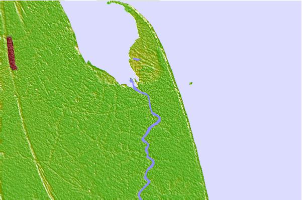
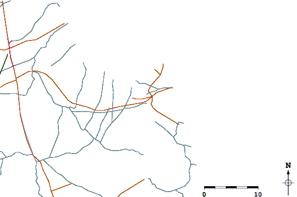
| Contours: | Roads & Rivers: | Select a
tide station / surf break / city |
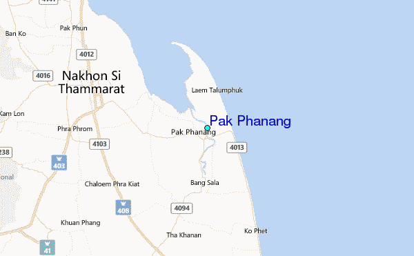
Use this relief map to navigate to tide stations, surf breaks and cities that are in the area of Pak Phanang.
Other Nearby Locations' tide tables and tide charts to Pak Phanang:
click location name for more details
 Surf breaks close to Pak Phanang:
|
||
|---|---|---|
| Closest surf break | Ko Samui | 81 mi |
| Second closest surf break | Chaweng Malibu | 82 mi |
| Third closest surf break | Songkhla - Fulerayem Point | 83 mi |
| Fourth closest surf break | Kho Phan-Ngan - Haad Rin | 92 mi |
| Fifth closest surf break | Koh Lanta - Khlong Dao | 94 mi |


 Nearest
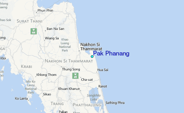