
| Distance / Altitude | Location | Report Date / Time | Live Weather | Wind | Gusts | Temp. | Visibility | Cloud |
|---|---|---|---|---|---|---|---|---|
| 23 km NNE / 360 m | Barahona Airport (Dominican Republic) | 2026-03-09 20:00 local (2026/03/10 00:00 GMT) | Dry and partly cloudy | moderate winds from the SE (26 km/h at 130) | 26°C | 10.0 | few scattered scattered | |
| 110 km NNE / 1420 m | El Gajo de la Paila wx (Dominican Republic) | 2026-03-09 20:34 local (2026/03/10 00:34 GMT) | dry | calm (3 km/h at 259) | 13°C | - | - - 0 | |
| 140 km ENE / 30 m | La Isabela International Airport (Dominican republic) | 2026-03-09 20:00 local (2026/03/10 00:00 GMT) | Moderate rain | calm (0 km/h at 0) | 22°C | 6.0 | few broken broken | |
| 152 km ENE / 41 m | Ensanche Savica de Mendoza wx (Dominican Republic) | 2026-03-09 20:19 local (2026/03/10 00:19 GMT) | dry | calm (0 km/h at 307) | 22°C | - | - - 0 | |
| 165 km ENE / 212 m | Punta Caucedo/Las Americas Airport (Dominican Republic) | 2026-03-09 20:00 local (2026/03/10 00:00 GMT) | Light rain | light winds from the N (15 km/h at 10) | 23°C | 7.0 | broken broken | |
| 170 km NNE / 209 m | Santiago International Airport (Dominican Republic) | 2026-03-09 20:00 local (2026/03/10 00:00 GMT) | Light rain | light winds from the ESE.(Wind varies from 080 to 150 degs) (7 km/h at 110) | 21°C | 8.0 | few broken | |
| 172 km NNE / 200 m | Los Zanjón wx (Dominican Republic) | 2026-03-09 20:04 local (2026/03/10 00:04 GMT) | dry | calm (0 km/h at ) | 21°C | - | - - 0 | |
| 174 km N / 64 m | Mao (Dominican Republic) | 2026-03-09 21:14 local (2026/03/10 01:14 GMT) | dry | light winds from the ENE (8 km/h at 64) | 22°C | - | - - 0 | |
| 204 km NNE / 466 m | Puerto Plata IN Airport (Dominican Republic) | 2026-03-09 20:00 local (2026/03/10 00:00 GMT) | Dry and partly cloudy | light winds from the ESE (11 km/h at 120) | 25°C | 10.0 | scattered | |
| 206 km NE / 10 m | El Catey International Airport (Dominican republic) | 2026-03-09 20:00 local (2026/03/10 00:00 GMT) | Dry and partly cloudy | calm (0 km/h at 0) | 24°C | 10.0 | broken broken |

| Contours: | Roads & Rivers: | Select a
tide station / surf break / city |
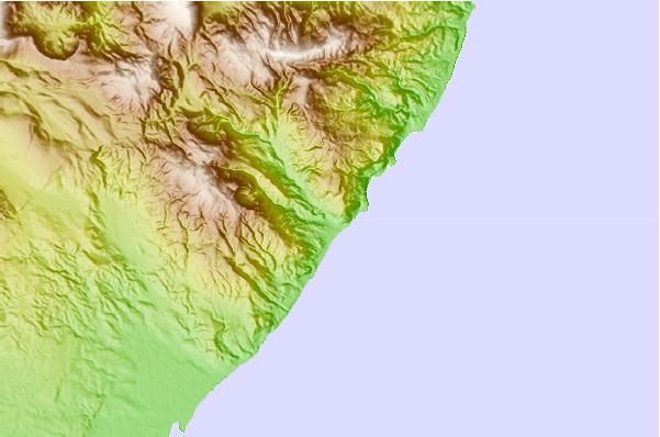
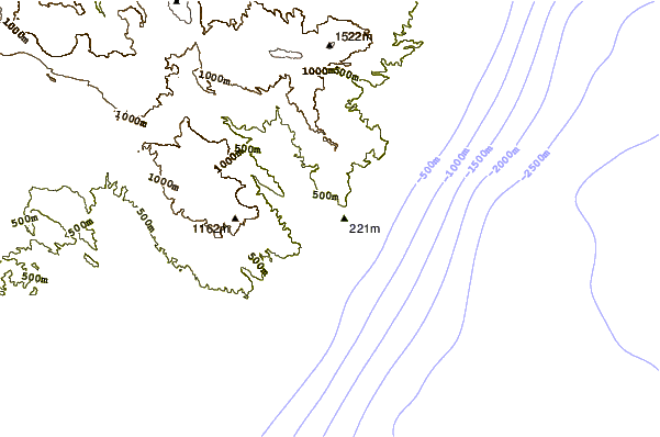
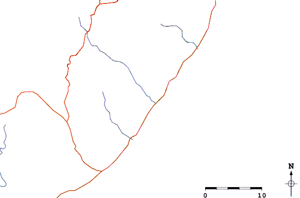
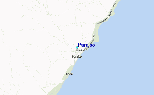
Use this relief map to navigate to tide stations, surf breaks and cities that are in the area of Paraiso.
Other Nearby Locations' tide tables and tide charts to Paraiso:
click location name for more details
 Surf breaks close to Paraiso:
|
||
|---|---|---|
| Closest surf break | Barranca | 1 mi |
| Second closest surf break | La Cienega | 10 mi |
| Third closest surf break | Baorvco | 11 mi |
| Fourth closest surf break | San Rafael | 16 mi |
| Fifth closest surf break | Paraiso | 17 mi |


 Nearest
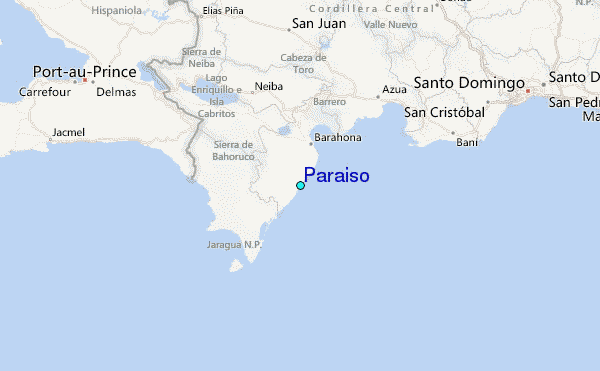