
| Distance / Altitude | Location | Report Date / Time | Live Weather | Wind | Gusts | Temp. | Visibility | Cloud |
|---|---|---|---|---|---|---|---|---|
| 26 km ENE / 219 m | Cross City Airport (Florida) | 2026-07-25 22:35 local (2026/07/26 02:35 GMT) | Clear | calm (0 km/h at 0) | 25°C | 16 | ||
| 42 km NW / 3 m | BUOY-KTNF1 (Marine) | 2026-07-25 23:20 local (2026/07/26 03:20 GMT) | light winds from the W (13 km/h at 270) | 30°C | - | |||
| 52 km SE / 3 m | BUOY-CDRF1 (Marine) | 2026-07-25 23:20 local (2026/07/26 03:20 GMT) | calm (5 km/h at 310) | 30°C | - | |||
| 52 km SE / 3 m | BUOY-CKYF1 (Marine) | 2026-07-25 23:00 local (2026/07/26 03:00 GMT) | light winds from the NW (8 km/h at 310) | 30°C | - | |||
| 66 km NW / 14 m | Perry Foley Airport (Florida) (Florida) | 2026-07-25 22:35 local (2026/07/26 02:35 GMT) | Clear | calm (0 km/h at 0) | 27°C | 16 | ||
| 81 km ESE / 23 m | lightning 6km SSW of Williston Highlands (United States) | 2026-07-25 22:01 local (2026/07/26 02:01 GMT) | Thunderstorm | (- km/h at -) | — | |||
| 82 km ENE / 20 m | thunderstorm affecting High Springs (United States) | 2026-07-25 21:03 local (2026/07/26 01:03 GMT) | Thunderstorm | (- km/h at -) | — | |||
| 86 km E / 28 m | lightning 10km N of Archer (United States) | 2026-07-25 21:31 local (2026/07/26 01:31 GMT) | Thunderstorm | (- km/h at -) | — | |||
| 86 km E / 19 m | lightning 5km WNW of Williston (United States) | 2026-07-25 21:31 local (2026/07/26 01:31 GMT) | Thunderstorm | (- km/h at -) | — | |||
| 89 km E / 23 m | Williston Municipal Airport (Florida) (Florida) | 2026-07-25 22:35 local (2026/07/26 02:35 GMT) | Dry and partly cloudy | calm (0 km/h at 0) | 25°C | 16 | scattered scattered scattered |
| Contours: | Roads & Rivers: | Select a
tide station / surf break / city |

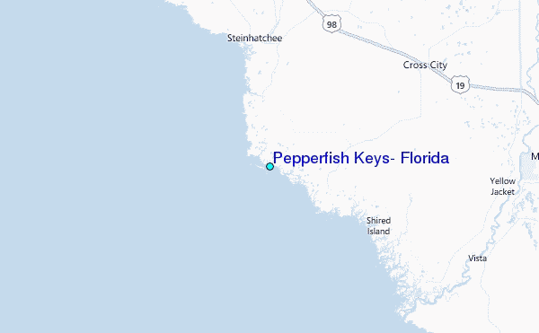
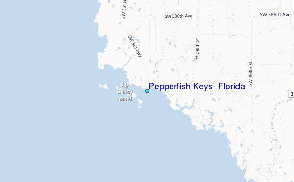
Use this relief map to navigate to tide stations, surf breaks and cities that are in the area of Pepperfish Keys, Florida.
Other Nearby Locations' tide tables and tide charts to Pepperfish Keys, Florida:
click location name for more details
 Surf breaks close to Pepperfish Keys, Florida:
|
||
|---|---|---|
| Closest surf break | St George Island | 92 mi |
| Second closest surf break | Anclote Island | 96 mi |
| Third closest surf break | Honeymoon Island | 101 mi |
| Fourth closest surf break | Clearwater Pass | 111 mi |
| Fifth closest surf break | Clearwater Beach | 112 mi |


 Nearest
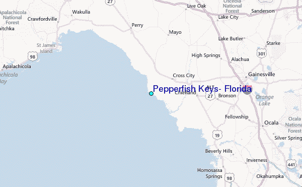