
| Distance / Altitude | Location | Report Date / Time | Live Weather | Wind | Gusts | Temp. | Visibility | Cloud |
|---|---|---|---|---|---|---|---|---|
| 5 km NW / 3 m | BUOY-EINL1 (Marine) | 2025-12-25 05:48 local (2025/12/25 11:48 GMT) | light winds from the ENE (13 km/h at 70) | — | - | |||
| 13 km N / 3 m | BUOY-AMRL1 (Marine) | 2025-12-25 05:48 local (2025/12/25 11:48 GMT) | calm (4 km/h at 50) | — | - | |||
| 39 km NNE / 3 m | BUOY-TESL1 (Marine) | 2025-12-25 05:48 local (2025/12/25 11:48 GMT) | calm (4 km/h at 50) | — | - | |||
| 43 km N / 209 m | Patterson Williams Memorial Airport (Louisiana) | 2025-12-25 05:31 local (2025/12/25 11:31 GMT) | Fog - | calm (0 km/h at 0) | 17°C | 0 | broken overcast | |
| 71 km ENE / 312 m | Houma Terrebonne Airport (Louisiana) | 2025-12-25 05:35 local (2025/12/25 11:35 GMT) | Dry and cloudy | calm (0 km/h at 0) | 15°C | 0 | overcast | |
| 82 km S / 3 m | BUOY-KSPR (Marine) | 2025-12-25 05:55 local (2025/12/25 11:55 GMT) | light winds from the E (17 km/h at 100) | 21°C | 16.1 | |||
| 83 km S / 31 m | Ship Shoal178 (Louisiana) | 2025-12-25 05:35 local (2025/12/25 11:35 GMT) | Dry and partly cloudy | light winds from the E (15 km/h at 100) | 21°C | 16 | few scattered | |
| 93 km NW / 218 m | New Iberia Airport (Louisiana) | 2025-12-25 04:53 local (2025/12/25 10:53 GMT) | Fog - | calm (0 km/h at 0) | 17°C | 0 | ||
| 96 km W / 3 m | BUOY-FRWL1 (Marine) | 2025-12-25 05:48 local (2025/12/25 11:48 GMT) | calm (5 km/h at 50) | — | - | |||
| 101 km NNE / 5 m | Louisiana Regional Airport, Gonzales (Louisiana) | 2025-12-25 05:35 local (2025/12/25 11:35 GMT) | Fog - | calm (0 km/h at 0) | 17°C | 0 | overcast |
| Contours: | Roads & Rivers: | Select a
tide station / surf break / city |

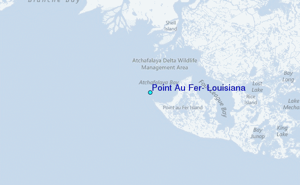
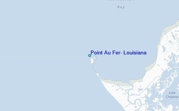
Use this relief map to navigate to tide stations, surf breaks and cities that are in the area of Point Au Fer, Louisiana.
Other Nearby Locations' tide tables and tide charts to Point Au Fer, Louisiana:
click location name for more details
 Surf breaks close to Point Au Fer, Louisiana:
|
||
|---|---|---|
| Closest surf break | Holly Beach | 131 mi |
| Second closest surf break | Chandeleur Islands | 155 mi |
| Third closest surf break | Bolivar | 188 mi |
| Fourth closest surf break | Meacom Pier | 203 mi |
| Fifth closest surf break | Galveston - Flagship Pier | 205 mi |


 Nearest
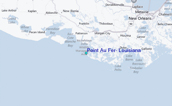