
| Distance / Altitude | Location | Report Date / Time | Live Weather | Wind | Gusts | Temp. | Visibility | Cloud |
|---|---|---|---|---|---|---|---|---|
| 47 km SE / 13 m | Quinhagak (AK) (Alaska) | 2026-06-23 20:56 local (2026/06/24 04:56 GMT) | Dry and partly cloudy | light winds from the SSW (17 km/h at 210) | 14°C | 16 | broken | |
| 87 km NNE / 214 m | Bethel Airport (Alaska) | 2026-06-23 20:53 local (2026/06/24 04:53 GMT) | Dry and cloudy | light winds from the SSW (17 km/h at 210) | 18°C | 16 | overcast | |
| 89 km NNE / 3 m | BUOY-BEXA2 (Marine) | 2026-06-23 22:32 local (2026/06/24 06:32 GMT) | light winds from the W (17 km/h at 260) | 18°C | - | |||
| 91 km WSW / 213 m | Kipnuk Airport (AK) (United States) | 2026-06-23 20:56 local (2026/06/24 04:56 GMT) | Dry and cloudy | moderate winds from the W (22 km/h at 260) | 12°C | 16 | broken overcast | |
| 122 km SSE / 182 m | Platinum (AK) Airport (United States) | 2026-06-23 20:56 local (2026/06/24 04:56 GMT) | Clear | light winds from the NW (7 km/h at 310) | — | 16 | ||
| 132 km S / 15 m | hy2b197E59N (Marine) | 2026-06-23 19:20 local (2026/06/24 03:20 GMT) | calm (5 km/h at 310) | — | - km | |||
| 153 km SSW / 15 m | hy2b196E59N (Marine) | 2026-06-23 19:20 local (2026/06/24 03:20 GMT) | light winds from the WNW (12 km/h at 290) | — | - km | |||
| 158 km W / 18 m | Toksook Bay Airport (Alaska) | 2026-06-23 20:56 local (2026/06/24 04:56 GMT) | Clear | moderate winds from the WNW (22 km/h at 290) | 12°C | 16 | ||
| 159 km S / 646 m | Cape Newenham Airport (Alaska) | 2026-06-23 21:06 local (2026/06/24 05:06 GMT) | Fog - | calm (0 km/h at 0) | 10°C | 0 | overcast | |
| 161 km SE / 194 m | Togiak Airport (Alaska) | 2026-06-23 20:56 local (2026/06/24 04:56 GMT) | Clear | light winds from the S (19 km/h at 190) | 13°C | 16 |
| Contours: | Roads & Rivers: | Select a
tide station / surf break / city |
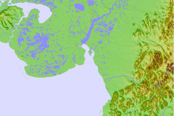
Use this relief map to navigate to tide stations, surf breaks and cities that are in the area of Popokamute, Alaska.
Other Nearby Locations' tide tables and tide charts to Popokamute, Alaska:
click location name for more details
 Surf breaks close to Popokamute, Alaska:
|
||
|---|---|---|
| Closest surf break | Bird Point (Tidal Bore) | 379 mi |
| Second closest surf break | Monashka Bay | 388 mi |
| Third closest surf break | Termination Point | 388 mi |
| Fourth closest surf break | Mill Bay | 390 mi |
| Fifth closest surf break | Fossil Beach Kodiak | 404 mi |


 Nearest