
| Distance / Altitude | Location | Report Date / Time | Live Weather | Wind | Gusts | Temp. | Visibility | Cloud |
|---|---|---|---|---|---|---|---|---|
| 24 km S / 32 m | Samuel Hill Aerodrome (Australia) | 2026-03-30 11:00 local (2026/03/30 01:00 GMT) | no report | moderate winds from the SE (24 km/h at 140) | 26°C | - | - no observation - | |
| 49 km ENE / 15 m | ASCATB151E22S (Marine) | 2026-03-30 09:13 local (2026/03/29 23:13 GMT) | strong winds from the SE (45 km/h at 126) | — | - km | |||
| 59 km WSW / 28 m | Williamson (Australia) | 2026-03-30 11:00 local (2026/03/30 01:00 GMT) | no report | - (- km/h at -) | 14°C | - | - | |
| 67 km S / 6 m | Yeppoon (Australia) | 2026-03-30 11:00 local (2026/03/30 01:00 GMT) | no report | moderate winds from the SE (22 km/h at 130) | 27°C | - | - no observation - | |
| 67 km S / 6 m | Yeppoon Automatic Weather Station (Australia) | 2026-03-30 11:00 local (2026/03/30 01:00 GMT) | no report | moderate winds from the SE (22 km/h at 130) | 27°C | - | - no observation - | |
| 93 km S / 176 m | Frenchville wx (Australia) | 2026-03-30 09:41 local (2026/03/29 23:41 GMT) | - | calm (0 km/h at 227) | 27°C | - | - - 0 | |
| 94 km N / 15 m | ASCATC151E22S (Marine) | 2026-03-30 09:47 local (2026/03/29 23:47 GMT) | strong winds from the SE (44 km/h at 127) | — | - km | |||
| 97 km S / 15 m | Rockhampton Aero (Australia) | 2026-03-30 11:00 local (2026/03/30 01:00 GMT) | no report | moderate winds from the ESE (26 km/h at 110) | 28°C | - | - no observation - | |
| 97 km S / 217 m | Rockhampton Airport (Australia) | 2026-03-30 10:30 local (2026/03/30 00:30 GMT) | Dry and partly cloudy | moderate winds from the ESE (24 km/h at 120) | 28°C | 10.0 | no cloud | |
| 97 km S / 217 m | Rockhampton Airport (Australia) | 2026-03-30 10:30 local (2026/03/30 00:30 GMT) | Dry and partly cloudy | moderate winds from the ESE (24 km/h at 120) | 28°C | 10.0 | no cloud scattered broken |
| Contours: | Roads & Rivers: | Select a
tide station / surf break / city |
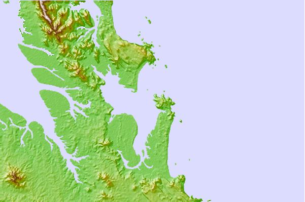
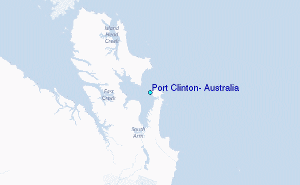
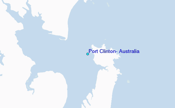
Use this relief map to navigate to tide stations, surf breaks and cities that are in the area of Port Clinton, Australia.
Other Nearby Locations' tide tables and tide charts to Port Clinton, Australia:
click location name for more details
 Surf breaks close to Port Clinton, Australia:
|
||
|---|---|---|
| Closest surf break | South Wall Mackay Harbour | 139 mi |
| Second closest surf break | North Wall Mackay Harbour Beach | 139 mi |
| Third closest surf break | Agnes Waters | 140 mi |
| Fourth closest surf break | Lamberts Beach | 140 mi |
| Fifth closest surf break | Dolphin Heads | 144 mi |


 Nearest
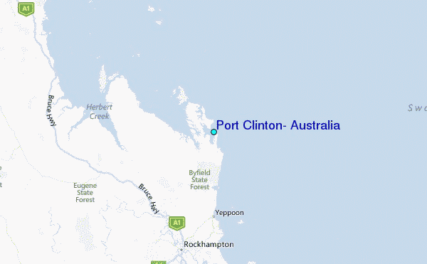