
| Distance / Altitude | Location | Report Date / Time | Live Weather | Wind | Gusts | Temp. | Visibility | Cloud |
|---|---|---|---|---|---|---|---|---|
| 38 km WSW / 4 m | Nelson Lagoon Airport (Alaska) | 2025-12-25 22:56 local (2025/12/26 07:56 GMT) | - | fresh winds from the ESE (35 km/h at 120) | 3°C | 0.0 | ||
| 38 km WSW / 3 m | BUOY-NLXA2 (Marine) | 2025-12-26 00:32 local (2025/12/26 09:32 GMT) | fresh winds from the SSE (35 km/h at 160) | 4°C | - | |||
| 53 km NNE / 3 m | BUOY-CPSA2 (Marine) | 2025-12-26 00:32 local (2025/12/26 09:32 GMT) | light winds from the SSE (18 km/h at 150) | 5°C | - | |||
| 142 km ENE / 212 m | Chignik Bay Airport (Alaska) | 2025-12-25 23:43 local (2025/12/26 08:43 GMT) | Light rain | wind obs. (19 kph from 80 degs) was rejected (- km/h at -) | 5°C | 16 | overcast | |
| 144 km SSW / 47 m | King Cove Airport (Alabama) (Alaska) | 2025-12-25 23:15 local (2025/12/26 08:15 GMT) | - | wind obs. (17 kph from 80 degs) was rejected (- km/h at -) | 5°C | 0.0 | ||
| 152 km SSW / 3 m | BUOY-KGCA2 (Marine) | 2025-12-26 00:00 local (2025/12/26 09:00 GMT) | moderate winds from the ESE (22 km/h at 120) | 6°C | - | |||
| 161 km SW / 161 m | Cold Bay Airport (Alaska) | 2025-12-25 23:05 local (2025/12/26 08:05 GMT) | Mist - | strong winds from the SSE (41 km/h at 150) | 6°C | 8 | scattered overcast | |
| 220 km SSW / 6 m | False Pass Airport (Alaska) | 2025-12-25 22:56 local (2025/12/26 07:56 GMT) | Light rain | moderate winds from the SSW (24 km/h at 200) | 6°C | 5 | overcast | |
| 256 km NE / 18 m | Pilot Point (Alaska) | 2025-12-25 22:56 local (2025/12/26 07:56 GMT) | Dry and cloudy | light winds from the ESE (19 km/h at 110) | 1°C | 16 | broken overcast | |
| 310 km NW / 646 m | Cape Newenham Airport (Alaska) | 2025-12-25 23:42 local (2025/12/26 08:42 GMT) | Heavy snow | near gales from the NNE.(Wind varies from 010 to 100 degs) (61 km/h at 30) | — | 0 |
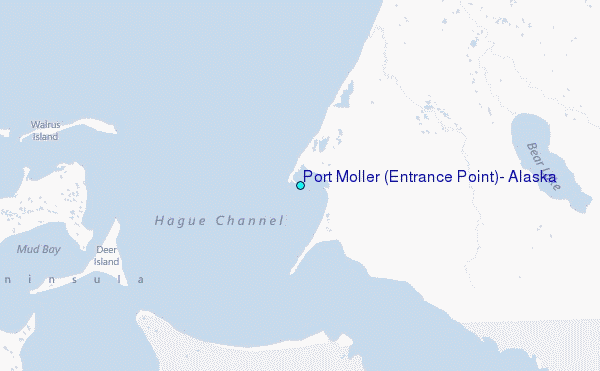
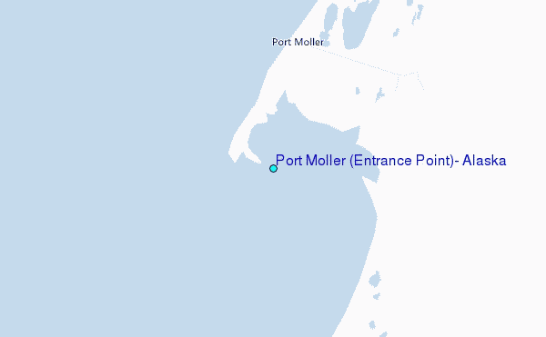
Choose Port Moller (Entrance Point), Alaska Location Map Zoom:
| Contours: | Roads & Rivers: | Select a
tide station / surf break / city |
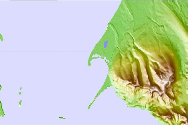
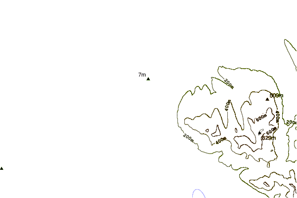

Use this relief map to navigate to tide stations, surf breaks and cities that are in the area of Port Moller (Entrance Point), Alaska.
Other Nearby Locations' tide tables and tide charts to Port Moller (Entrance Point), Alaska:
click location name for more details
 Surf breaks close to Port Moller (Entrance Point), Alaska:
|
||
|---|---|---|
| Closest surf break | Fossil Beach Kodiak | 327 mi |
| Second closest surf break | Monashka Bay | 332 mi |
| Third closest surf break | Termination Point | 334 mi |
| Fourth closest surf break | Mill Bay | 335 mi |
| Fifth closest surf break | Bird Point (Tidal Bore) | 466 mi |


 Nearest
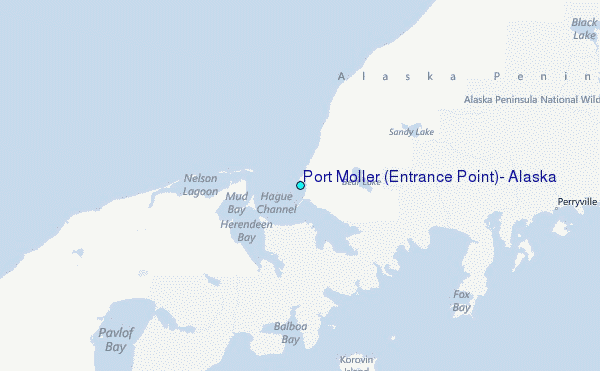