
| Distance / Altitude | Location | Report Date / Time | Live Weather | Wind | Gusts | Temp. | Visibility | Cloud |
|---|---|---|---|---|---|---|---|---|
| 14 km ESE / 138 m | Waiongana wx (New Zealand) | 2026-06-02 05:06 local (2026/06/01 17:06 GMT) | dry | calm (0 km/h at ) | 13°C | - | - - 0 | |
| 15 km ENE / 28 m | NewPlymouthAero Aws (New Zealand) | 2026-06-02 05:00 local (2026/06/01 17:00 GMT) | Continuous light rain | moderate winds from the NNE (22 km/h at 30) | 16°C | 10 km | no observation | |
| 25 km S / 216 m | Tumahu wx (New Zealand) | 2026-06-02 05:01 local (2026/06/01 17:01 GMT) | dry | light winds from the NNW (6 km/h at 341) | 15°C | - | - - 0 | |
| 64 km SSE / 100 m | HaweraAws (New Zealand) | 2026-06-02 05:00 local (2026/06/01 17:00 GMT) | Continuous light rain | strong winds from the NNE (41 km/h at 20) | 17°C | - | - no observation - | |
| 116 km NNE / 28 m | Port Taharoa Automatic Weather Station (New Zealand) | 2026-06-02 05:00 local (2026/06/01 17:00 GMT) | Continuous light rain | moderate winds from the NE (26 km/h at 50) | 16°C | - | - no observation - | |
| 131 km SE / 14 m | WanganuiAeroAws (New Zealand) | 2026-06-02 05:00 local (2026/06/01 17:00 GMT) | Clear skies | light winds from the N (15 km/h at 350) | 20°C | 20 km | no observation | |
| 146 km ESE / 820 m | Waiouru Aero Automatic Weather Station (New Zealand) | 2026-06-02 05:00 local (2026/06/01 17:00 GMT) | - | moderate winds from the ENE (28 km/h at 60) | 13°C | - | - no observation - | |
| 161 km NE / 75 m | Kihikihi wx (New Zealand) | 2026-06-02 05:24 local (2026/06/01 17:24 GMT) | dry | calm (0 km/h at ) | 16°C | - | - - 0 | |
| 170 km SE / 5 m | Ohakea Airport (New Zealand) | 2026-06-02 04:30 local (2026/06/01 16:30 GMT) | Shower light rain shower | light winds from the E (13 km/h at 90) | 17°C | 10.0 | overcast | |
| 175 km NE / 53 m | HamiltonAeroAws (New Zealand) | 2026-06-02 05:00 local (2026/06/01 17:00 GMT) | Continuous light rain | fresh winds from the ENE (30 km/h at 70) | 17°C | 20 km | no observation |
| Contours: | Roads & Rivers: | Select a
tide station / surf break / city |
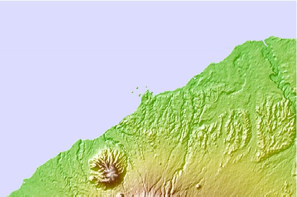
Use this relief map to navigate to tide stations, surf breaks and cities that are in the area of Port Taranaki, New Zealand.
Other Nearby Locations' tide tables and tide charts to Port Taranaki, New Zealand:
click location name for more details
 Surf breaks close to Port Taranaki, New Zealand:
|
||
|---|---|---|
| Closest surf break | Back Beach | 1 mi |
| Second closest surf break | Mikotai | 1 mi |
| Third closest surf break | Paritutu and Ngamotu Beach | 1 mi |
| Fourth closest surf break | Belt Road | 1 mi |
| Fifth closest surf break | East End and The Gap | 2 mi |


 Nearest