
| Distance / Altitude | Location | Report Date / Time | Live Weather | Wind | Gusts | Temp. | Visibility | Cloud |
|---|---|---|---|---|---|---|---|---|
| 9 km SW / 3 m | SHIP3287 (Marine) | 2026-04-01 14:00 local (2026/04/01 13:00 GMT) | - (- km/h at -) | 14°C | - | |||
| 12 km WSW / 33 m | Craigmillar wx (United Kingdom) | 2026-04-01 14:43 local (2026/04/01 13:43 GMT) | dry | light winds from the SSW (16 km/h at 197) | 10°C | - | - - 0 | |
| 16 km SW / 175 m | Edinburgh (United Kingdom) | 2026-04-01 14:05 local (2026/04/01 13:05 GMT) | dry | light winds from the SW (11 km/h at 233) | 11°C | - | - - 0 | |
| 9 km SW / 15 m | SHIP5135 (Marine) | 2026-04-01 13:00 local (2026/04/01 12:00 GMT) | - (- km/h at -) | — | - km | |||
| 9 km SW / 3 m | SHIP7028 (Marine) | 2026-04-01 13:00 local (2026/04/01 12:00 GMT) | - (- km/h at -) | 14°C | - | |||
| 9 km SW / 3 m | SHIP4833 (Marine) | 2026-04-01 13:00 local (2026/04/01 12:00 GMT) | - (- km/h at -) | 14°C | - | |||
| 9 km SW / 3 m | SHIP6735 (Marine) | 2026-04-01 14:00 local (2026/04/01 13:00 GMT) | - (- km/h at -) | 14°C | - | |||
| 9 km SW / 3 m | SHIP6447 (Marine) | 2026-04-01 13:00 local (2026/04/01 12:00 GMT) | - (- km/h at -) | 14°C | - | |||
| 9 km SW / 15 m | SHIP8655 (Marine) | 2026-04-01 14:00 local (2026/04/01 13:00 GMT) | - (- km/h at -) | — | - km | |||
| 9 km SW / 3 m | SHIP8491 (Marine) | 2026-04-01 13:00 local (2026/04/01 12:00 GMT) | - (- km/h at -) | 14°C | - |
| Contours: | Roads & Rivers: | Select a
tide station / surf break / city |
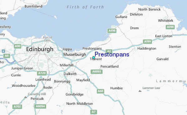
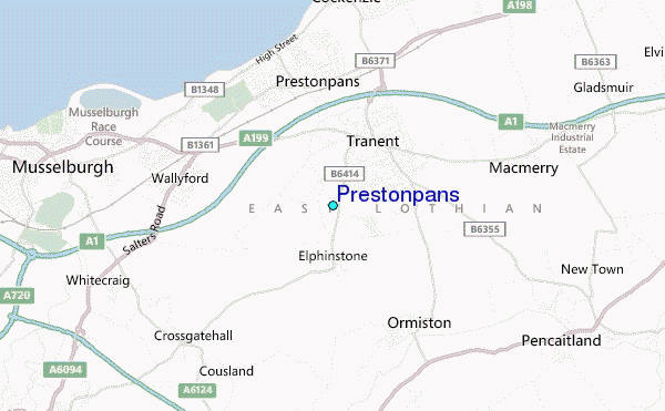
Use this relief map to navigate to tide stations, surf breaks and cities that are in the area of Prestonpans.
Other Nearby Locations' tide tables and tide charts to Prestonpans:
click location name for more details
 Surf breaks close to Prestonpans:
|
||
|---|---|---|
| Closest surf break | Gullane Bay | 9 mi |
| Second closest surf break | Yellowcraig Beach | 12 mi |
| Third closest surf break | North Berwick | 12 mi |
| Fourth closest surf break | Peffer Sands | 16 mi |
| Fifth closest surf break | Dunbar/Belhaven Bay | 18 mi |


 Nearest
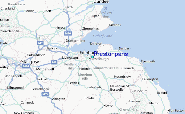