
| Distance / Altitude | Location | Report Date / Time | Live Weather | Wind | Gusts | Temp. | Visibility | Cloud |
|---|---|---|---|---|---|---|---|---|
| 535 km E / 2 m | Manihiki Automatic Weather Station (Cook Islands) | 2026-03-05 15:00 local (2026/03/06 01:00 GMT) | no report | wind obs. (9 kph from 120 degs) was rejected (- km/h at -) | 27°C | - | - | |
| 535 km E / 1 m | Manihiki (Cook Islands) | 2026-03-05 14:00 local (2026/03/06 00:00 GMT) | - | light winds from the E (6 km/h at 100) | 31°C | - | no observation | |
| 537 km E / 0 m | Manihiki Island Airport (Samoa/polynesia) | 2026-03-05 15:00 local (2026/03/06 01:00 GMT) | - | wind obs. (7 kph from 120 degs) was rejected (- km/h at -) | 31°C | |||
| 627 km SSW / 3 m | Aunuu- American Samoa (Marine) | 2026-03-05 14:26 local (2026/03/06 00:26 GMT) | - (- km/h at -) | 28°C | - | |||
| 644 km SSW / 3 m | BUOY-NSTP6 (Marine) | 2026-03-05 14:48 local (2026/03/06 00:48 GMT) | - (- km/h at -) | — | - | |||
| 650 km SSW / 213 m | Pago Pago Airport (Samoa/polynesia) | 2026-03-05 13:50 local (2026/03/05 23:50 GMT) | Dry and cloudy | calm (4 km/h at 1) | 26°C | 19 | scattered broken overcast | |
| 651 km SSW / 5 m | PagoPagoInt.airp.American Samoa (United States) | 2026-03-05 14:00 local (2026/03/06 00:00 GMT) | State of sky unchanged | calm (4 km/h at 990) | 26°C | 39 km | overcast | |
| 663 km SSW / 3 m | BUOY-51214 (Marine) | 2026-03-05 14:00 local (2026/03/06 00:00 GMT) | - (- km/h at -) | 27°C | - | |||
| 684 km W / 3 m | NukunonuAws (Tokelau) | 2026-03-05 15:00 local (2026/03/06 01:00 GMT) | no report | light winds from the SE (9 km/h at 130) | 29°C | - | - no observation - | |
| 719 km SW / 132 m | Apia (Samoa) | 2026-03-05 14:00 local (2026/03/06 00:00 GMT) | distant precipitation but not falling at station | light winds from the SE (7 km/h at 130) | 26°C | 20 | - mostly cloudy - |
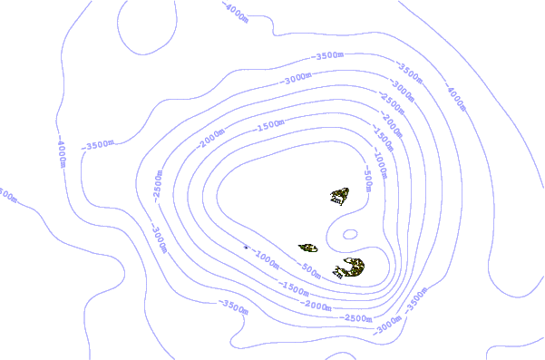
| Contours: | Roads & Rivers: | Select a
tide station / surf break / city |
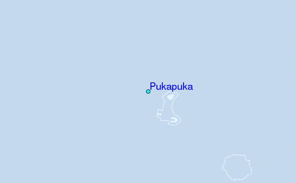
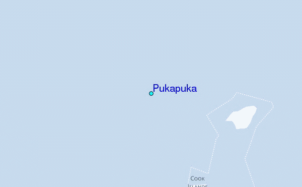
Use this relief map to navigate to tide stations, surf breaks and cities that are in the area of Pukapuka.
Other Nearby Locations' tide tables and tide charts to Pukapuka:
click location name for more details
 Surf breaks close to Pukapuka:
|
||
|---|---|---|
| Closest surf break | Tula | 395 mi |
| Second closest surf break | Alao | 395 mi |
| Third closest surf break | Aunu'u Island | 396 mi |
| Fourth closest surf break | Amouli | 397 mi |
| Fifth closest surf break | Alofau Gas Station | 398 mi |


 Nearest