
| Distance / Altitude | Location | Report Date / Time | Live Weather | Wind | Gusts | Temp. | Visibility | Cloud |
|---|---|---|---|---|---|---|---|---|
| 2 km E / 3 m | BUOY-PCGT2 (Marine) | 2025-12-24 05:48 local (2025/12/24 11:48 GMT) | light winds from the E (8 km/h at 90) | — | - | |||
| 3 km SW / 3 m | BUOY-PTIT2 (Marine) | 2025-12-24 05:48 local (2025/12/24 11:48 GMT) | light winds from the E (13 km/h at 90) | — | - | |||
| 3 km E / 3 m | BUOY-BZST2 (Marine) | 2025-12-24 05:48 local (2025/12/24 11:48 GMT) | light winds from the E (11 km/h at 90) | — | - | |||
| 10 km W / 2 m | Laguna Vista (Texas) | 2025-12-24 04:48 local (2025/12/24 10:48 GMT) | dry | calm (2 km/h at 118) | 23°C | - | - - 0 | |
| 18 km WNW / 218 m | Port Isabel Airport (Texas) | 2025-12-24 04:53 local (2025/12/24 10:53 GMT) | - | light winds from the ESE (7 km/h at 110) | 21°C | 14 | few | |
| 23 km NW / 3 m | BUOY-RLIT2 (Marine) | 2025-12-24 05:48 local (2025/12/24 11:48 GMT) | light winds from the E (17 km/h at 100) | — | - | |||
| 29 km WSW / 7 m | Los Fresnos wx (United States) | 2025-12-24 06:06 local (2025/12/24 12:06 GMT) | dry | calm (0 km/h at 0) | 21°C | - | - - 0 | |
| 31 km WSW / 6 m | Los Fresnos (Texas) | 2025-12-24 05:04 local (2025/12/24 11:04 GMT) | dry | calm (0 km/h at 113) | 19°C | - | - - 0 | |
| 31 km SSW / 219 m | Brownsville Airport (Texas) | 2025-12-24 05:26 local (2025/12/24 11:26 GMT) | Mist - | light winds from the NE (6 km/h at 50) | 22°C | 5 | scattered broken | |
| 49 km W / 216 m | Harlingen Airport (Texas) | 2025-12-24 05:27 local (2025/12/24 11:27 GMT) | Fog - | calm (0 km/h at 0) | 19°C | 0 | broken overcast |
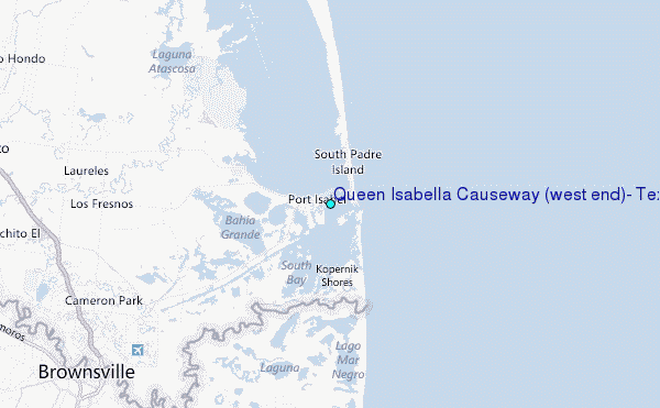
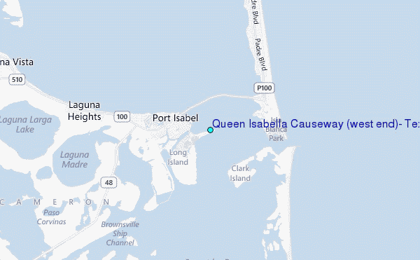
Choose Queen Isabella Causeway (west end), Texas Location Map Zoom:
| Contours: | Roads & Rivers: | Select a
tide station / surf break / city |
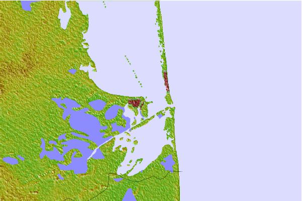

Use this relief map to navigate to tide stations, surf breaks and cities that are in the area of Queen Isabella Causeway (west end), Texas.
Other Nearby Locations' tide tables and tide charts to Queen Isabella Causeway (west end), Texas:
click location name for more details
 Surf breaks close to Queen Isabella Causeway (west end), Texas:
|
||
|---|---|---|
| Closest surf break | Boca Chica | 2 mi |
| Second closest surf break | Cove | 2 mi |
| Third closest surf break | South Padre Island | 2 mi |
| Fourth closest surf break | Port Isabel | 4 mi |
| Fifth closest surf break | Port Mansfield Jetty | 36 mi |


 Nearest
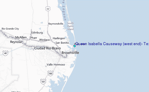