
| Distance / Altitude | Location | Report Date / Time | Live Weather | Wind | Gusts | Temp. | Visibility | Cloud |
|---|---|---|---|---|---|---|---|---|
| 28 km SSE / 218 m | Townsville Airport (Australia) | 2025-12-25 05:30 local (2025/12/24 19:30 GMT) | Light rain | light winds from the S (11 km/h at 170) | 25°C | 10.0 | few broken | |
| 29 km SSE / 9 m | TownsvilleAero (Australia) | 2025-12-25 06:00 local (2025/12/24 20:00 GMT) | Moderate to heavy rain showers | light winds from the NE (17 km/h at 40) | 28°C | - | - no observation - | |
| 43 km S / 228 m | Woolshed (Australia) | 2025-12-25 06:00 local (2025/12/24 20:00 GMT) | No report | calm (2 km/h at 80) | 23°C | - | no observation | |
| 44 km SSE / 235 m | MountStuart(Defence) (Australia) | 2025-12-25 06:00 local (2025/12/24 20:00 GMT) | no report | light winds from the NNE (7 km/h at 30) | 20°C | - | - no observation - | |
| 49 km SSW / 525 m | Townsville - Air Weapons Range (Defence) (Australia) | 2025-12-25 06:00 local (2025/12/24 20:00 GMT) | No report | calm (0 km/h at 0) | 23°C | - | - no observation - | |
| 54 km ESE / 0 m | Cape Ferguson Ntc Aws (Australia) | 2025-12-25 06:00 local (2025/12/24 20:00 GMT) | no report | light winds from the ESE (7 km/h at 120) | 22°C | - | - | |
| 62 km NW / 10 m | LucindaPoint (Australia) | 2025-12-25 06:00 local (2025/12/24 20:00 GMT) | no report | light winds from the SSE (7 km/h at 160) | 27°C | - | - no observation - | |
| 84 km S / 361 m | Townsville - Fanning River (Defence) (Australia) | 2025-12-25 06:00 local (2025/12/24 20:00 GMT) | No report | calm (0 km/h at 0) | 24°C | - | - no observation - | |
| 102 km ESE / 8 m | AlvaBeach (Australia) | 2025-12-25 06:00 local (2025/12/24 20:00 GMT) | - | wind obs. (6 kph from 180 degs) was rejected (- km/h at -) | — | - | - no observation - | |
| 103 km SE / 17 m | Ayr Dpi Research Stn (Australia) | 2025-12-25 06:00 local (2025/12/24 20:00 GMT) | Fog, sky visible, thinning | light winds from the NNW (9 km/h at 340) | 24°C | - | - no observation - |
| Contours: | Roads & Rivers: | Select a
tide station / surf break / city |

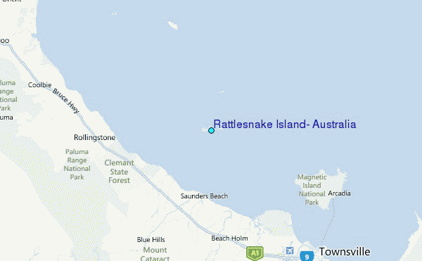
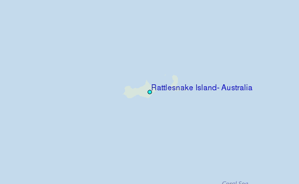
Use this relief map to navigate to tide stations, surf breaks and cities that are in the area of Rattlesnake Island, Australia.
Other Nearby Locations' tide tables and tide charts to Rattlesnake Island, Australia:
click location name for more details
 Surf breaks close to Rattlesnake Island, Australia:
|
||
|---|---|---|
| Closest surf break | Eimeo Point | 216 mi |
| Second closest surf break | Dolphin Heads | 217 mi |
| Third closest surf break | Lamberts Beach | 221 mi |
| Fourth closest surf break | North Wall Mackay Harbour Beach | 222 mi |
| Fifth closest surf break | South Wall Mackay Harbour | 222 mi |


 Nearest
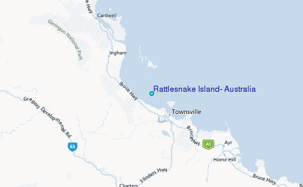