
| Distance / Altitude | Location | Report Date / Time | Live Weather | Wind | Gusts | Temp. | Visibility | Cloud |
|---|---|---|---|---|---|---|---|---|
| 12 km SW / 2 m | Bradenton wx (United States) | 2026-02-11 20:43 local (2026/02/12 01:43 GMT) | dry | wind obs. (6 kph from 8 degs) was rejected (- km/h at -) | 12°C | - | - - 0 | |
| 15 km NW / 3 m | BUOY-PMAF1 (Marine) | 2026-02-11 20:00 local (2026/02/12 01:00 GMT) | - (- km/h at -) | 17°C | - | |||
| 16 km S / 219 m | Sarasota/Bradenton Airport (Florida) | 2026-02-11 18:53 local (2026/02/11 23:53 GMT) | Clear | light winds from the SW (6 km/h at 220) | 18°C | 16 | ||
| 18 km WNW / 3 m | BUOY-MTBF1 (Marine) | 2026-02-11 20:00 local (2026/02/12 01:00 GMT) | light winds from the SW (11 km/h at 230) | 16°C | 10.9 | |||
| 30 km NW / 3 m | BUOY-SAPF1 (Marine) | 2026-02-11 20:00 local (2026/02/12 01:00 GMT) | light winds from the SW (8 km/h at 230) | 17°C | - | |||
| 31 km NW / 218 m | St Peters/Albert Whitted Airport (Florida) | 2026-02-11 18:53 local (2026/02/11 23:53 GMT) | Clear | light winds from the WSW (9 km/h at 240) | 19°C | 16 | ||
| 38 km N / 3 m | BUOY-OPTF1 (Marine) | 2026-02-11 20:00 local (2026/02/12 01:00 GMT) | light winds from the S (8 km/h at 190) | 17°C | - | |||
| 42 km N / 15 m | SHIP1789 (Marine) | 2026-02-11 19:00 local (2026/02/12 00:00 GMT) | light winds from the SW (7.5600000000000005 km/h at 230) | 15°C | - km | |||
| 42 km N / 3 m | SHIP10660 (Marine) | 2026-02-11 19:00 local (2026/02/12 00:00 GMT) | - (- km/h at -) | 18°C | - | |||
| 42 km N / - m | SHIP480 (ocean) | 2026-02-11 20:00 local (2026/02/12 01:00 GMT) | No report | light winds from the SSW (7 km/h at 210) | 18°C | - | no observation |
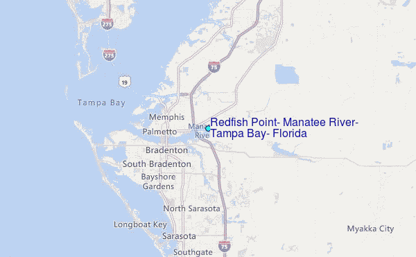
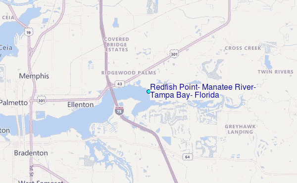
Choose Redfish Point, Manatee River, Tampa Bay, Florida Location Map Zoom:
| Contours: | Roads & Rivers: | Select a
tide station / surf break / city |

Use this relief map to navigate to tide stations, surf breaks and cities that are in the area of Redfish Point, Manatee River, Tampa Bay, Florida.
Other Nearby Locations' tide tables and tide charts to Redfish Point, Manatee River, Tampa Bay, Florida:
click location name for more details
 Surf breaks close to Redfish Point, Manatee River, Tampa Bay, Florida:
|
||
|---|---|---|
| Closest surf break | Bradenton Beach | 14 mi |
| Second closest surf break | Holmes Beach Pier | 14 mi |
| Third closest surf break | Siesta | 14 mi |
| Fourth closest surf break | Turtle Beach | 15 mi |
| Fifth closest surf break | Anna Maria Key | 16 mi |


 Nearest
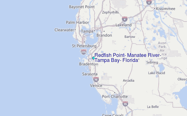