
| Distance / Altitude | Location | Report Date / Time | Live Weather | Wind | Gusts | Temp. | Visibility | Cloud |
|---|---|---|---|---|---|---|---|---|
| 19 km NE / 3 m | lightning 30km E of Lely Resort (United States) | 2026-07-28 13:04 local (2026/07/28 17:04 GMT) | Thunderstorm | (- km/h at -) | — | |||
| 23 km WNW / 2 m | Marco Island Airport (Florida) (Florida) | 2026-07-28 13:24 local (2026/07/28 17:24 GMT) | Light rain | light winds from the SW (11 km/h at 220) | 26°C | 16 | few scattered broken | |
| 29 km WNW / 3 m | BUOY-RKXF1 (Marine) | 2026-07-28 14:00 local (2026/07/28 18:00 GMT) | light winds from the W (11 km/h at 260) | 29°C | - | |||
| 32 km ESE / 3 m | BUOY-WPLF1 (Marine) | 2026-07-28 13:00 local (2026/07/28 17:00 GMT) | - (- km/h at -) | — | - | |||
| 35 km N / 3 m | lightning 13km E of Golden Gate (United States) | 2026-07-28 13:04 local (2026/07/28 17:04 GMT) | Thunderstorm | (- km/h at -) | — | |||
| 37 km ESE / 3 m | BUOY-CNBF1 (Marine) | 2026-07-28 13:00 local (2026/07/28 17:00 GMT) | - (- km/h at -) | — | - | |||
| 41 km WNW / 217 m | Naples Municipal Airport (Florida) | 2026-07-28 12:53 local (2026/07/28 16:53 GMT) | - | light winds from the WSW (19 km/h at 250) | 31°C | 14 | few | |
| 42 km NNE / 5 m | lightning 26km E of Orangetree (United States) | 2026-07-28 12:19 local (2026/07/28 16:19 GMT) | Thunderstorm | (- km/h at -) | — | |||
| 47 km SE / 3 m | BUOY-LMRF1 (Marine) | 2026-07-28 13:00 local (2026/07/28 17:00 GMT) | - (- km/h at -) | — | - | |||
| 48 km SSE / 0 m | lightning 70km SE of Marco (United States) | 2026-07-28 14:45 local (2026/07/28 18:45 GMT) | Thunderstorm | (- km/h at -) | — |
| Contours: | Roads & Rivers: | Select a
tide station / surf break / city |
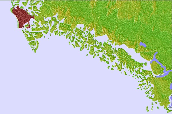

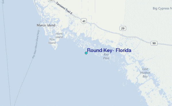
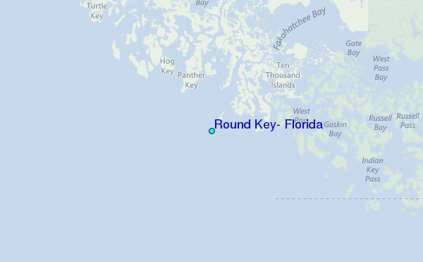
Use this relief map to navigate to tide stations, surf breaks and cities that are in the area of Round Key, Florida.
Other Nearby Locations' tide tables and tide charts to Round Key, Florida:
click location name for more details
 Surf breaks close to Round Key, Florida:
|
||
|---|---|---|
| Closest surf break | Naples Pier | 23 mi |
| Second closest surf break | Wiggins Pass | 37 mi |
| Third closest surf break | South Beach (Miami) | 87 mi |
| Fourth closest surf break | Dunes Hotel (Miami) | 88 mi |
| Fifth closest surf break | Fifth Street (Miami) | 88 mi |


 Nearest
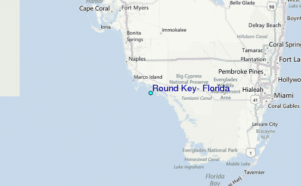