
| Distance / Altitude | Location | Report Date / Time | Live Weather | Wind | Gusts | Temp. | Visibility | Cloud |
|---|---|---|---|---|---|---|---|---|
| 3 km S / 3 m | Isles of Scilly St Marys Sound Waverider Buoy (Marine) | 2026-03-28 00:32 local (2026/03/28 00:32 GMT) | - (- km/h at -) | — | - | |||
| 5 km NNE / 30 m | Isles of Scilly (United Kingdom) | 2026-03-28 01:25 local (2026/03/28 01:25 GMT) | dry | moderate winds from the NW (24 km/h at 323) | 8°C | - | - - 0 | |
| 26 km NE / 3 m | Sevenstones Buoy (Marine) | 2026-03-28 01:00 local (2026/03/28 01:00 GMT) | - (- km/h at -) | 9°C | 9.3 | |||
| 38 km ENE / 3 m | SHIP1909 (Marine) | 2026-03-28 00:00 local (2026/03/28 00:00 GMT) | - (- km/h at -) | 9°C | - | |||
| 62 km ENE / 3 m | Penzance Waverider (Marine) | 2026-03-28 00:01 local (2026/03/28 00:01 GMT) | - (- km/h at -) | — | - | |||
| 38 km ENE / 3 m | SHIP1151 (Marine) | 2026-03-28 00:00 local (2026/03/28 00:00 GMT) | - (- km/h at -) | 9°C | - | |||
| 38 km ENE / 15 m | SHIP2579 (Marine) | 2026-03-28 00:00 local (2026/03/28 00:00 GMT) | - (- km/h at -) | — | - km | |||
| 38 km ENE / 15 m | SHIP6819 (Marine) | 2026-03-28 00:00 local (2026/03/28 00:00 GMT) | - (- km/h at -) | — | - km | |||
| 38 km ENE / 3 m | SHIP5056 (Marine) | 2026-03-28 00:00 local (2026/03/28 00:00 GMT) | - (- km/h at -) | 9°C | - | |||
| 38 km ENE / 3 m | SHIP4319 (Marine) | 2026-03-28 00:00 local (2026/03/28 00:00 GMT) | - (- km/h at -) | 9°C | - |
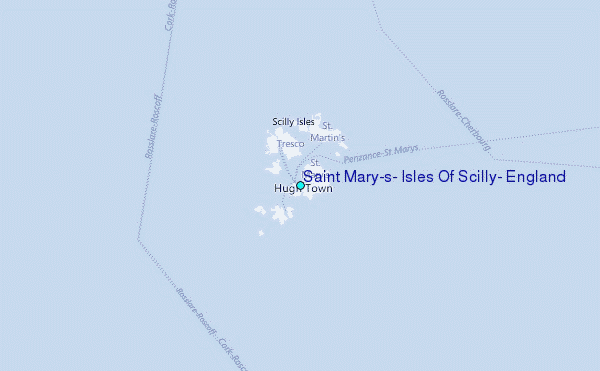
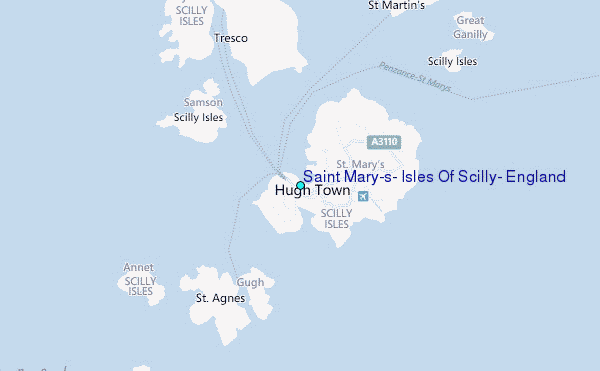
Choose Saint Mary's, Isles Of Scilly, England Location Map Zoom:
| Contours: | Roads & Rivers: | Select a
tide station / surf break / city |

Use this relief map to navigate to tide stations, surf breaks and cities that are in the area of Saint Mary's, Isles Of Scilly, England.
Other Nearby Locations' tide tables and tide charts to Saint Mary's, Isles Of Scilly, England:
click location name for more details
 Surf breaks close to Saint Mary's, Isles Of Scilly, England:
|
||
|---|---|---|
| Closest surf break | Nanjizal | 29 mi |
| Second closest surf break | Porthcurno | 30 mi |
| Third closest surf break | Sennen Cove | 30 mi |
| Fourth closest surf break | Gwenvor | 30 mi |
| Fifth closest surf break | Priests Cove | 31 mi |


 Nearest
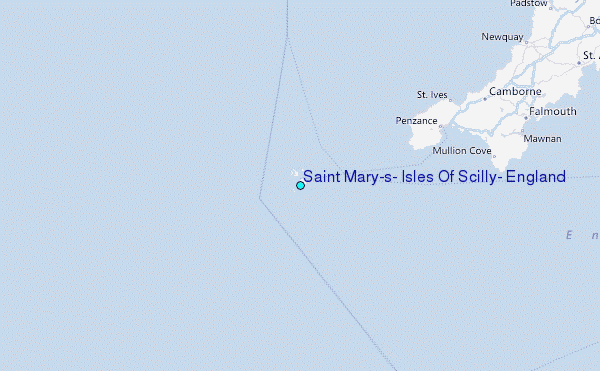