
| Distance / Altitude | Location | Report Date / Time | Live Weather | Wind | Gusts | Temp. | Visibility | Cloud |
|---|---|---|---|---|---|---|---|---|
| 121 km SW / 142 m | Huatulco (Mexico) | 2026-04-05 21:12 local (2026/04/06 03:12 GMT) | dry | light winds from the NW (6 km/h at 319) | 26°C | - | - - 0 | |
| 122 km SW / 150 m | Bahías de Huatulco Airport (Mexico) | 2026-04-05 20:45 local (2026/04/06 02:45 GMT) | - | light winds from the WNW (9 km/h at 300) | — | 13 | ||
| 185 km W / 1510 m | Oaxaca/Xoxocotlán International Airport (Mexico) | 2026-04-05 19:40 local (2026/04/06 01:40 GMT) | Dry and partly cloudy | calm (4 km/h at 290) | 23°C | 13 | scattered broken | |
| 202 km WSW / 225 m | Puerto Escondido Airport (Mexico) | 2026-04-05 20:44 local (2026/04/06 02:44 GMT) | - | light winds from the W (15 km/h at 280) | — | 16 | ||
| 218 km ENE / 194 m | lightning 14km W of Tecpatan (Mexico) | 2026-04-05 20:47 local (2026/04/06 02:47 GMT) | Thunderstorm | (- km/h at -) | — | |||
| 225 km NNE / 323 m | Minatitlan Airport (Mexico) | 2026-04-05 20:41 local (2026/04/06 02:41 GMT) | Dry and partly cloudy | moderate winds from the NNE (22 km/h at 30) | 26°C | 16 | scattered scattered | |
| 232 km ENE / 293 m | Tuxtla Gutierrez (Mexico) | 2026-04-05 20:45 local (2026/04/06 02:45 GMT) | - | moderate winds from the WNW (28 km/h at 300) | — | 13 | - - - | |
| 246 km ENE / 400 m | lightning 7km SE of Ostuacan (Mexico) | 2026-04-05 19:18 local (2026/04/06 01:18 GMT) | Thunderstorm | (- km/h at -) | — | |||
| 256 km E / 850 m | lightning 10km WNW of Nueva Palestina (Mexico) | 2026-04-05 19:30 local (2026/04/06 01:30 GMT) | Thunderstorm | (- km/h at -) | — | |||
| 268 km E / 544 m | lightning 22km N of Angel Albino Corzo (Mexico) | 2026-04-05 19:33 local (2026/04/06 01:33 GMT) | Thunderstorm | (- km/h at -) | — |
| Contours: | Roads & Rivers: | Select a
tide station / surf break / city |
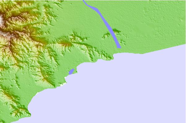
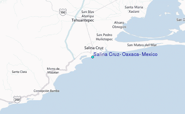
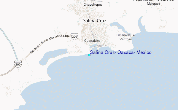
Use this relief map to navigate to tide stations, surf breaks and cities that are in the area of Salina Cruz, Oaxaca, Mexico.
Other Nearby Locations' tide tables and tide charts to Salina Cruz, Oaxaca, Mexico:
click location name for more details
 Surf breaks close to Salina Cruz, Oaxaca, Mexico:
|
||
|---|---|---|
| Closest surf break | Punta Conejo | 0 mi |
| Second closest surf break | Salina Cruz | 6 mi |
| Third closest surf break | Punta Guetaguichi | 6 mi |
| Fourth closest surf break | Punta Chipehua | 17 mi |
| Fifth closest surf break | Bahia Grande | 39 mi |


 Nearest
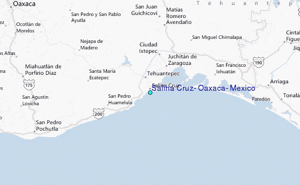