
| Distance / Altitude | Location | Report Date / Time | Live Weather | Wind | Gusts | Temp. | Visibility | Cloud |
|---|---|---|---|---|---|---|---|---|
| 246 km NNE / 326 m | Mexicali International Airport (Mexico) | 2026-06-01 09:43 local (2026/06/01 16:43 GMT) | - | light winds from the N (6 km/h at 10) | — | 16 | ||
| 247 km ENE / 61 m | Puerto Penasco- Son. (Mexico) | 2026-06-01 09:00 local (2026/06/01 16:00 GMT) | no report | - (- km/h at -) | 27°C | 20 | - - - | |
| 247 km NW / 363 m | Tijuana International Airport (Mexico) | 2026-06-01 08:46 local (2026/06/01 15:46 GMT) | Dry and partly cloudy | light winds from the NW (7 km/h at 310) | 19°C | 8 | scattered | |
| 250 km ENE / 7.6 m | Puerto Penasco (Åland) | 2026-06-01 10:09 local (2026/06/01 17:09 GMT) | dry | calm (3 km/h at 166) | 28°C | - | - - 0 | |
| 252 km ENE / 9 m | Puerto Penasco Airport (Mexico) | 2026-06-01 09:42 local (2026/06/01 16:42 GMT) | - | light winds from the SE (15 km/h at 140) | — | 16 | ||
| 253 km NW / 218 m | San Diego/Brown Field Municipal Airport (California) | 2026-06-01 08:57 local (2026/06/01 15:57 GMT) | Mist - | light winds from the WNW (7 km/h at 290) | 19°C | 11 | scattered | |
| 256 km NW / 218 m | Imperial Beach Airport (California) | 2026-06-01 08:53 local (2026/06/01 15:53 GMT) | Dry and cloudy | light winds from the SW (13 km/h at 220) | 18°C | 16 | overcast | |
| 258 km NW / 3 m | BUOY-TIXC1 (Marine) | 2026-06-01 09:45 local (2026/06/01 16:45 GMT) | light winds from the W (9 km/h at 280) | 18°C | - | |||
| 259 km NE / 70 m | Yuma (Arizona) | 2026-06-01 10:17 local (2026/06/01 17:17 GMT) | dry | wind obs. (11 kph from 360 degs) was rejected (- km/h at -) | 23°C | - | - - 0 | |
| 259 km N / 1341 m | Horse - SDHGPA (United States) | 2026-06-01 10:00 local (2026/06/01 17:00 GMT) | - | moderate winds from the SSW (22 km/h at 200) | 23°C | - | - - 0 |
| Contours: | Roads & Rivers: | Select a
tide station / surf break / city |
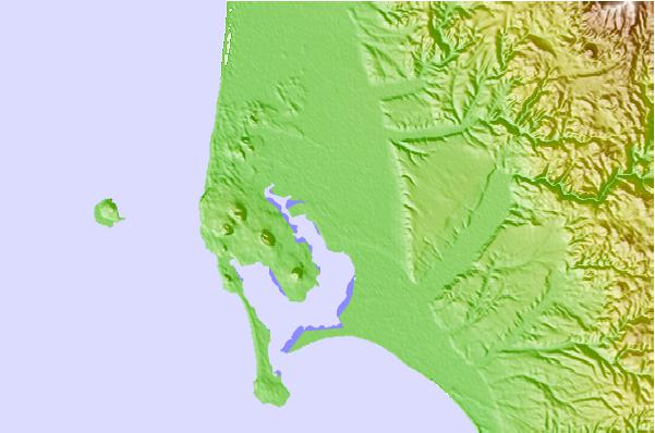
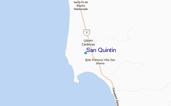
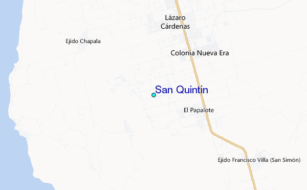
Use this relief map to navigate to tide stations, surf breaks and cities that are in the area of San Quintin.
Other Nearby Locations' tide tables and tide charts to San Quintin:
click location name for more details
 Surf breaks close to San Quintin:
|
||
|---|---|---|
| Closest surf break | Cabo San Quintin | 7 mi |
| Second closest surf break | Playa Santa Maria | 7 mi |
| Third closest surf break | Cielito Lindo | 9 mi |
| Fourth closest surf break | El Socorro | 17 mi |
| Fifth closest surf break | Playa San Ramon | 19 mi |


 Nearest
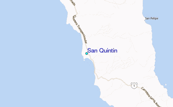