
| Distance / Altitude | Location | Report Date / Time | Live Weather | Wind | Gusts | Temp. | Visibility | Cloud |
|---|---|---|---|---|---|---|---|---|
| 46 km NNE / 15 m | ASCATC160E9S (Marine) | 2025-12-25 10:09 local (2025/12/24 23:09 GMT) | light winds from the SE (16 km/h at 131) | — | - km | |||
| 47 km S / 9 m | Honiara/Henderson Airport (Solomon Islands) | 2025-12-25 11:00 local (2025/12/25 00:00 GMT) | Distant precipitation but not falling at station | light winds from the ENE (11 km/h at 70) | 32°C | 10.0 | few few scattered | |
| 49 km S / 182 m | Honiara (Solomon Islands) | 2025-12-25 11:00 local (2025/12/25 00:00 GMT) | moderate to heavy rain showers | wind obs. (22 kph from 180 degs) was rejected (- km/h at -) | 24°C | 10 | - | |
| 72 km ENE / 11 m | Auki (Solomon Islands) | 2025-12-25 11:00 local (2025/12/25 00:00 GMT) | distant precipitation but not falling at station | calm (4 km/h at 90) | — | 10 | - - - | |
| 108 km W / 0 m | lightning 55km SW of Buala (Solomon Islands) | 2025-12-25 12:03 local (2025/12/25 01:03 GMT) | Thunderstorm | (- km/h at -) | — | |||
| 114 km N / 15 m | ASCATC160E8S (Marine) | 2025-12-25 10:09 local (2025/12/24 23:09 GMT) | moderate winds from the NNE (21 km/h at 18) | — | - km | |||
| 152 km E / 15 m | ASCATC161E9S (Marine) | 2025-12-25 10:09 local (2025/12/24 23:09 GMT) | moderate winds from the ENE (23 km/h at 68) | — | - km | |||
| 153 km ENE / 15 m | ASCATC161E8S (Marine) | 2025-12-25 10:09 local (2025/12/24 23:09 GMT) | moderate winds from the E (21 km/h at 84) | — | - km | |||
| 168 km S / 15 m | ASCATC160E10S (Marine) | 2025-12-25 10:10 local (2025/12/24 23:10 GMT) | light winds from the SSE (10 km/h at 151) | — | - km | |||
| 170 km ENE / 15 m | ASCATC162E8S (Marine) | 2025-12-25 10:09 local (2025/12/24 23:09 GMT) | fresh winds from the NE (30 km/h at 34) | — | - km |
| Contours: | Roads & Rivers: | Select a
tide station / surf break / city |
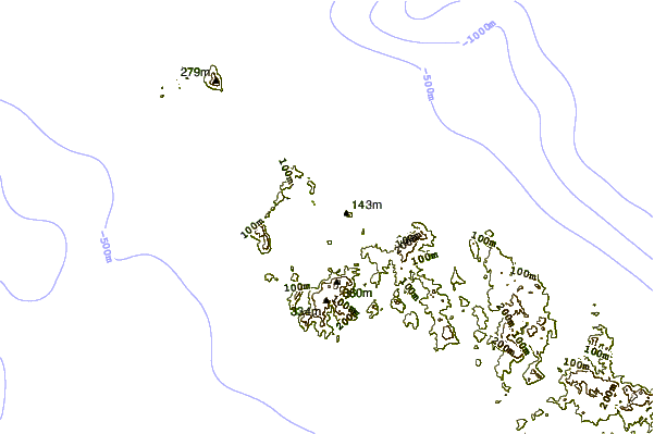
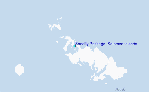
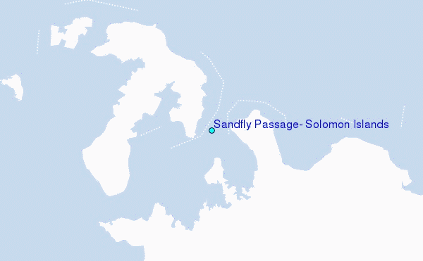
Use this relief map to navigate to tide stations, surf breaks and cities that are in the area of Sandfly Passage, Solomon Islands.
Other Nearby Locations' tide tables and tide charts to Sandfly Passage, Solomon Islands:
click location name for more details
 Surf breaks close to Sandfly Passage, Solomon Islands:
|
||
|---|---|---|
| Closest surf break | Coves | 198 mi |
| Second closest surf break | Kundu Kundu | 202 mi |
| Third closest surf break | Lavata | 203 mi |
| Fourth closest surf break | Mbirimbiri | 205 mi |
| Fifth closest surf break | Skull Island | 207 mi |


 Nearest
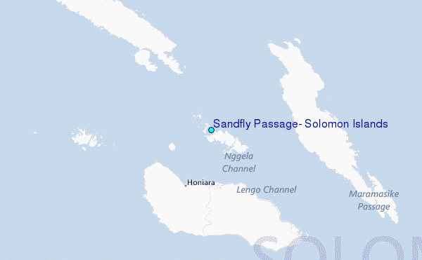