
| Distance / Altitude | Location | Report Date / Time | Live Weather | Wind | Gusts | Temp. | Visibility | Cloud |
|---|---|---|---|---|---|---|---|---|
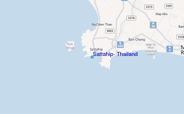
| 11 km ENE / 18 m | Sattahip (Thailand) | 2025-12-26 12:00 local (2025/12/26 05:00 GMT) | no report | wind obs. (7 kph from 220 degs) was rejected (- km/h at -) | 35°C | 10 | - mostly cloudy - | |
| 29 km N / 61 m | Phatthaya (Thailand) | 2025-12-26 12:00 local (2025/12/26 05:00 GMT) | no report | wind obs. (9 kph from 240 degs) was rejected (- km/h at -) | 33°C | - | - | |
| 29 km ENE / 45 m | Huai Pong Agromet (Thailand) | 2025-12-26 12:00 local (2025/12/26 05:00 GMT) | no report | calm (4 km/h at 170) | 32°C | - | - | |
| 31 km E / 6 m | Ban Takuan wx (Thailand) | 2025-12-26 12:13 local (2025/12/26 05:13 GMT) | - | calm (0 km/h at 0) | 36°C | - | - - 0 | |
| 36 km E / 3 m | Ban Nong Taengme wx (Thailand) | 2025-12-26 12:47 local (2025/12/26 05:47 GMT) | dry | wind obs. (31 kph from 0 degs) was rejected (- km/h at -) | 31°C | - | - - 0 | |
| 36 km E / 6 m | Ban Nong Taengme wx (Thailand) | 2025-12-26 12:36 local (2025/12/26 05:36 GMT) | dry | wind obs. (13 kph from 135 degs) was rejected (- km/h at -) | 32°C | - | - - 0 | |
| 39 km N / 15 m | SHIP3252 (Marine) | 2025-12-26 12:00 local (2025/12/26 05:00 GMT) | - (- km/h at -) | — | - km | |||
| 39 km N / 15 m | SHIP2599 (Marine) | 2025-12-26 11:00 local (2025/12/26 04:00 GMT) | - (- km/h at -) | — | - km | |||
| 39 km N / 15 m | SHIP5979 (Marine) | 2025-12-26 10:00 local (2025/12/26 03:00 GMT) | - (- km/h at -) | — | - km | |||
| 39 km N / 15 m | SHIP8208 (Marine) | 2025-12-26 10:00 local (2025/12/26 03:00 GMT) | - (- km/h at -) | — | - km |
| Contours: | Roads & Rivers: | Select a
tide station / surf break / city |
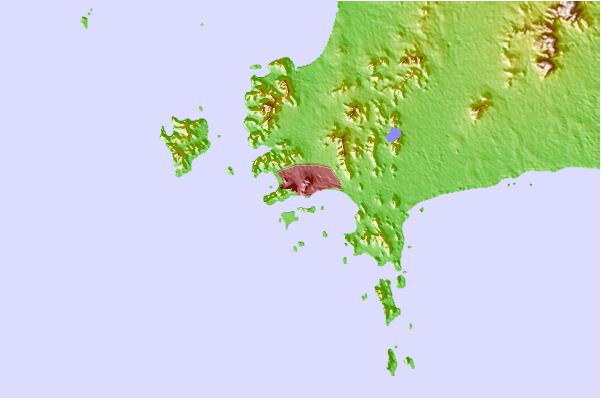
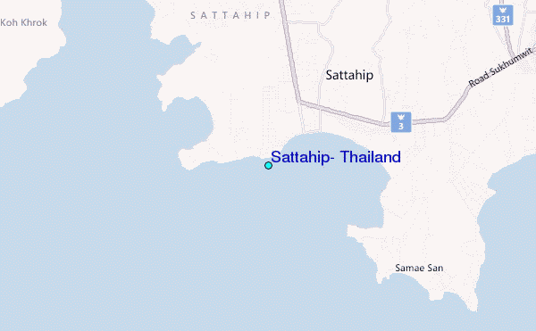
Use this relief map to navigate to tide stations, surf breaks and cities that are in the area of Sattahip, Thailand.
Other Nearby Locations' tide tables and tide charts to Sattahip, Thailand:
click location name for more details
 Surf breaks close to Sattahip, Thailand:
|
||
|---|---|---|
| Closest surf break | Rayong Mae Ramphung Beach | 36 mi |
| Second closest surf break | Ko Samet - Sai Kaew | 40 mi |
| Third closest surf break | Hinsuay Namsay | 45 mi |
| Fourth closest surf break | Mae Phim Beach (Rayong) | 50 mi |
| Fifth closest surf break | Aho Kahi Harbor Entrance | 52 mi |


 Nearest
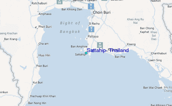