
| Distance / Altitude | Location | Report Date / Time | Live Weather | Wind | Gusts | Temp. | Visibility | Cloud |
|---|---|---|---|---|---|---|---|---|
| 7 km SSW / 6 m | Sebastian Airport (Florida) (Florida) | 2026-03-30 20:35 local (2026/03/31 00:35 GMT) | - | light winds from the E (17 km/h at 100) | 23°C | 16 | few | |
| 24 km S / 218 m | Vero Beach Airport (Florida) | 2026-03-30 19:53 local (2026/03/30 23:53 GMT) | - | light winds from the E (19 km/h at 100) | 23°C | 16 | few | |
| 33 km WNW / 218 m | Melbourne Airport (Florida) | 2026-03-30 19:53 local (2026/03/30 23:53 GMT) | Clear | light winds from the ESE (19 km/h at 110) | 23°C | 16 | ||
| 38 km ENE / 15 m | SHIP3258 (Marine) | 2026-03-30 19:00 local (2026/03/30 23:00 GMT) | - (- km/h at -) | — | - km | |||
| 39 km SE / 3 m | BUOY-41068 (Marine) | 2026-03-30 21:08 local (2026/03/31 01:08 GMT) | fresh winds from the ESE (29 km/h at 110) | 24°C | - | |||
| 38 km ENE / 3 m | SHIP5518 (Marine) | 2026-03-30 19:00 local (2026/03/30 23:00 GMT) | - (- km/h at -) | 23°C | - | |||
| 38 km ENE / 3 m | SHIP3799 (Marine) | 2026-03-30 19:00 local (2026/03/30 23:00 GMT) | - (- km/h at -) | 23°C | - | |||
| 38 km ENE / 3 m | SHIP7627 (Marine) | 2026-03-30 19:00 local (2026/03/30 23:00 GMT) | - (- km/h at -) | 23°C | - | |||
| 38 km ENE / 3 m | SHIP4925 (Marine) | 2026-03-30 19:00 local (2026/03/30 23:00 GMT) | - (- km/h at -) | 23°C | - | |||
| 38 km ENE / 15 m | SHIP2777 (Marine) | 2026-03-30 19:00 local (2026/03/30 23:00 GMT) | - (- km/h at -) | — | - km |
| Contours: | Roads & Rivers: | Select a
tide station / surf break / city |
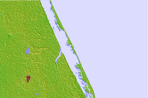
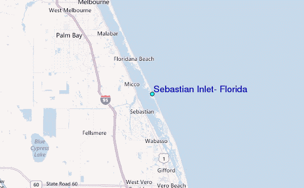
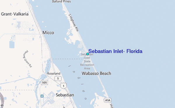
Use this relief map to navigate to tide stations, surf breaks and cities that are in the area of Sebastian Inlet, Florida.
Other Nearby Locations' tide tables and tide charts to Sebastian Inlet, Florida:
click location name for more details
 Surf breaks close to Sebastian Inlet, Florida:
|
||
|---|---|---|
| Closest surf break | Sebastian Inlet-Third Peak | 0 mi |
| Second closest surf break | Sebastian Inlet-Second Peak | 1 mi |
| Third closest surf break | Sebastian Inlet-First Peak | 1 mi |
| Fourth closest surf break | Long Point | 2 mi |
| Fifth closest surf break | Monster Hole | 2 mi |


 Nearest
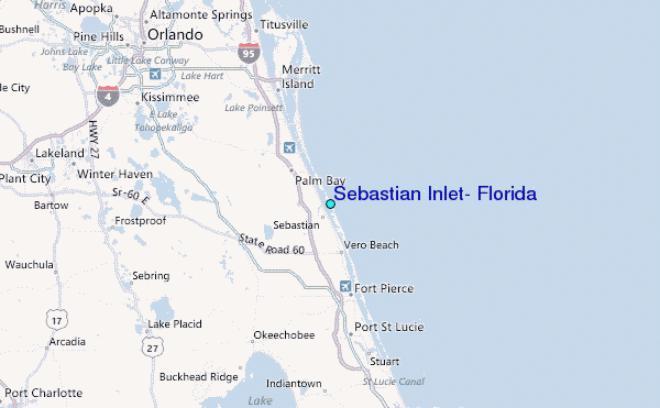