
| Distance / Altitude | Location | Report Date / Time | Live Weather | Wind | Gusts | Temp. | Visibility | Cloud |
|---|---|---|---|---|---|---|---|---|
| 10 km SSW / 152 m | Bukitsari wx (Indonesia) | 2026-06-30 09:10 local (2026/06/30 02:10 GMT) | - | - (- km/h at ) | 29°C | - | - - 0 | |
| 10 km SSW / 152 m | Bukitsari wx (Indonesia) | 2026-06-30 09:20 local (2026/06/30 02:20 GMT) | - | - (- km/h at ) | 32°C | - | - - 0 | |
| 11 km WSW / 5 m | Ahmad Yani International Airport (Indonesia) | 2026-06-30 09:30 local (2026/06/30 02:30 GMT) | Dry and partly cloudy | light winds from the NW (11 km/h at 310) | 29°C | 8.0 | no significant cloud | |
| 68 km SSW / 1394 m | Gunungmalang wx (Indonesia) | 2026-06-30 10:37 local (2026/06/30 03:37 GMT) | dry | light winds from the S (10 km/h at 169) | 22°C | - | - - 0 | |
| 69 km SW / 2039 m | Dieng Kulon wx (Indonesia) | 2026-06-30 10:47 local (2026/06/30 03:47 GMT) | - | wind obs. (32 kph from 92 degs) was rejected (- km/h at -) | 13°C | - | - - 0 | |
| 143 km SW / 101 m | Pamijen Lor wx (Indonesia) | 2026-06-30 10:43 local (2026/06/30 03:43 GMT) | - | - (- km/h at ) | 29°C | - | - - 0 | |
| 258 km E / 2 m | Juanda Airport (Indonesia) | 2026-06-30 09:30 local (2026/06/30 02:30 GMT) | - | light winds from the ENE (6 km/h at 70) | — | 0.0 | ||
| 300 km E / 15 m | ASCATC113E6S (Marine) | 2026-06-30 08:20 local (2026/06/30 01:20 GMT) | light winds from the SE (17 km/h at 142) | — | - km | |||
| 321 km WSW / 796 m | Srigunting wx (Indonesia) | 2026-06-30 10:40 local (2026/06/30 03:40 GMT) | - | light winds from the NE (6 km/h at 53) | 27°C | - | - - 0 | |
| 323 km E / 15 m | ASCATC113E7S (Marine) | 2026-06-30 08:20 local (2026/06/30 01:20 GMT) | light winds from the SE (16 km/h at 145) | — | - km |
| Contours: | Roads & Rivers: | Select a
tide station / surf break / city |
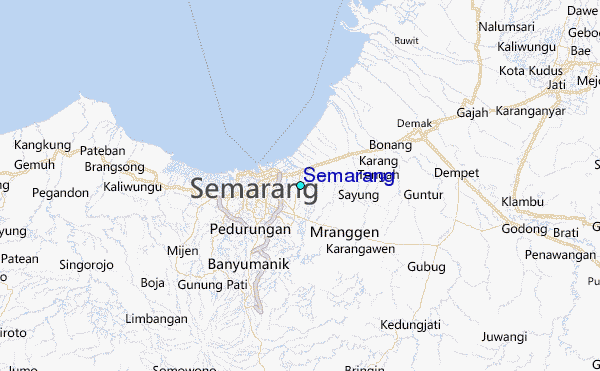
Use this relief map to navigate to tide stations, surf breaks and cities that are in the area of Semarang.
Other Nearby Locations' tide tables and tide charts to Semarang:
click location name for more details
 Surf breaks close to Semarang:
|
||
|---|---|---|
| Closest surf break | Karang Nini | 131 mi |
| Second closest surf break | Batu Mandi | 135 mi |
| Third closest surf break | Batu Hiu | 142 mi |
| Fourth closest surf break | Batu Karas | 146 mi |
| Fifth closest surf break | Keusik Luhur | 149 mi |


 Nearest
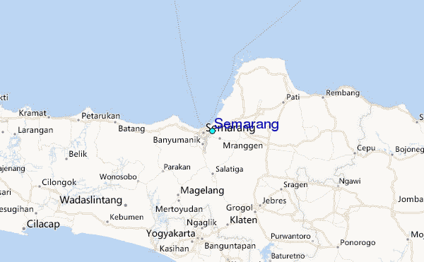