
| Distance / Altitude | Location | Report Date / Time | Live Weather | Wind | Gusts | Temp. | Visibility | Cloud |
|---|---|---|---|---|---|---|---|---|
| 19 km S / 52 m | Dabolim Airport - Goa (India) | 2025-12-24 07:00 local (2025/12/24 01:30 GMT) | Haze - | light winds from the E (9 km/h at 90) | 20°C | 2.3 | few | |
| 92 km ENE / 758 m | Belgaum Airport (India) | 2025-12-24 07:00 local (2025/12/24 01:30 GMT) | Mist - | light winds from the ESE (6 km/h at 120) | 14°C | 4.0 | no significant cloud | |
| 134 km NNE / 570 m | Kolhapur (India) | 2025-12-24 07:30 local (2025/12/24 02:00 GMT) | Haze - | light winds from the SE (6 km/h at 140) | 15°C | 2.0 | no significant cloud | |
| 135 km E / 662 m | Hubli Airport (India) | 2025-12-24 07:00 local (2025/12/24 01:30 GMT) | Mist - | light winds from the NE (9 km/h at 50) | 13°C | 5.0 | no significant cloud | |
| 307 km SSE / 103 m | Mangalore International Airport (Bajpe) (India) | 2025-12-24 07:00 local (2025/12/24 01:30 GMT) | Mist - | calm (0 km/h at 0) | 20°C | 3.0 | no significant cloud | |
| 411 km NW / 195 m | Bombay/Santacruz Airport (India) | 2025-12-24 07:00 local (2025/12/24 01:30 GMT) | - | light winds from the ESE (15 km/h at 120) | 23°C | 3.0 | few | |
| 441 km SSE / 76 m | Kannur International Airport (India) | 2025-12-24 07:00 local (2025/12/24 01:30 GMT) | Mist - | light winds from the E (15 km/h at 100) | 20°C | 2.5 | no significant cloud | |
| 476 km S / 3 m | SHIP7970 (Marine) | 2025-12-24 05:30 local (2025/12/24 00:00 GMT) | light winds from the N (15 km/h at 10) | 29°C | 20.4 | |||
| 476 km S / 3 m | SHIP5946 (Marine) | 2025-12-24 05:30 local (2025/12/24 00:00 GMT) | light winds from the N (15 km/h at 10) | 29°C | 20.4 | |||
| 476 km S / 15 m | SHIP9512 (Marine) | 2025-12-24 05:30 local (2025/12/24 00:00 GMT) | light winds from the N (14.76 km/h at 10) | 31°C | 17.7 km |
| Contours: | Roads & Rivers: | Select a
tide station / surf break / city |
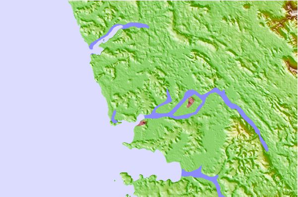
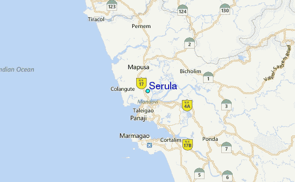
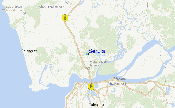
Use this relief map to navigate to tide stations, surf breaks and cities that are in the area of Serula.
Other Nearby Locations' tide tables and tide charts to Serula:
click location name for more details
 Surf breaks close to Serula:
|
||
|---|---|---|
| Closest surf break | Morjim Beach | 9 mi |
| Second closest surf break | Arambol | 14 mi |
| Third closest surf break | Betalbatim Beach Taj | 17 mi |
| Fourth closest surf break | Benaulim Beach | 20 mi |
| Fifth closest surf break | Agonda | 35 mi |


 Nearest
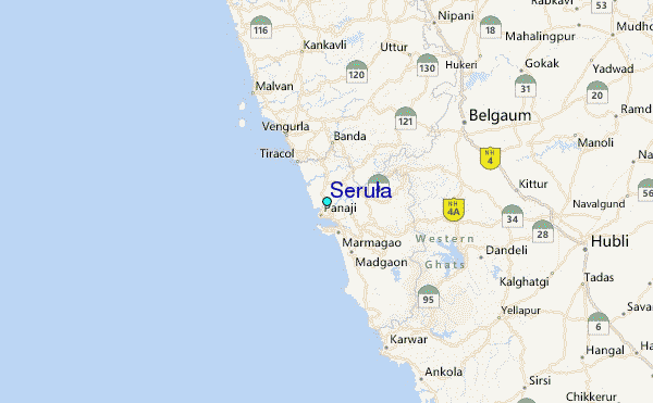