
| Distance / Altitude | Location | Report Date / Time | Live Weather | Wind | Gusts | Temp. | Visibility | Cloud |
|---|---|---|---|---|---|---|---|---|
| 12 km N / 11 m | Dalatangi (4197 -0) (Iceland) | 2026-07-04 00:00 local (2026/07/04 00:00 GMT) | no report | light winds from the S (11 km/h at 170) | 7°C | 70 | - - - | |
| 32 km W / 949 m | Gagnheidi (Iceland) | 2026-07-03 23:00 local (2026/07/03 23:00 GMT) | - | - (- km/h at -) | — | - | - | |
| 38 km W / 214 m | Egilsstadir Airport (Iceland) | 2026-07-03 23:00 local (2026/07/03 23:00 GMT) | Dry and partly cloudy | light winds from the SSW (9 km/h at 200) | 9°C | 10.0 | few scattered | |
| 126 km SSW / 5 m | Hofn (Iceland) | 2026-07-04 00:00 local (2026/07/04 00:00 GMT) | no report | light winds from the SSW (11 km/h at 200) | 8°C | - | - | |
| 128 km W / 386 m | Grimsstadir (Iceland) | 2026-07-04 00:00 local (2026/07/04 00:00 GMT) | no report | calm (4 km/h at 350) | 6°C | 60 | - | |
| 180 km WNW / 10 m | Raufarhofn (Iceland) | 2026-07-04 00:00 local (2026/07/04 00:00 GMT) | no report | moderate winds from the W (20 km/h at 270) | 4°C | - | - | |
| 215 km W / 211 m | Akureyri Airport (Iceland) | 2026-07-04 00:00 local (2026/07/04 00:00 GMT) | no report | light winds from the NW (11 km/h at 320) | 7°C | 10.0 | few broken - | |
| 253 km WNW / 16 m | Grimsey Island Airport (Iceland) | 2026-07-04 00:00 local (2026/07/04 00:00 GMT) | no report | light winds from the WNW (15 km/h at 290) | 5°C | 10.0 | broken broken - | |
| 254 km WNW / 17 m | Grimsey (Iceland) | 2026-07-04 00:00 local (2026/07/04 00:00 GMT) | no report | light winds from the WNW (15 km/h at 290) | 5°C | - | - | |
| 264 km SW / 120 m | Kirkjubaejarklaustu (Iceland) | 2026-07-04 00:00 local (2026/07/04 00:00 GMT) | no report | wind obs. (7 kph from 80 degs) was rejected (- km/h at -) | 9°C | - | - |
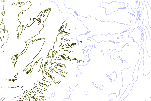
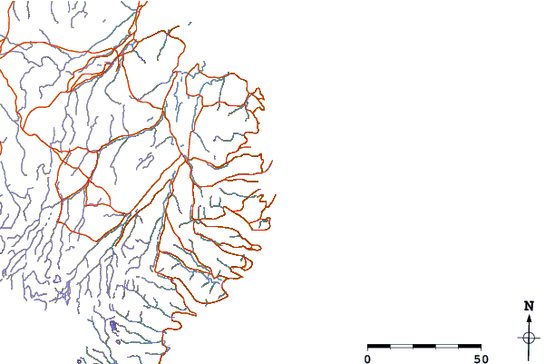
| Contours: | Roads & Rivers: | Select a
tide station / surf break / city |
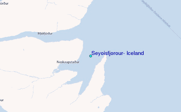
Use this relief map to navigate to tide stations, surf breaks and cities that are in the area of Seyðisfjörður, Iceland.
Other Nearby Locations' tide tables and tide charts to Seyoisfjorour, Iceland:
click location name for more details
 Surf breaks close to Seyoisfjorour, Iceland:
|
||
|---|---|---|
| Closest surf break | Eyvik | 124 mi |
| Second closest surf break | Þorlákshöfn or Porlackshofn | 248 mi |
| Third closest surf break | Grotta | 259 mi |
| Fourth closest surf break | Hafnarfjordur | 260 mi |
| Fifth closest surf break | Grindavik Lighthouse ( Hopsnesta) | 278 mi |


 Nearest
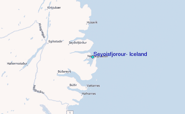