
| Distance / Altitude | Location | Report Date / Time | Live Weather | Wind | Gusts | Temp. | Visibility | Cloud |
|---|---|---|---|---|---|---|---|---|
| 74 km WNW / 200 m | Abadan International Airport (Iran, Islamic Rep) | 2025-12-25 09:00 local (2025/12/25 06:00 GMT) | Mist - | light winds from the W (7 km/h at 270) | 12°C | 1.0 | no significant cloud | |
| 77 km WNW / 7 m | Abadan (Iran) | 2025-12-25 09:00 local (2025/12/25 06:00 GMT) | Mist | light winds from the W (7 km/h at 270) | 12°C | 1.0 km | clear | |
| 91 km SSW / 7 m | Abu Hassaniya (Kuwait) | 2025-12-25 10:18 local (2025/12/25 07:18 GMT) | dry | calm (0 km/h at 152) | — | - | - - 0 | |
| 92 km NNE / 213 m | Bandar Mahshahr Airport (Iran, Islamic Rep) | 2025-12-25 09:00 local (2025/12/25 06:00 GMT) | Mist - | light winds from the NW (15 km/h at 310) | 13°C | 4.0 | no significant cloud | |
| 93 km S / - m | SHIP1487 (ocean) | 2025-12-25 10:00 local (2025/12/25 07:00 GMT) | No report | moderate winds from the WNW (28 km/h at 300) | 18°C | 2 km | no observation | |
| 92 km S / 15 m | SHIP4407 (Marine) | 2025-12-25 10:00 local (2025/12/25 07:00 GMT) | moderate winds from the WNW (27.720000000000002 km/h at 300) | — | 1.6 km | |||
| 92 km S / 3 m | SHIP5433 (Marine) | 2025-12-25 10:00 local (2025/12/25 07:00 GMT) | moderate winds from the WNW (28 km/h at 300) | 18°C | 1.9 | |||
| 92 km NNE / 213 m | Bandar Mahshahr Airport (Iran, Islamic Rep) | 2025-12-25 09:00 local (2025/12/25 06:00 GMT) | Mist - | light winds from the NW (15 km/h at 310) | 13°C | 4.0 | no significant cloud | |
| 92 km S / - m | SHIP567 (ocean) | 2025-12-25 10:00 local (2025/12/25 07:00 GMT) | No report | moderate winds from the WNW (28 km/h at 300) | 18°C | 2 km | no observation | |
| 105 km S / 3 m | SHIP2275 (Marine) | 2025-12-25 09:00 local (2025/12/25 06:00 GMT) | - (- km/h at -) | 18°C | - |
| Contours: | Roads & Rivers: | Select a
tide station / surf break / city |

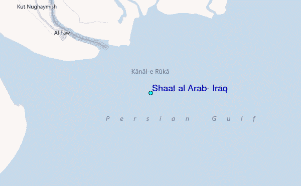
Use this relief map to navigate to tide stations, surf breaks and cities that are in the area of Shaat al Arab, Iraq.
Other Nearby Locations' tide tables and tide charts to Shaat al Arab, Iraq:
click location name for more details
 Surf breaks close to Shaat al Arab, Iraq:
|
||
|---|---|---|
| Closest surf break | Mangaf | 62 mi |
| Second closest surf break | Jebal Ali Lefts | 510 mi |
| Third closest surf break | Jumeirah Beach | 512 mi |
| Fourth closest surf break | Al Hamra - Ras Al Khema | 518 mi |
| Fifth closest surf break | Tim's Reef | 556 mi |


 Nearest
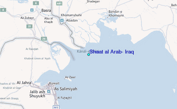