
| Distance / Altitude | Location | Report Date / Time | Live Weather | Wind | Gusts | Temp. | Visibility | Cloud |
|---|---|---|---|---|---|---|---|---|
| 8 km S / 211 m | Charlotte County/Punta Gorda Airport (Florida) | 2026-07-17 01:53 local (2026/07/17 05:53 GMT) | Dry and partly cloudy | light winds from the SE (6 km/h at 140) | 27°C | 16 | scattered | |
| 14 km WSW / 3 m | lightning 4km W of Port Charlotte (United States) | 2026-07-17 03:35 local (2026/07/17 07:35 GMT) | Thunderstorm | (- km/h at -) | — | |||
| 25 km WSW / 2 m | lightning 9km S of North Port (United States) | 2026-07-17 04:00 local (2026/07/17 08:00 GMT) | Thunderstorm | (- km/h at -) | — | |||
| 30 km SW / 3 m | thunderstorm affecting Rotonda (United States) | 2026-07-17 04:00 local (2026/07/17 08:00 GMT) | Thunderstorm | (- km/h at -) | — | |||
| 30 km SW / 2 m | Placida Coral Creek Airport (Florida) (Florida) | 2026-07-17 02:35 local (2026/07/17 06:35 GMT) | Thunderstorm - in the vicinity | calm (0 km/h at 0) | — | 16 | ||
| 30 km W / 5 m | thunderstorm affecting Warm Mineral Springs (United States) | 2026-07-17 04:00 local (2026/07/17 08:00 GMT) | Thunderstorm | (- km/h at -) | — | |||
| 35 km SW / 0 m | thunderstorm affecting Grove City (United States) | 2026-07-17 03:33 local (2026/07/17 07:33 GMT) | Thunderstorm | (- km/h at -) | — | |||
| 36 km S / 0 m | thunderstorm affecting Bokeelia (United States) | 2026-07-17 04:00 local (2026/07/17 08:00 GMT) | Thunderstorm | (- km/h at -) | — | |||
| 39 km SSE / 3 m | BUOY-FMRF1 (Marine) | 2026-07-17 03:00 local (2026/07/17 07:00 GMT) | calm (2 km/h at 350) | 29°C | - | |||
| 39 km WSW / 4 m | lightning 4km SSW of Plantation (United States) | 2026-07-17 03:34 local (2026/07/17 07:34 GMT) | Thunderstorm | (- km/h at -) | — |
| Contours: | Roads & Rivers: | Select a
tide station / surf break / city |

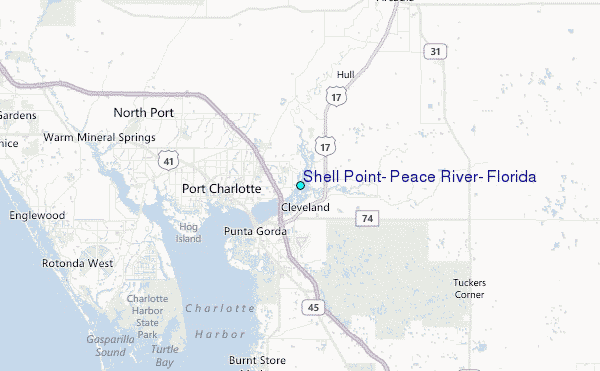
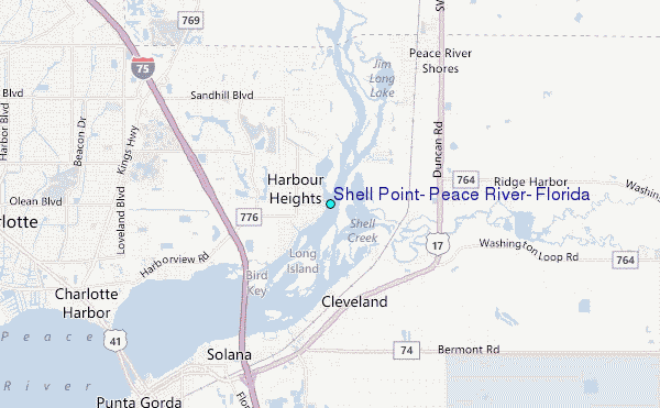
Use this relief map to navigate to tide stations, surf breaks and cities that are in the area of Shell Point, Peace River, Florida.
Other Nearby Locations' tide tables and tide charts to Shell Point, Peace River, Florida:
click location name for more details
 Surf breaks close to Shell Point, Peace River, Florida:
|
||
|---|---|---|
| Closest surf break | Venice North and South Jetty | 29 mi |
| Second closest surf break | Point o Rocks | 38 mi |
| Third closest surf break | Turtle Beach | 46 mi |
| Fourth closest surf break | Siesta | 48 mi |
| Fifth closest surf break | Wiggins Pass | 50 mi |


 Nearest
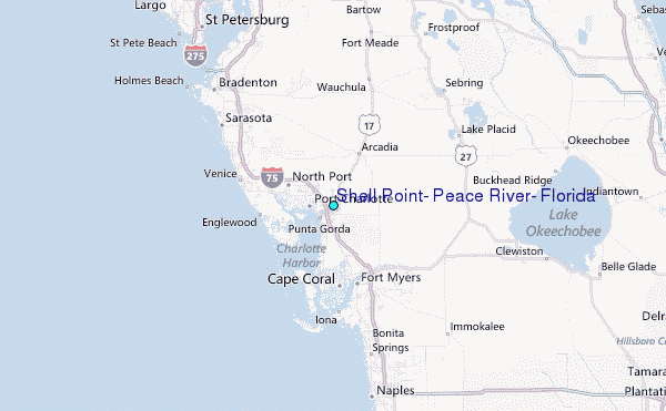