
| Distance / Altitude | Location | Report Date / Time | Live Weather | Wind | Gusts | Temp. | Visibility | Cloud |
|---|---|---|---|---|---|---|---|---|
| 14 km E / 3 m | BUOY-NWHC3 (Marine) | 2026-05-05 17:18 local (2026/05/05 21:18 GMT) | light winds from the S (17 km/h at 190) | — | - | |||
| 16 km S / 200 m | Bridgeport Airport (Connecticut) | 2026-05-05 15:52 local (2026/05/05 19:52 GMT) | Clear | fresh winds from the S (30 km/h at 180) | 20°C | 16 | ||
| 17 km S / 3 m | BUOY-BRHC3 (Marine) | 2026-05-05 17:18 local (2026/05/05 21:18 GMT) | light winds from the SSW (13 km/h at 200) | — | - | |||
| 18 km ESE / 218 m | New Haven/Tweed Airport (Connecticut) | 2026-05-05 15:53 local (2026/05/05 19:53 GMT) | Clear | light winds from the S (17 km/h at 190) | 19°C | 13 | ||
| 19 km NW / 684 m | Oxford/Waterbury Airport (Connecticut) | 2026-05-05 15:56 local (2026/05/05 19:56 GMT) | Clear | moderate winds from the S (24 km/h at 180) | 23°C | 16 | ||
| 31 km NE / 218 m | Meriden Airport (Connecticut) | 2026-05-05 15:53 local (2026/05/05 19:53 GMT) | Clear | moderate winds from the S (28 km/h at 180) | 23°C | 16 | ||
| 35 km W / 218 m | Danbury Airport (Connecticut) | 2026-05-05 15:53 local (2026/05/05 19:53 GMT) | Clear | fresh winds from the S (30 km/h at 170) | 25°C | 16 | ||
| 45 km S / 44 m | Terryville (New York) | 2026-05-05 17:25 local (2026/05/05 21:25 GMT) | dry | calm (2 km/h at 288) | 20°C | - | - - 0 | |
| 49 km E / 219 m | Chester Airport (CT) (United States) | 2026-05-05 16:35 local (2026/05/05 20:35 GMT) | Clear | light winds from the S.(Wind varies from 130 to 210 degs) (13 km/h at 180) | 21°C | 16 | ||
| 56 km S / 218 m | Islip Airport (New York) | 2026-05-05 15:56 local (2026/05/05 19:56 GMT) | - | moderate winds from the S (26 km/h at 190) | 17°C | 16 | few |
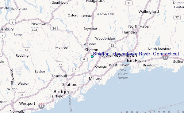
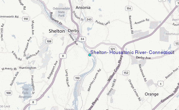
Choose Shelton, Housatonic River, Connecticut Location Map Zoom:
| Contours: | Roads & Rivers: | Select a
tide station / surf break / city |
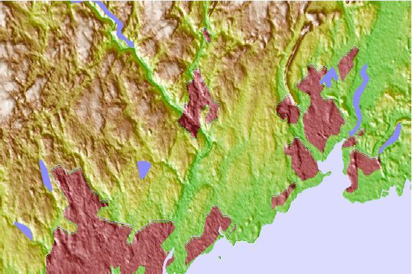
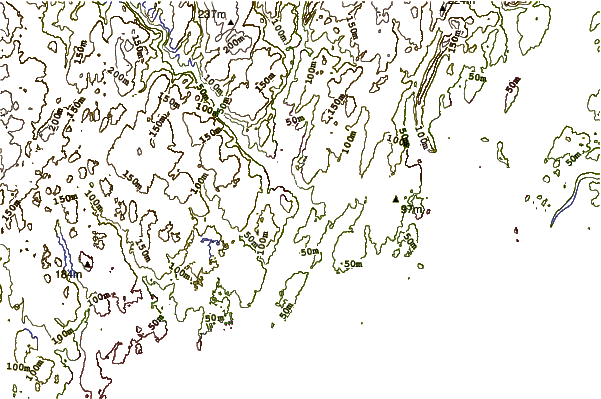
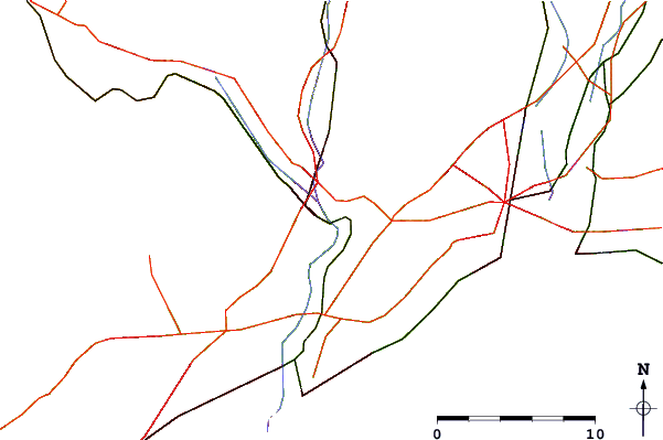
Use this relief map to navigate to tide stations, surf breaks and cities that are in the area of Shelton, Housatonic River, Connecticut.
Other Nearby Locations' tide tables and tide charts to Shelton, Housatonic River, Connecticut:
click location name for more details
 Surf breaks close to Shelton, Housatonic River, Connecticut:
|
||
|---|---|---|
| Closest surf break | Cupsogue | 41 mi |
| Second closest surf break | Fire Island | 41 mi |
| Third closest surf break | Jetty | 42 mi |
| Fourth closest surf break | Road K | 44 mi |
| Fifth closest surf break | Ponquogue The Bowl | 44 mi |


 Nearest
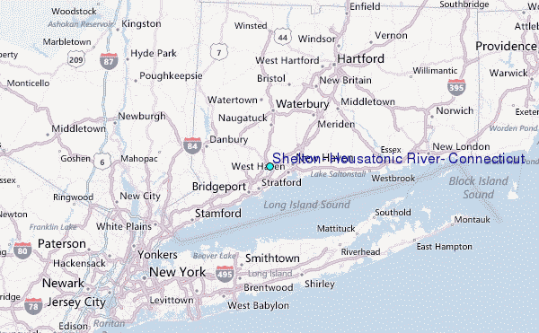