
Shirley Sea Conditions table showing wave height, swell direction and period.
High and low tide times are also provided on the table along with the moon phase and forecast weather. Sunrise today is at 05:20 AM and sunset is at 08:25 PM.
Days 1–3 Weather SummaryLight rain (total 9mm), mostly falling on Thu night. Warm air temperatures (max 27°C on Wed afternoon, min 19°C on Wed morning). Wind will be generally light. | Days 4–6 Weather SummaryMostly dry. Warm air temperatures (max 22°C on Sun afternoon, min 19°C on Sat morning). Wind will be generally light. | Days 7–9 Weather SummaryMostly dry. Warm (max 34°C on Thu afternoon, min 21°C on Tue morning). Winds decreasing (fresh winds from the SSW on Tue afternoon, light winds from the NW by Wed night). | Days 10–12 Weather SummarySome drizzle, heaviest during Fri night. Warm (max 33°C on Fri afternoon, min 18°C on Sat morning). Mainly fresh winds. | Days 13–16 Weather SummaryModerate rain (total 17mm), heaviest on Thu morning. Warm (max 32°C on Tue afternoon, min 21°C on Wed night). Wind will be generally light. | |||||||||||||||||||||||||||||||||||||||||||
Wednesday 24 | Thursday 25 | Friday 26 | Saturday 27 | Sunday 28 | Monday 29 | Tuesday 30 | Wednesday 1 | Thursday 2 | Friday 3 | Saturday 4 | Sunday 5 | Monday 6 | Tuesday 7 | Wednesday 8 | Thu 9 | ||||||||||||||||||||||||||||||||
AM | PM | night | AM | PM | night | AM | PM | night | AM | PM | night | AM | PM | night | AM | PM | night | AM | PM | night | AM | PM | night | AM | PM | night | AM | PM | night | AM | PM | night | AM | PM | night | AM | PM | night | AM | PM | night | AM | PM | night | AM | PM | |
Wave Height Map | 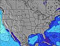 | 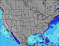 | 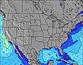 | 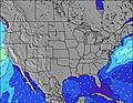 | 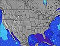 | 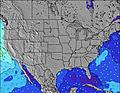 | 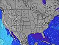 | 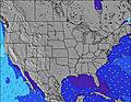 | 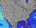 | 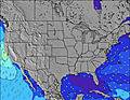 | 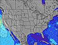 | 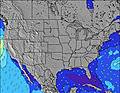 | 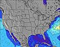 | 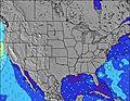 | 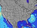 | 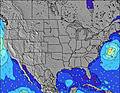 | |||||||||||||||||||||||||||||||
High Tide | 4:12PM1.23m | 4:25AM0.99m | 4:58PM1.24m | 5:12AM0.98m | 5:41PM1.26m | 5:56AM0.99m | 6:22PM1.29m | 6:39AM1.01m | 7:04PM1.30m | 7:22AM1.03m | 7:44PM1.32m | 8:03AM1.04m | 8:23PM1.32m | 8:44AM1.06m | 9:02PM1.31m | 9:25AM1.07m | 9:39PM1.28m | 10:06AM1.08m | 10:17PM1.25m | 10:48AM1.11m | 10:56PM1.22m | 11:32AM1.14m | 11:39PM1.18m | 12:20PM1.18m | 00:27AM1.15m | 1:12PM1.23m | 1:22AM1.12m | 2:08PM1.29m | |||||||||||||||||||
Low Tide | 9:38AM0.28m | 10:38PM0.36m | 10:23AM0.29m | 11:25PM0.34m | 11:07AM0.29m | 00:09AM0.32m | 11:50AM0.28m | 00:51AM0.30m | 12:32PM0.27m | 1:32AM0.28m | 1:14PM0.25m | 2:12AM0.26m | 1:56PM0.25m | 2:50AM0.25m | 2:37PM0.26m | 3:28AM0.24m | 3:18PM0.28m | 4:05AM0.23m | 4:00PM0.30m | 4:41AM0.23m | 4:44PM0.31m | 5:19AM0.22m | 5:32PM0.33m | 5:59AM0.21m | 6:26PM0.33m | 6:45AM0.20m | 7:25PM0.32m | 7:36AM0.19m | |||||||||||||||||||
Wave Height (m) Direction Period (s) | SSE 6 | SSE 7 | SSE 7 | SSE 7 | SSE 7 | S 5 | S 5 | SSE 6 | SSE 6 | SSE 6 | S 6 | S 6 | S 7 | S 6 | SE 10 | SE 10 | SE 10 | SE 10 | SE 10 | SSW 4 | SSW 6 | SSW 5 | SSW 5 | S 6 | S 6 | S 5 | SSW 5 | SSE 6 | S 6 | SSW 5 | ESE 5 | E 6 | SE 6 | SE 9 | SE 8 | SSW 4 | SW 4 | SSW 4 | SSW 6 | SSW 5 | SE 10 | SSW 5 | SSW 5 | SSW 5 | SSW 6 | S 6 | S 6 |
clear | clear | clear | some clouds | some clouds | light rain | light rain | light rain | light rain | some clouds | some clouds | clear | some clouds | some clouds | clear | clear | clear | clear | clear | clear | some clouds | clear | clear | clear | clear | clear | clear | some clouds | some clouds | rain shwrs | clear | clear | clear | clear | some clouds | clear | some clouds | clear | clear | clear | clear | clear | clear | clear | rain shwrs | rain shwrs | risk tstorm | |
km/h | |||||||||||||||||||||||||||||||||||||||||||||||
mm | — | — | — | — | — | 3 | 2 | 2 | 2 | — | — | — | — | — | — | — | — | — | — | — | — | — | — | — | — | — | — | — | — | 1 | — | — | — | — | — | — | — | — | — | — | — | — | — | — | 5 | 6 | 4 |
max °C | 24 | 27 | 25 | 22 | 23 | 22 | 19 | 20 | 20 | 20 | 21 | 21 | 21 | 22 | 21 | 21 | 22 | 20 | 22 | 23 | 22 | 27 | 31 | 32 | 33 | 34 | 31 | 32 | 33 | 28 | 20 | 22 | 19 | 23 | 24 | 21 | 26 | 28 | 28 | 31 | 32 | 29 | 29 | 30 | 25 | 22 | 24 |
Moonrise | — | 3:56 | — | — | 4:59 | — | — | 6:02 | — | — | 7:01 | — | — | 7:55 | — | — | 8:43 | — | — | — | 9:22 | — | — | 9:56 | — | — | 10:23 | — | — | 10:48 | — | — | 11:09 | — | — | 11:31 | — | — | 11:52 | — | — | — | 12:16 | — | — | 12:43 | — |
Moonset | 1:29 | — | — | 1:55 | — | — | 2:25 | — | — | 3:01 | — | — | 3:44 | — | — | 4:35 | — | — | 5:33 | — | — | 6:35 | — | — | 7:39 | — | — | 8:44 | — | — | 9:48 | — | — | 10:53 | — | — | 11:58 | — | — | 1:06 | — | — | 2:18 | — | — | — | 3:33 |
5:20 | — | — | 5:20 | — | — | 5:20 | — | — | 5:20 | — | — | 5:22 | — | — | 5:22 | — | — | 5:22 | — | — | 5:22 | — | — | 5:24 | — | — | 5:24 | — | — | 5:24 | — | — | 5:24 | — | — | 5:26 | — | — | 5:26 | — | — | 5:26 | — | — | 5:28 | — | |
— | 8:25 | — | — | 8:25 | — | — | 8:25 | — | — | 8:27 | — | — | 8:27 | — | — | 8:27 | — | — | 8:25 | — | — | 8:25 | — | — | 8:25 | — | — | 8:25 | — | — | 8:25 | — | — | 8:25 | — | — | 8:24 | — | — | 8:24 | — | — | 8:24 | — | — | 8:23 | |
Today's sea temperature in Shirley is 18.9° C (Statistics for 24 Jun 1981-2005 – mean: 18.8 max: 21.4 min: 16.6°C) | |||||||||||||||||||||||||||||||||||||||||||||||


 Nearest